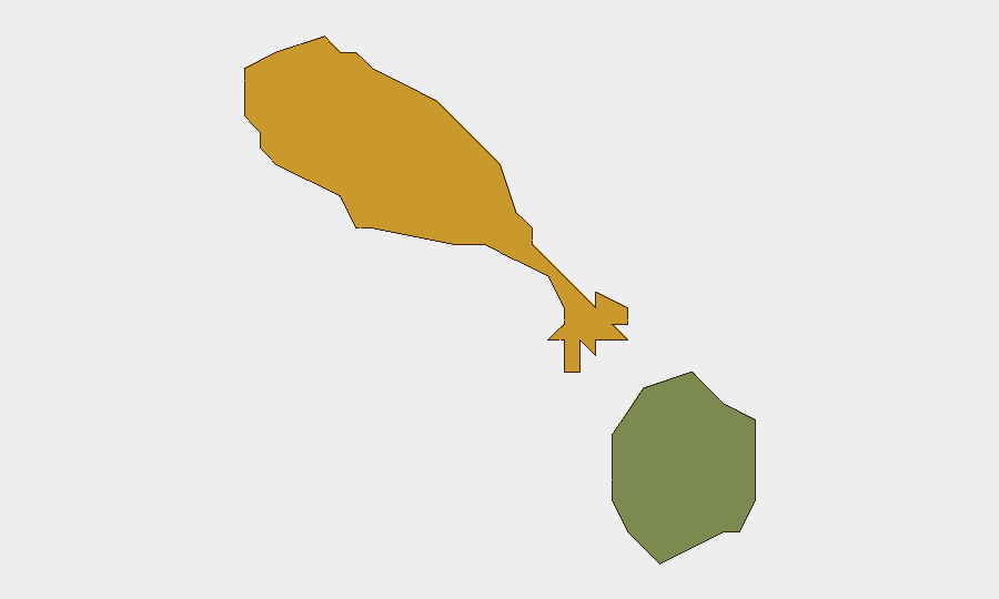
Situation Summary
Saint Kitts and Nevis remains a low-threat environment globally (rank #180; composite threat score 3) with no discrete security incidents documented in the past 24–48 hours. Risk is concentrated in Saint Kitts, which carries a significantly elevated sub-national score (72) relative to Nevis (28), reflecting persistent localized crime and gang activity rather than active unrest or systemic instability. The federation's security posture has remained stable through August, with no indication of imminent escalation or cross-border spillover.
Key Developments
- No confirmed incidents in the past 24–48 hours. Available open-source feeds, local news outlets, and government channels have yielded no new security events, civil unrest, infrastructure disruptions, or travel-risk incidents as of 29 August 2026.
- Historical context (August): A shooting investigation in Newtown, Saint Kitts was documented on 8 August; this remains an outlier event and does not reflect a current spike in violence.
- Weather monitoring: Tropical weather conditions are being tracked for 29–30 August; no severe weather alerts currently affect movement or operations.
- Routine governance: Government and municipal activity continues without disruption; no roadwork or administrative changes pose immediate security risk.
Highest-Risk Areas
Saint Kitts dominates the sub-national risk profile, with a composite score of 72 compared to Nevis's 28—a differential reflecting concentrated gang activity, gang-related homicide, and street crime in specific neighborhoods, particularly in Basseterre and surrounding urban areas. Nevis operates at materially lower risk and remains relatively stable. Duty-of-care teams should weight personnel and asset exposure in Saint Kitts more heavily, especially in dense urban zones and after-hours environments; Nevis-based operations face substantially lower incident probability.
How GeoBit Would Assist
Security teams should deploy AOI Monitoring & Early Warning focused on high-risk districts in Basseterre and Saint Kitts to capture emerging gang activity, roadblocks, or localized unrest before they affect operations. Intel Sweep and X/Twitter OSINT will provide real-time intelligence on police operations, street-level incidents, and community reporting; multi-language search and sentiment analysis can flag shifts in local tension or threat rhetoric. Routing & Network Analysis can identify alternative travel corridors and safe passage windows for personnel moving through Saint Kitts, reducing exposure during peak-risk periods.
7-Day Outlook
No escalation drivers are visible over the next seven days; weather and seasonal patterns do not suggest heightened risk. Continued baseline monitoring of street-level crime and gang dynamics in Saint Kitts is warranted to detect any deviation from current low-incident reporting. Nevis operations remain low-risk and do not require elevated posture.
Highest-Risk Areas — Ranked
| # | State / Region | Risk |
|---|---|---|
| 1 | Saint Kitts | 72 |
| 2 | Nevis | 28 |
Sources
Previous Daily Briefs
A new Saint Kitts and Nevis brief is written every day — each with its own risk map and downloadable CSV. Here's the last week; use the calendar to go further back.
- August 26, 2026
- August 23, 2026
- August 21, 2026
- August 18, 2026
- August 16, 2026
- August 14, 2026
- August 12, 2026
📅 Browse every day by calendar →
Highlighted days have a brief. Tap a day for that day's map & analysis, or “csv” for that day's dataset ($5).
Atlas — our AI intelligence desk — emails them this snapshot personally. Nothing else, no list.