Situation Summary
Saint Lucia remains a moderately constrained operating environment (global rank #148, composite threat score 6) with concentrated violence and organized crime activity in northern urban centers. Recent days have seen a cluster of homicides, altercations resulting in fatalities, and coordinated police interdiction operations targeting firearms and drug trafficking. The trajectory reflects endemic gang and drug-related violence rather than systemic instability, but incident frequency and lethality warrant heightened vigilance in high-risk districts.
Key Developments
- Micoud, Anse Ger (2026-08-09, reported 2026-08-11): One homicide investigated; victim identified as Nick Daniel, 28, with injuries to face and body; one person in custody.
- Gros Islet, Rodney Bay (2026-08-02, fatality confirmed 2026-08-10): Woman (Tanisha/Tenisha Yarde, 28) struck by omnibus following an altercation; died at Owen King EU Hospital; case under police investigation.
- Castries/Goodlands (2026-08-03): Intelligence-led police operation recovered prohibited weapon, ammunition, cash, electronic devices, and documents tied to firearms investigation; multiple detentions made.
- Canaries, Dix Street (2026-08-02): Police search warrant yielded 9mm pistol with auto sear, nine rounds of ammunition, and three arrests on weapons charges.
- Babonneau, Des Barras (2026-08-03): Police recovered 3.81 kg of cannabis; one arrest made during narcotics sweep.
- Gros Islet Carnival area (2026-08-02 to 2026-08-03): Police conducted targeted patrols and anti-crime sweeps during carnival operations.
Highest-Risk Areas
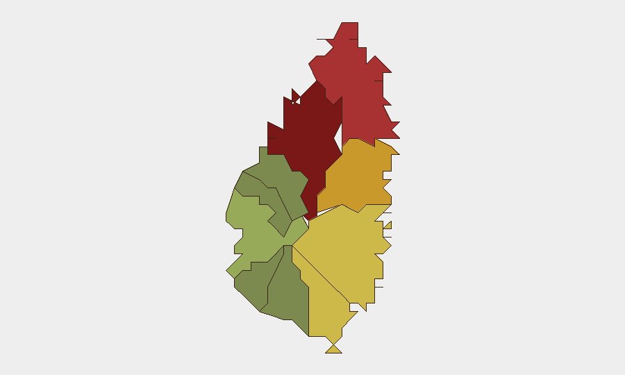
Castries (risk 95) and Gros Islet (risk 78) remain the primary threat drivers, accounting for the majority of lethal incidents, firearm seizures, and organized crime operations. Northern coastal zones (Gros Islet, Dennery, risk 72) show elevated violence-against-civilian indicators and gang activity; Vieux Fort (risk 68) and Micoud (risk 65) present secondary hotspots for drug trafficking and inter-personal homicide. Southern and western districts (Soufrière, Laborie, Choiseul, Canaries) are substantially lower-risk, reflecting both lower population density and reduced criminal organization presence.
How GeoBit Would Assist
Teams with personnel or assets in Saint Lucia should leverage Intel Sweep and global event feeds to monitor police operations and incident reporting in real time across the high-risk northern zone. AOI Monitoring & Early Warning persistent watch on Castries and Gros Islet, coupled with X/Twitter and Telegram OSINT for gang communications and threat signaling, enables duty-of-care teams to anticipate violence spikes around carnival events and police interdiction cycles. Risk & Threat Assessment and Network & Actor Analysis capabilities support identification of trafficking routes and criminal networks affecting corporate operations or supply chains.
7-Day Outlook
Police interdiction tempo is expected to remain elevated in response to recent homicides and firearm seizures. Carnival-related gatherings and associated police sweeps create elevated risk of crowd-related incidents and retaliatory violence in Gros Islet through mid-August. No systemic threat escalation is forecast, but teams should maintain heightened situational awareness in Castries and Gros Islet and consider movement restrictions during high-traffic entertainment and festival periods.
Highest-Risk Areas — Ranked
| # | State / Region | Risk |
|---|---|---|
| 1 | Castries | 95 |
| 2 | Gros Islet | 78 |
| 3 | Dennery | 72 |
| 4 | Vieux Fort | 68 |
| 5 | Micoud | 65 |
| 6 | Soufrière | 42 |
| 7 | Laborie | 38 |
| 8 | Choiseul | 35 |
| 9 | Anse La Raye | 28 |
| 10 | Canaries | 12 |
Sources
- thevoiceslu.com
- our.today
- thevoiceslu.com
- freetravelriskmap.sicurogroup.com
- youtube.com
- saintluciadailypost.com
- stluciatimes.com
- caribbeannewspoint.com
- caribbeannewspoint.com
- thestkittsnevisobserver.com
- youtube.com
- saintluciadailypost.com
- times509.com
- stluciatimes.com
- saintluciadailypost.com
- saintluciadailypost.com
- travelriskcalculator.com
- expedia.com
Previous Daily Briefs
A new Saint Lucia brief is written every day — each with its own risk map and downloadable CSV. Here's the last week; use the calendar to go further back.
- August 12, 2026
- August 10, 2026
- August 8, 2026
- August 6, 2026
- August 5, 2026
- August 4, 2026
- August 3, 2026
📅 Browse every day by calendar →
Highlighted days have a brief. Tap a day for that day's map & analysis, or “csv” for that day's dataset ($5).
Atlas — our AI intelligence desk — emails them this snapshot personally. Nothing else, no list.