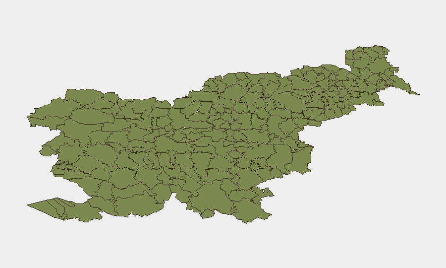
Situation Summary
Slovenia remains a low-threat environment with a composite threat score of 4 and no tracked discrete security events in the current assessment window. A violent parking-dispute incident in Piran on 2026-08-20 and a separate animal-attack injury near Lukovica (2026-08-16) represent isolated criminal and accidental incidents rather than systemic security degradation. Overall trajectory remains stable; no indicators suggest emerging regional instability or organized threat activity.
Key Developments
- Piran (2026-08-20) — Police investigation ongoing into a violent parking-garage dispute resulting in serious bodily harm to one individual; classified as a criminal offense involving particularly serious assault. This is a localized dispute with no indication of broader criminal network activity or organized violence.
- Lukovica/Lipa (2026-08-16) — A bull attack in a rural pasture caused severe injuries requiring airlift evacuation to UKC Ljubljana. This is an agricultural accident rather than a security threat but flags hazards in rural/pastoral areas frequented by tourists and residents.
Highest-Risk Areas
All 12 sub-national regions listed carry a composite risk score of 0, indicating uniform low threat across Slovenia. The top-ranked areas (Bovec, Kobarid, Kanal, Kranjska Gora, Gorje, Tolmin, Bohinj, Cerkno, Brda) are concentrated in the northwest (Upper Soča Valley and Julian Alps), which are primarily tourist and outdoor-recreation zones rather than crime or instability hotspots. The absence of differentiated regional risk reflects Slovenia's overall security stability; no municipality exhibits elevated threat profiles relative to national baseline.
How GeoBit Would Assist
Security teams managing personnel or assets in Slovenia should employ AOI Monitoring & Early Warning on high-traffic locations (Ljubljana, Maribor, Lake Bled, Piran) to detect emerging criminal or civil incidents in near-real time. OSINT Fusion & Corroboration across local police reports, municipal statements, and Telegram/social channels will provide early signal of localized disputes, protests, or vandalism before they escalate. Routing & Network Analysis can identify safe transit corridors and alternate routes in rural areas, particularly around high-risk agricultural zones and mountain passes, supporting duty-of-care planning for field teams.
7-Day Outlook
No intelligence suggests an uptick in organized violence, terrorism, or civil unrest over the next seven days. Isolated criminal incidents (assaults, vandalism, traffic accidents) will likely persist at baseline rates typical of a mid-size Central European country. Summer tourism season may elevate accident risk (water, mountain, road) in alpine and lake regions, but no security threat escalation is anticipated.
Highest-Risk Areas — Ranked
| # | State / Region | Risk |
|---|---|---|
| 1 | Bovec | 0 |
| 2 | Kobarid | 0 |
| 3 | Kanal | 0 |
| 4 | Kranjska Gora | 0 |
| 5 | Gorje | 0 |
| 6 | Tolmin | 0 |
| 7 | Bohinj | 0 |
| 8 | Cerkno | 0 |
| 9 | Brda | 0 |
| 10 | Šempeter-Vrtojba | 0 |
| 11 | Renče-Vogrsko | 0 |
| 12 | Miren-Kostanjevica | 0 |
Sources
Previous Daily Briefs
A new Slovenia brief is written every day — each with its own risk map and downloadable CSV. Here's the last week; use the calendar to go further back.
- August 18, 2026
- August 16, 2026
- August 14, 2026
- August 12, 2026
- August 10, 2026
- August 8, 2026
- August 6, 2026
📅 Browse every day by calendar →
Highlighted days have a brief. Tap a day for that day's map & analysis, or “csv” for that day's dataset ($5).
Atlas — our AI intelligence desk — emails them this snapshot personally. Nothing else, no list.