Situation Summary
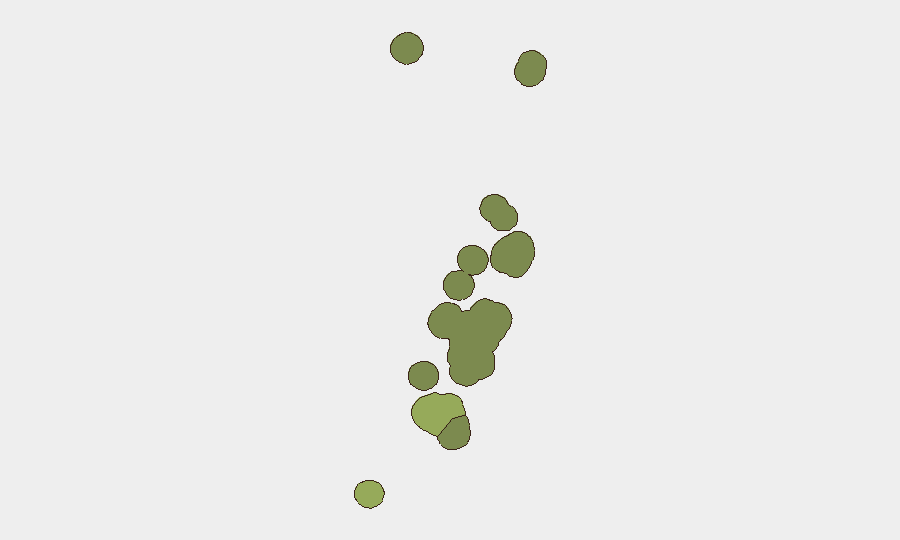
Tonga's security environment remains stable with no verified physical security incidents, civil unrest, or infrastructure disruptions reported in the past 24–48 hours. Online political discourse has intensified in domestic social-media channels, but this activity has not yet translated into street-level protests, organized demonstrations, or security emergencies. Tongatapu remains the highest-risk administrative division (composite score 45), reflecting its status as the capital and most populous region, though absolute risk levels remain low by global standards. Current conditions support routine corporate and operational activities across the country.
Key Developments
- Online political discourse spike (Tonga-wide, 13–15 June): Tongan social-media platforms have registered increased critical political commentary and debate in the past 48 hours; no corresponding street protests, organized demonstrations, or physical security incidents have been corroborated by independent sources.
- Regional maritime security cooperation (Pacific, mid-June): Ongoing Pacific maritime security operations targeting illegal fishing and drug trafficking in nearby waters (Papua New Guinea region) represent routine regional enforcement; no new interdictions or maritime threats specific to Tongan waters have been reported in the last 24–48 hours.
- Seismic activity (western Tonga, recent): Two moderate-magnitude earthquakes (M 4.5 and M 4.4) were recorded west of populated centers (Hihifo and Houma); no damage reports, infrastructure disruption, or tsunami warnings have been issued; seismic monitoring remains routine.
- Routine political and social reporting (Nukuʻalofa, through 12 June): Most recent television news bulletins cover standard political and social matters without reporting protests, major crime, or infrastructure failures in the capital or surrounding areas; no follow-up incident reports have emerged in the subsequent 24–48-hour window.
- No acute travel or transport disruptions reported (Tonga-wide, 13–15 June): Air, maritime, and ground transport networks show no confirmed new outages, delays, or safety incidents based on available open-source monitoring in the past two days.
Highest-Risk Areas
Tongatapu (risk score 45) dominates the sub-national risk ranking, reflecting its concentration of government institutions, commercial activity, population density, and historical precedent as the locus of any major incidents in Tonga. Vavaʻu (28) and Haʻapai (22) register secondary and tertiary risk scores, likely reflecting smaller populations, limited infrastructure redundancy, and geographic isolation, which can amplify impact of localized incidents. ʻEua and Ongo Niua present lower absolute risk. Risk elevation in Tongatapu should be interpreted within context: no acute drivers (organized political opposition, armed groups, significant criminal networks, or infrastructure vulnerabilities) are currently evident, and the online political activity noted above remains discourse-level rather than movement-level.
How GeoBit Would Assist
Corporate security and duty-of-care teams operating in Tonga would deploy Intel Sweep and multi-language OSINT to monitor emerging political and civil unrest signals across Tongan social media and news sources in real time, with sentiment and temporal analysis to distinguish online debate from actionable protest risk. AOI Monitoring with early-warning alerting on Nukuʻalofa and key commercial or operational sites would provide continuous watch for disruptions, security incidents, or infrastructure failures affecting personnel or assets. Routing & Network Analysis would enable rapid alternative-route and journey planning if sudden localized incidents required staff relocation or supply-chain adjustment.
7-Day Outlook
No significant security deterioration is forecast for the next seven days based on current indicators. Online political discourse may persist or fluctuate, but absence of organizational capability, announced demonstrations, or historical precedent for rapid escalation from social-media activity to physical unrest suggests near-term stability. Routine seismic and weather monitoring should continue as standard precaution for a Pacific island nation.
Highest-Risk Areas — Ranked
| # | State / Region | Risk |
|---|---|---|
| 1 | Tongatapu | 45 |
| 2 | Vavaʻu | 28 |
| 3 | Haʻapai | 22 |
| 4 | ʻEua | 18 |
| 5 | Ongo Niua | 12 |
Sources
Previous Daily Briefs
A new Tonga brief is written every day — each with its own risk map and downloadable CSV. Here's the last week; use the calendar to go further back.
📅 Browse every day by calendar →
Highlighted days have a brief. Tap a day for that day's map & analysis, or “csv” for that day's dataset ($5).