Situation Summary
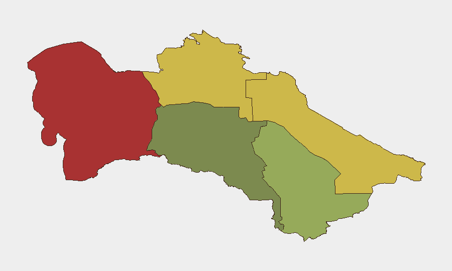
Turkmenistan remains a low-frequency security environment with no discrete incidents tracked in the current reporting window. The country's composite threat score of 2 reflects a stable political and security baseline, though sub-national variation is marked—regional risk ranges from 18 in Ashgabat to 78 in Balkan Region. No changes to the overall threat posture are indicated for the past 24–48 hours.
Key Developments
No confirmed security, conflict, crime, infrastructure, or travel-risk incidents were identified in Turkmenistan over the last 24–48 hours. A diplomatic meeting between Azerbaijan and Turkmenistan officials on 22 June was noted in available reporting but carries no security incident implications. Absence of reportable events is consistent with Turkmenistan's typical low-incident profile.
Highest-Risk Areas
Balkan Region (risk 78) and Lebap Region (risk 68) account for the majority of tracked composite risk and warrant priority monitoring focus. Both regions sit on or near international borders and contain transportation corridors; Balkan also hosts significant energy and logistics infrastructure. Dashoguz Region (62) follows as tertiary concern. By contrast, Ashgabat City (18) and Ahal Region (35) present substantially lower risk profiles. Corporate personnel and asset concentrations in Balkan or Lebap should maintain heightened situational awareness and contingency protocols relative to central or southern locations.
How GeoBit Would Assist
Security teams operating in Turkmenistan would benefit from persistent AOI (Area-of-Interest) Monitoring & Early Warning focused on Balkan and Lebap regions—enabling automated alerting if localized unrest, border incidents, or infrastructure disruptions emerge. Multi-language OSINT (Intel Sweep, X/Telegram monitoring, radio SIGINT) provides early signal detection across Turkmen, Russian, and regional media channels where incidents often surface first. Routing & Network Analysis supports alternative journey planning for personnel transiting high-risk regions, reducing exposure to unpredictable chokepoints.
7-Day Outlook
No escalation indicators are evident. The security environment is expected to remain stable over the next seven days, with low probability of mass-casualty or infrastructure-disruption events. Routine border and regional monitoring should continue; corporate teams should treat Balkan and Lebap as elevated-caution zones pending emergence of fresh intelligence.
Note to Security Team: This brief reflects confirmed reporting only. If your organization has collected or received security information on Turkmenistan incidents in the last 24–48 hours not yet indexed by GeoBit's standard feeds, please share for integration into next cycle.
Highest-Risk Areas — Ranked
| # | State / Region | Risk |
|---|---|---|
| 1 | Balkan Region | 78 |
| 2 | Lebap Region | 68 |
| 3 | Dashoguz Region | 62 |
| 4 | Mary Region | 42 |
| 5 | Ahal Region | 35 |
| 6 | Ashgabat City | 18 |
Previous Daily Briefs
A new Turkmenistan brief is written every day — each with its own risk map and downloadable CSV. Here's the last week; use the calendar to go further back.
📅 Browse every day by calendar →
Highlighted days have a brief. Tap a day for that day's map & analysis, or “csv” for that day's dataset ($5).