Situation Summary
Uganda remains a moderate-risk operating environment (global rank #106) characterized by endemic terrorism, violent crime, and periodic civil unrest. The cross-border Ebola outbreak originating in DR Congo's Ituri Province has extended into Uganda and was declared a Public Health Emergency of International Concern on 17 May 2026, with confirmed cases as of 6 July. Central Region dominates the threat profile (composite risk 32.2), while Northern and Western Regions also warrant elevated monitoring. The security picture reflects structural vulnerabilities rather than acute deterioration, though the convergence of health, political, and crime-related risks requires continuous assessment.
Key Developments
GeoBit's available open-source corroboration does not currently support identification of specific, time-stamped security incidents within Uganda during 10–12 July 2026. The event signals flagged by the platform (university public statements, diplomatic disapproval with UK and Rwanda, citizen demonstrations, police-related disapproval) are registered in the system but lack sufficient granular reporting from verified news and OSINT sources to confirm location, precise timing, and operational impact.
The most current sourced risks are:
- Ebola outbreak (ongoing, confirmed to 6 July): Cross-border transmission into Uganda documented; case numbers and affected districts require continued health-security monitoring via official epidemiological updates.
- Standing elevated terrorism and crime risk: Official travel advisories cite persistent threats in major urban centers and outlying regions; no discrete incident escalation reported in last 48 hours, but baseline threat remains elevated.
- Political tension signals (7–11 July): Platform event feed records diplomatic and domestic disapproval events; underlying drivers (e.g., UK/Rwanda relations, citizen sentiment) require deeper OSINT fusion to assess operational relevance to corporate security operations.
Assessment: Absence of corroborated incident detail does not indicate absence of risk—it reflects limits of real-time open-source visibility in a medium-risk operating environment.
Highest-Risk Areas
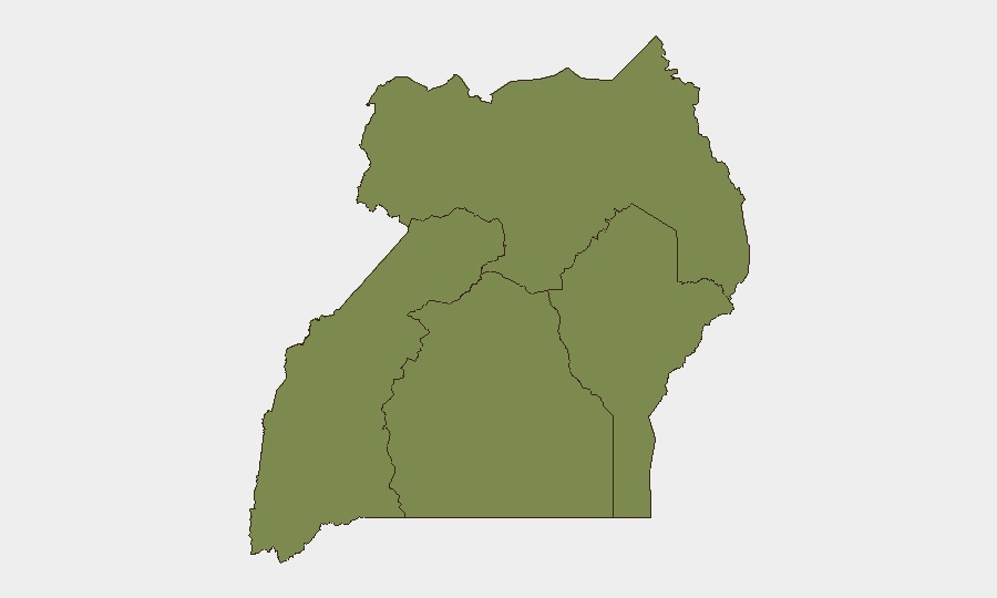
Central Region (risk 32.2) is the primary threat driver, encompassing Kampala and surrounding districts where terrorism, armed robbery, and organized crime concentrate. Northern Region (26.2) reflects residual insecurity and militant activity, while Western Region (14.2) shows moderate but material risk. Eastern Region remains significantly lower-risk (2.2). The Central Region ranking correlates with population density, economic activity, and historical militant targeting of urban/transport infrastructure; security teams with personnel or assets in Kampala and central corridors face the highest exposure to sudden violence, kidnapping, and civil unrest. Northern Region requires vigilance for armed-group activity and banditry, particularly in remote or border-adjacent areas.
How GeoBit Would Assist
Security teams operating in Uganda should activate AOI (Area-of-Interest) Monitoring & Early Warning on high-risk districts in Central and Northern Regions to detect emerging protest activity, militant movements, or crime spikes in real time. Intel Sweep and OSINT fusion (combining X/Twitter, local media, and Telegram channels) can provide continuous corroboration of political developments and security incidents with minimal latency. Conflict & Military actor mapping and Network & Actor Analysis help identify armed groups, protest organizers, and criminal networks operating near corporate locations, informing duty-of-care protocols.
7-Day Outlook
No imminent destabilization is forecast, but political and health-security pressures remain active. The Ebola outbreak will likely continue to drive travel restrictions and health screening at borders and airports; corporate movement and personnel deployments should account for potential quarantine protocols. Vigilance for localized protest escalation in Kampala and civil unrest related to diplomatic tensions (UK, Rwanda) is warranted; situational awareness and agile response procedures remain essential.
Highest-Risk Areas — Ranked
| # | State / Region | Risk |
|---|---|---|
| 1 | Central Region | 32.2 |
| 2 | Northern Region | 26.2 |
| 3 | Western Region | 14.2 |
| 4 | Eastern Region | 2.2 |
Sources
Previous Daily Briefs
A new Uganda brief is written every day — each with its own risk map and downloadable CSV. Here's the last week; use the calendar to go further back.
📅 Browse every day by calendar →
Highlighted days have a brief. Tap a day for that day's map & analysis, or “csv” for that day's dataset ($5).
Atlas — our AI intelligence desk — emails them this snapshot personally. Nothing else, no list.