Situation Summary
Vanuatu remains a low-threat environment with a composite threat score of 3 globally. Recent diplomatic tensions with New Caledonia and France, signaled on 2026-06-11, have not yet manifested as security incidents affecting civilians or business operations. A magnitude 5.4 earthquake 197 km south-southeast of Isangel underscores ongoing seismic risk typical of the region. No credible reports of acute security incidents, civil unrest, crime spikes, or infrastructure failures have been corroborated in the past 24–48 hours.
Key Developments
- Diplomatic tension · New Caledonia / Vanuatu · 2026-06-11 – New Caledonia signaled reduced relations with Vanuatu; Vanuatu issued multiple public statements in response. No direct impact on security operations or travel corridors reported.
- French relations criticism · Vanuatu · 2026-06-11 – Vanuatu issued two disapprovals directed at France. Statements remain rhetorical; no sanctions, restrictions on movement, or asset seizures announced.
- Seismic activity · South-central region · recent – Magnitude 5.4 earthquake occurred 197 km south-southeast of Isangel (Tafea Province). No casualties, infrastructure damage, or tsunami warnings reported in available sources.
No additional corroborated security events (riots, attacks, significant crime, political crises, travel alerts) have been identified in the past 48 hours.
Highest-Risk Areas
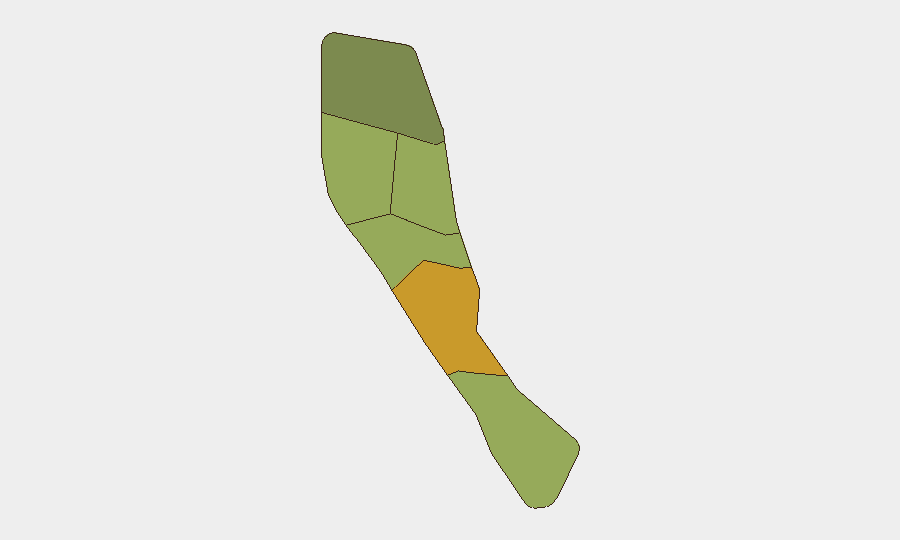
Shefa Province (risk score 72) remains the highest-risk jurisdiction, likely reflecting Port Vila's density, transient population, and concentration of government and commercial activity. Penama (58) and Sanma (52) follow; these provinces experience greater relative isolation, limited emergency-response capacity, and periodic maritime security concerns. Tafea (45) and Torba (35) carry lower composite risk but remain subject to seismic hazard, cyclone exposure, and health-system constraints typical of Vanuatu's remote outer islands. Risk rankings reflect structural vulnerability rather than acute conflict or civil unrest.
How GeoBit Would Assist
Intel Sweep and OSINT fusion would provide real-time monitoring of diplomatic statements and social channels to track escalation in France / New Caledonia / Vanuatu relations and flag any spillover affecting Port Vila or business corridors. AOI Monitoring & Early Warning paired with satellite & imagery analysis would detect infrastructure disruptions, port congestion, or unusual military or police deployments. Seismic and environmental health monitoring feeds would alert security teams to earthquakes, cyclone track updates, and volcanic activity in advance of mass-casualty or evacuation scenarios.
7-Day Outlook
Diplomatic rhetoric is likely to continue; no imminent military action or travel restrictions are signaled. Seismic activity in the Tafea region may persist as part of normal crustal adjustment; cyclone season (November–April) is not active. Corporate operations and movement in Port Vila and provincial centers are not forecast to face acute disruption over the next seven days, though baseline care around infrastructure reliability, health-service capacity, and maritime delays should remain standard practice.
Highest-Risk Areas — Ranked
| # | State / Region | Risk |
|---|---|---|
| 1 | Shefa Province | 72 |
| 2 | Penama | 58 |
| 3 | Sanma | 52 |
| 4 | Malampa | 48 |
| 5 | Tafea | 45 |
| 6 | Torba | 35 |
Sources
Previous Daily Briefs
A new Vanuatu brief is written every day — each with its own risk map and downloadable CSV. Here's the last week; use the calendar to go further back.
📅 Browse every day by calendar →
Highlighted days have a brief. Tap a day for that day's map & analysis, or “csv” for that day's dataset ($5).