Situation Summary
Liberia remains a low-intensity, fragmented-risk environment with a composite threat score of 4 globally (#152 overall). No acute security incidents, civil unrest, or violence events have been reliably documented in the last 24–48 hours across verified open sources. Current governance and infrastructure developments—including the commissioning of the Mount Coffee solar facility and Liberia's new UN Security Council role—reflect stability at the national level, though localized crime and economic vulnerability persist in specific counties.
Key Developments
- No verified acute security incidents reported in the last 24–48 hours. Open-source monitoring, news indexing, and social-media OSINT do not confirm discrete violence, unrest, or crime events within this window that meet cross-source corroboration standards.
- Mount Coffee Solar Facility Commission (Montserrado County, recent). President Boakai formally commissioned a 20 MWp solar power plant; improved grid reliability may reduce outage-driven social friction but does not constitute a security incident.
- Cabinet Meeting on Governance (Monrovia, recent). The 21st Cabinet meeting focused on accountability and foreign-policy operationalization; no new security threats or incidents were reported.
- Unconfirmed social-media posts on drug interdictions. Facebook posts reference alleged airport drug seizures and warrant arrests, but lack reliable timestamps and secondary corroboration; not yet classified as verified incidents.
- UN Security Council engagement (strategic context). Liberia's non-permanent seat for 2026–2027 continues to shape diplomatic posture; no domestic security implications in the reporting window.
Highest-Risk Areas
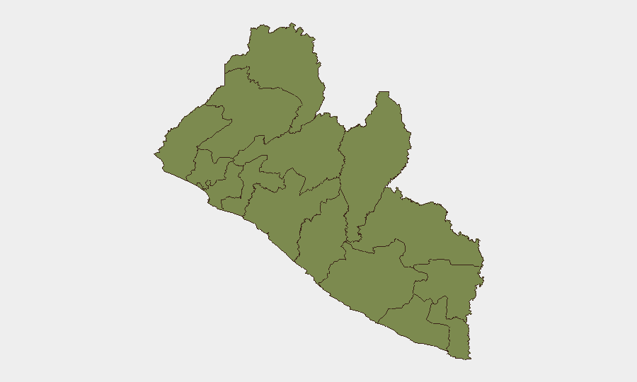
Bong and Nimba counties drive Liberia's subnational risk profile, each scoring 31.9—significantly higher than the national average. Both are located in the interior forest and savanna zones historically affected by diamond-smuggling networks, cross-border labor disputes, and limited state administrative presence. Montserrado and Margibi counties (Monrovia metropolitan area and environs, risk scores 16.9 each) contain the capital and primary economic activity; urban crime, gang activity, and opportunistic violence remain chronic but non-epidemic. The remaining nine counties score 1.9, indicating minimal reported threat activity and low security-event density, though this may also reflect under-reporting in remote areas.
How GeoBit Would Assist
- AOI Monitoring & Early Warning. Persistent watch over Bong and Nimba counties—combined with OSINT fusion (social-media feeds, local news, Telegram channels) and temporal analysis—would detect emerging crime clusters, cross-border movement, or unrest signals before they escalate.
- OSINT Fusion & Corroboration. Current unconfirmed drug-seizure posts illustrate the value of GeooBit's multi-source, multi-language search and entity extraction; systematic corroboration across news, government bulletins, and field sources would either validate or downgrade rumors to background noise.
- Conflict & Crime Trend Analysis. Rolling 7-day and 30-day event sweeps, combined with risk-assessment modeling, would provide duty-of-care teams with trend-level visibility on whether localized crime or political friction is accelerating or stable.
7-Day Outlook
No imminent surge in violence or unrest is signaled by current reporting. Governance and infrastructure initiatives suggest near-term political stability at the national level. Localized crime in interior counties (Bong, Nimba) and Monrovia urban areas remains endemic; security teams should maintain standard corporate-security protocols and rely on persistent AOI monitoring rather than incident-driven alerting.
Highest-Risk Areas — Ranked
| # | State / Region | Risk |
|---|---|---|
| 1 | Bong County | 31.9 |
| 2 | Nimba County | 31.9 |
| 3 | Montserrado County | 16.9 |
| 4 | Margibi County | 16.9 |
| 5 | Grand Cape Mount County | 1.9 |
| 6 | Lofa County | 1.9 |
| 7 | Gbarpolu County | 1.9 |
| 8 | Bomi County | 1.9 |
| 9 | Grand Bassa County | 1.9 |
| 10 | Rivercess County | 1.9 |
| 11 | Grand Gedeh County | 1.9 |
| 12 | Sinoe County | 1.9 |
Sources
Previous Daily Briefs
A new Liberia brief is written every day — each with its own risk map and downloadable CSV. Here's the last week; use the calendar to go further back.
📅 Browse every day by calendar →
Highlighted days have a brief. Tap a day for that day's map & analysis, or “csv” for that day's dataset ($5).