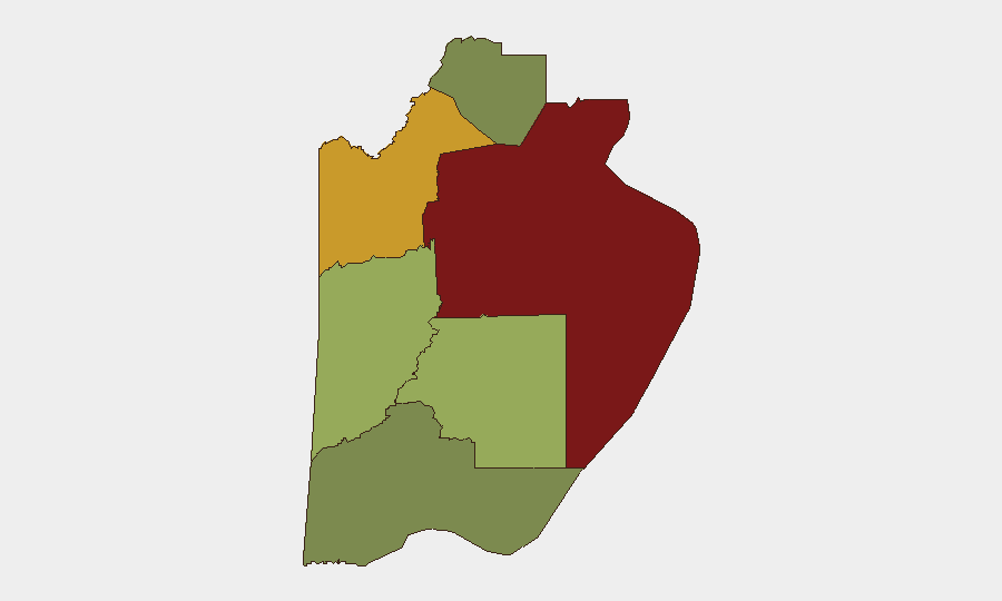
Situation Summary
Belize remains a stable, low-threat environment at the national level (rank #67 globally, composite threat score 17). No verified security incidents or civil unrest have been reported in the last 24–48 hours across major local news sources, police channels, or social media. The security picture is characterized by baseline gang and property crime concentrated in specific urban areas, particularly Belize City and Orange Walk District, with no escalation signals in the current monitoring window.
Key Developments
No discrete, time-stamped security incidents meeting recency and multi-source corroboration thresholds have been confirmed for Belize in the last 24–48 hours. Open-source monitoring (Belize Police, News 5 Live, Channel 7, Love FM, social media) and GeoBit event signals detected diplomatic and political statements between government actors (2026-07-02 to 2026-07-04) but no associated security, unrest, or infrastructure events within the reporting window. Older incidents—including a San Pedro maritime shooting and bus-terminal robbery—remain in circulation on local media but are undated or explicitly several weeks old and therefore do not qualify as current developments.
Highest-Risk Areas
Belize District (risk 95) and Orange Walk District (risk 72) account for the majority of sub-national threat concentration. Belize District, anchored by Belize City, hosts the largest concentration of gang activity, interpersonal violence, and property crime; Orange Walk District faces similar but slightly lower-intensity gang and narcotic-trafficking-related risk. Cayo District (risk 58) and Stann Creek District (risk 48) carry moderate baseline risk tied to property crime and border-region dynamics. Toledo and Corozal Districts (risk 35 and 22, respectively) remain substantially lower-risk and are safer for travel and operations. Risk correlates with urbanization, gang territorial presence, and in Orange Walk, proximity to cross-border trafficking routes.
How GeoBit Would Assist
Security and duty-of-care teams operating in Belize would deploy AOI (Area-of-Interest) Monitoring & Early Warning on high-risk districts—particularly Belize City and Orange Walk—to detect emerging gang activity, roadblocks, or civil unrest with automated alerting. Multi-language OSINT Sweep and Entity Extraction across Belizean media, social platforms, and police channels would provide real-time baseline event tracking and early signals of organized-crime or protest activity. GIS & Spatial Analysis combined with Routing & Network Analysis would support alternative journey planning and venue security assessment for personnel and asset movement in high-risk zones.
7-Day Outlook
No imminent escalation is forecast. Baseline gang and property crime in Belize City and Orange Walk will likely persist at established levels; security operations should maintain standard precautions in those districts. Diplomatic activity between government actors will continue but is not expected to translate into domestic unrest, roadblocks, or security incidents in the near term. Monitoring should remain routine unless new event signals or civil-unrest indicators emerge.
Highest-Risk Areas — Ranked
| # | State / Region | Risk |
|---|---|---|
| 1 | Belize District | 95 |
| 2 | Orange Walk District | 72 |
| 3 | Cayo District | 58 |
| 4 | Stann Creek District | 48 |
| 5 | Toledo District | 35 |
| 6 | Corozal District | 22 |
Sources
Previous Daily Briefs
A new Belize brief is written every day — each with its own risk map and downloadable CSV. Here's the last week; use the calendar to go further back.
📅 Browse every day by calendar →
Highlighted days have a brief. Tap a day for that day's map & analysis, or “csv” for that day's dataset ($5).
Atlas — our AI intelligence desk — emails them this snapshot personally. Nothing else, no list.