Situation Summary
Burkina Faso remains ranked #19 globally for composite security threat (score 72), driven primarily by active insurgency. The country has recorded 63 tracked security events in the current monitoring cycle, with recent signals indicating internal institutional friction alongside ongoing unconventional violence. The Sahel region—the nation's highest-risk sub-national area (80.5)—continues to anchor the threat picture, though security pressures are dispersed across multiple zones. Current trajectory suggests compounding stress on state capacity and civil-military relations.
Key Developments
- Ouagadougou, 2026-06-12 – Small arms combat reported between Prime Minister's office and Burkina Faso security forces; concurrent signals of institutional disapproval of security force conduct.
- Ouagadougou, 2026-06-12 – Unconventional violence incident recorded (specific nature and location under verification).
- Ouagadougou, 2026-06-13 – Public statement issued by Bahama entity directed at media; context suggests political or institutional messaging amid broader instability.
- Ouagadougou, June 2026 (precise date unconfirmed) – State authorities suspended Coordination of Muslim Youth of Burkina Faso and Association for Peace for three months on security/public-order grounds; imam of Grand Mosque reportedly arrested, triggering civil-liberties debate.
*Note:* Available open-source reporting for the last 24–48 hours is limited. The above reflects the highest-confidence developments; additional incident-level detail remains under corroboration by GeoBit's intel team.
Highest-Risk Areas
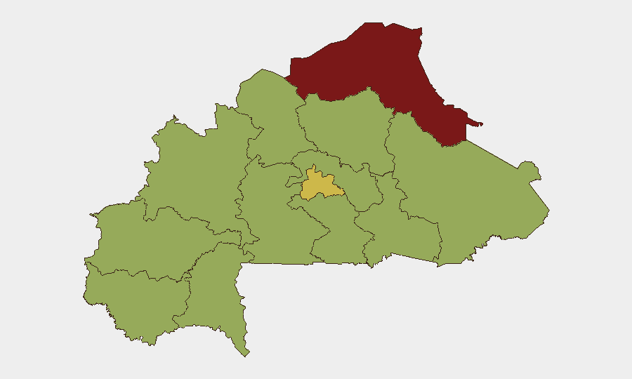
The Sahel region dominates Burkina Faso's security geography, with a composite risk score of 80.5—nearly 20 points above the second-highest zone (Centre, 61.4). Sahel's elevated risk reflects sustained insurgent operations, weak state presence, and cross-border spillover from Mali and Niger. The Centre region (61.4) and North (57.7) follow as secondary concentrations, likely driven by proximity to Sahel pressure, competition for resources, and state-counterinsurgency intensity. Remaining regions cluster between 50.5 and 51.4, indicating a broad national baseline of moderate-to-elevated risk rather than isolated hotspots; this diffusion complicates security planning for organizations with national footprints.
How GeoBit Would Assist
Security and risk teams operating in Burkina Faso should deploy AOI (Area-of-Interest) Monitoring & Early Warning with alerting on the Sahel, Centre, and North regions to detect insurgent activity, military movements, and administrative disruption before they affect operations or personnel. Conflict & Military mapping combined with Network & Actor Analysis provides tactical-level visibility on insurgent force structures, state security deployments, and spoiler groups. Intel Sweep and OSINT fusion (X/Twitter, local media, radio SIGINT) enable continuous monitoring of political and institutional fractures—such as the apparent civil-military tension evident in recent event signals—which often precede broader state fragility or security force misconduct affecting civilian safety.
7-Day Outlook
Institutional strain between the Prime Minister's office and security forces is likely to persist, potentially affecting coordination of counterinsurgency operations and creating tactical opportunities for insurgent groups. Continued restrictions on civil-society organizations (mosques, youth groups) may generate secondary grievances and complicate intelligence gathering. Absent major escalation, the Sahel and Centre regions will remain the primary operational concern for corporations and humanitarian actors; however, any further deterioration in state-security-force cohesion could rapidly degrade security across multiple zones.
Highest-Risk Areas — Ranked
| # | State / Region | Risk |
|---|---|---|
| 1 | Sahel | 80.5 |
| 2 | Centre | 61.4 |
| 3 | North | 57.7 |
| 4 | Central-North | 51.4 |
| 5 | Upper-Basins | 50.5 |
| 6 | Boucle du Mouhoun | 50.5 |
| 7 | Central-West | 50.5 |
| 8 | Central-South | 50.5 |
| 9 | Central-East | 50.5 |
| 10 | Waterfalls | 50.5 |
| 11 | Southwest | 50.5 |
| 12 | East | 50.5 |
Sources
Previous Daily Briefs
A new Burkina Faso brief is written every day — each with its own risk map and downloadable CSV. Here's the last week; use the calendar to go further back.
📅 Browse every day by calendar →
Highlighted days have a brief. Tap a day for that day's map & analysis, or “csv” for that day's dataset ($5).