Situation Summary
Cape Verde remains a low-threat jurisdiction globally (rank #178, composite threat score 3) with no discrete security incidents tracked in the current reporting window. The country is assessed at U.S. State Department Level 1 (Exercise Normal Precautions), reflecting the absence of active conflict, organized crime violence, or political instability. Current risk is seasonal and weather-driven rather than security-incident driven, with authorities implementing heightened disaster-preparedness protocols ahead of the Atlantic rainy season.
Key Developments
- Cape Verde (nationwide) — 2026-08-11 to 2026-08-12 — The National Civil Protection Service activated heightened readiness for the rainy season, with updated emergency response plans, flood-risk monitoring systems, and cross-island disaster coordination. This reflects standard seasonal preparedness, not response to an active event.
- Central Atlantic / Cape Verde region — 2026-08-11 to 2026-08-12 — A tropical disturbance was reported approximately 550 miles southwest of the Cape Verde Islands; meteorological forecasters assessed a medium probability of organization within 48 hours. Current trajectory and intensity remain subject to atmospheric conditions; no impact on land assessed at this time.
- Cape Verde (travel advisory status) — 2026-08-12 — No change to the Level 1 travel advisory; no active GDACS (Global Disaster Alert and Coordination System) event declared. Commercial and port operations remain unaffected.
No confirmed security incidents, civil unrest, criminal events, or political developments were identified in Cape Verde for the 24–48-hour window ending 2026-08-12.
Highest-Risk Areas
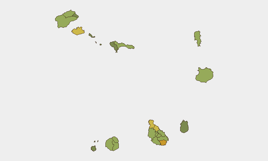
Praia (risk 72) and São Miguel (risk 68) lead the sub-national ranking, followed by São Vicente (risk 65) and Tarrafal (risk 62). These scores reflect aggregate factors including population density, maritime exposure, and port infrastructure rather than active conflict or organized crime. Praia's elevation as the capital and primary urban/commercial hub accounts for concentration of people and assets; São Miguel and São Vicente, as secondary population centers with maritime interfaces, carry elevated exposure to weather, accident, and logistical disruption. Risk scores in this range (48–72) remain low in absolute terms and do not indicate instability or violence.
How GeoBit Would Assist
Corporate security and duty-of-care teams should employ AOI Monitoring & Early Warning on Praia and secondary ports (São Vicente, Tarrafal) to track maritime traffic, weather-related disruption, and port operational status in near-real time. Environmental & Health intelligence (satellite imagery, weather feeds, GDACS integration) provides 72-hour advance notice of tropical systems and flooding risk, enabling logistics rerouting and staff movement decisions. Economic & Trade search combined with Maritime & Aviation tracking supports supply-chain continuity planning and asset-movement coordination across the archipelago.
7-Day Outlook
The tropical disturbance southwest of Cape Verde warrants 48–72-hour monitoring; if organization occurs, maritime and aviation impacts are possible but not yet probable. Rainy-season conditions will persist through October, elevating localized flood and weather-delay risk. No political, security, or conflict drivers are anticipated to materially alter Cape Verde's low-threat profile over the next week.
Highest-Risk Areas — Ranked
| # | State / Region | Risk |
|---|---|---|
| 1 | Praia | 72 |
| 2 | São Miguel | 68 |
| 3 | São Vicente | 65 |
| 4 | Tarrafal | 62 |
| 5 | São Filipe | 58 |
| 6 | Santa Catarina | 58 |
| 7 | Santa Cruz | 55 |
| 8 | Mosteiros | 52 |
| 9 | São Salvador do Mundo | 52 |
| 10 | Ribeira Grande | 50 |
| 11 | Porto Novo | 48 |
| 12 | Sal | 48 |
Sources
Previous Daily Briefs
A new Cape Verde brief is written every day — each with its own risk map and downloadable CSV. Here's the last week; use the calendar to go further back.
📅 Browse every day by calendar →
Highlighted days have a brief. Tap a day for that day's map & analysis, or “csv” for that day's dataset ($5).
Atlas — our AI intelligence desk — emails them this snapshot personally. Nothing else, no list.