Situation Summary
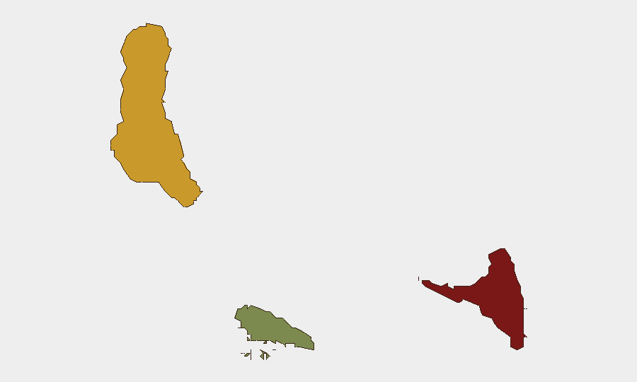
Comoros remains classified as a lower-tier global security risk (composite score 7), with no discrete security events tracked in the current monitoring window. The archipelago's threat landscape is heavily concentrated in Anjouan (risk score 88), which substantially exceeds risk levels in Grande Comore (72) and Moheli (35), indicating acute geographic fragmentation of instability. No verified security incidents, civil unrest, infrastructure disruptions, or travel-safety developments have been confirmed in Comoros over the last 24–48 hours; the overall trajectory remains stable absent new triggers.
Key Developments
No discrete security, conflict, crime, or political-instability events have been verified in Comoros during the 24–48 hour reporting window. Standard monitoring protocols remain in effect pending new credible reporting.
Highest-Risk Areas
Anjouan constitutes the primary area of concern, with a composite risk score of 88—substantially higher than other islands and consistent with a history of separatist and governance tensions. Grande Comore (score 72) presents secondary risk concentration, likely tied to national-capital politics and maritime domain challenges. Moheli (35) reflects significantly lower acute risk. The disparity between Anjouan and other islands underscores the need for asset-owner and travel teams to apply heightened situational awareness in that jurisdiction and to segment contingency planning by island.
How GeoBit Would Assist
For organizations with personnel or assets in Comoros, three capabilities are operationally critical: AOI Monitoring & Early Warning to establish persistent watch on Anjouan and Grande Comore with rule-based alerting on political, security, or maritime triggers; Intel Sweep and multi-language OSINT to detect early signals of governance friction, separatist activity, or cross-border instability before they escalate; and Routing & Network Analysis to pre-plan alternative transport and evacuation pathways across the three islands, accounting for port and airfield accessibility. This layered approach reduces surprise and compresses decision-lag in any escalation scenario.
7-Day Outlook
No material change in the baseline security posture is anticipated over the next seven days absent new political or maritime incidents. Continued monitoring of Anjouan-centered governance dynamics and Indian Ocean maritime activity remains prudent given historical volatility in that region. Organizations should maintain current duty-of-care protocols and ensure staff briefing on island-specific risk profiles.
Note: This brief reflects available open-source verification only. Organizations requiring real-time confirmation of Comoros developments are encouraged to supply raw X/Twitter feeds, news alerts, or regional intelligence sources for rapid GeoBit analysis. A customized Comoros monitoring template can be constructed on request.
Highest-Risk Areas — Ranked
| # | State / Region | Risk |
|---|---|---|
| 1 | Anjouan | 88 |
| 2 | Grande Comore | 72 |
| 3 | Moheli | 35 |
Previous Daily Briefs
A new Comoros brief is written every day — each with its own risk map and downloadable CSV. Here's the last week; use the calendar to go further back.
📅 Browse every day by calendar →
Highlighted days have a brief. Tap a day for that day's map & analysis, or “csv” for that day's dataset ($5).