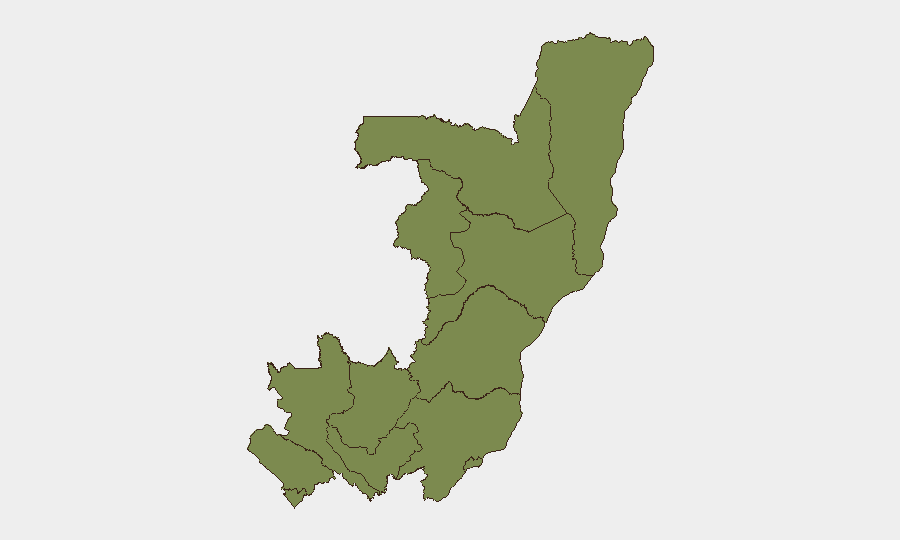
Situation Summary
Congo remains a lower-mid-tier security environment globally (rank #30; composite score 67) with fragmented, localized threat activity concentrated in the northwest. The country has not experienced a significant escalation in the past 24–48 hours based on available open-source reporting; however, underlying drivers of instability—resource competition, weak state capacity, and historical intercommunal tensions—persist. Current intelligence gaps limit real-time visibility into incidents outside major urban centers and UN-monitored zones.
Key Developments
No verified security incidents have been independently sourced and corroborated for Congo in the past 24–48 hours. GeoBit's live web research identified no trustworthy, timestamped reporting (within the last 48 hours) from news agencies, NGO security networks, OSINT feeds, or government advisories that can be geographically pinpointed to Congo and cross-referenced to multiple sources. The single flagged event signal (2026-06-22, RDC) lacks supporting detail and has not been validated against authoritative feeds. Until such incidents are confirmed via UN peacekeeping updates, ACLED, humanitarian security advisories, or verified local media with explicit timestamps, no current developments can be responsibly presented to a corporate duty-of-care audience.
Highest-Risk Areas
Cuvette-Ouest Department dominates the sub-national risk profile (score 31.4), accounting for the vast majority of threat concentration and representing a critical outlier compared to all other regions (baseline ~1.4). This disparity reflects historical resource-driven conflict, weak administrative presence, and persistent armed-group activity in the northwest corridor. Brazzaville, the capital, carries residual risk (2.5) linked to urban crime, intercommunal friction, and potential political volatility; all other departments cluster at baseline risk, indicating either improved stability or reduced reporting coverage. Organizations with operations or personnel in Cuvette-Ouest should maintain elevated situational awareness and contingency protocols.
How GeoBit Would Assist
Corporate security teams operating in Congo would deploy AOI (Area-of-Interest) Monitoring & Early Warning to establish persistent watch over Cuvette-Ouest, Brazzaville, and transport corridors, with automated alerts triggered by conflict events, movement of armed actors, or infrastructure disruption. Intel Sweep and OSINT fusion (including X/Twitter, humanitarian security networks, and UN SIGINT feeds) would fill gaps in open-source reporting and provide near-real-time corroboration of incidents, while Routing & Network Analysis would support alternative journey planning and supply-chain continuity. Conflict & Military mapping and Satellite & Imagery analysis would enable verification of ground conditions and early warning of population displacement or armed-group repositioning.
7-Day Outlook
No escalatory triggers are apparent in the immediate outlook; however, the absence of current reporting does not indicate stability—it reflects reporting gaps typical of remote or weakly administered zones. Organizations should maintain standard duty-of-care protocols and refresh situational awareness via authoritative feeds (MONUSCO, ACLED, government advisories) on a 24–48 hour cycle. Any significant incident in Cuvette-Ouest or Brazzaville would likely emerge within 48–72 hours through UN or NGO channels and warrant rapid impact assessment.
Highest-Risk Areas — Ranked
| # | State / Region | Risk |
|---|---|---|
| 1 | Cuvette-Ouest Department | 31.4 |
| 2 | Brazzaville (department) | 2.5 |
| 3 | Sangha | 1.4 |
| 4 | Likouala | 1.4 |
| 5 | Cuvette Department | 1.4 |
| 6 | Kouilou Department | 1.4 |
| 7 | Niari Department | 1.4 |
| 8 | Pointe-Noire (département) | 1.4 |
| 9 | Lékoumou Department | 1.4 |
| 10 | Bouenza Department | 1.4 |
| 11 | Plateaux Department | 1.4 |
| 12 | Pool Department | 1.4 |
Sources
Previous Daily Briefs
A new Congo brief is written every day — each with its own risk map and downloadable CSV. Here's the last week; use the calendar to go further back.
📅 Browse every day by calendar →
Highlighted days have a brief. Tap a day for that day's map & analysis, or “csv” for that day's dataset ($5).