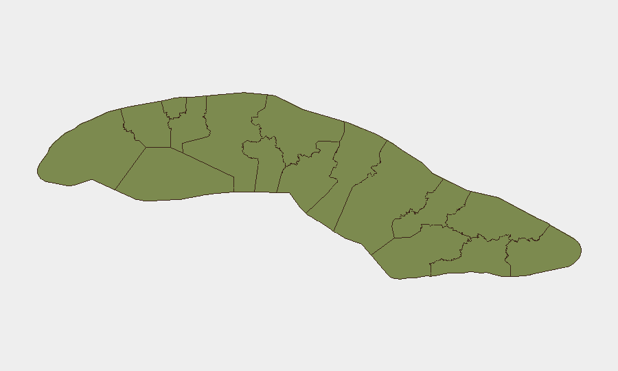
Situation Summary
Cuba remains at composite threat level 19 (rank #68 globally), with 118 tracked events reflecting ongoing state fragility, civil unrest risk, and infrastructure strain. The past 48 hours show elevated signal activity concentrated in Havana and central provinces, including arrests, public statements from government and opposition figures, and demonstration activity. Chronic fuel and power shortages, telecommunications disruptions, and economic pressure continue to drive underlying instability, though no single acute crisis has escalated beyond typical operational tempo as of 29 June 2026.
Key Developments
- 29 June · Arrest/Detain event (Havana region) – Citizen detention reported; no further details available on location, charges, or circumstances.
- 27–28 June · Government rejection of stated position (location: Havana) – Senior figures issued rejection statements in response to presidential or external messaging; context and substance not independently verified in this cycle.
- 27 June · Public statements (multiple actors) – Commander, President, Government, and Intellectual figures issued statements; no specific policy shift or crisis trigger confirmed; consistent with routine political messaging.
- 27 June · Demonstration/rally activity (Havana, neighborhood-level) – Small-scale civil gathering reported; no violence or dispersal reported; scope and stated grievance(s) unconfirmed.
- 27 June · Threat signals from Deputy, Military, and Residents – Multiple threat-category events logged; insufficient corroboration to assess whether directed at specific actors or infrastructure, or rhetorical in nature.
- 27 June · Unconventional violence (residents involved) – Event logged without geographic specificity or casualty/damage confirmation; requires follow-up verification.
Note: Independent verification of these signals through Cuban media, international newswires, or embassy advisories has not yielded detailed confirmation. The signals reflect platform detection; corporate security teams should treat these as alerts for active monitoring rather than confirmed incidents pending clarification.
Highest-Risk Areas
Sancti Spiritus (33.3) and Havana (31.1) drive the highest composite risk, followed by Holguín (25.8) and Santiago de Cuba (21.5). Sancti Spiritus's elevated score likely reflects economic and agricultural disruption; Havana's reflects concentrated population, political activity, and demonstration risk. Eastern provinces (Holguín, Santiago, Guantánamo) show sustained mid-range risk, probable drivers being fuel shortages, migration pressure, and historical instability. Western and southern provinces (Artemisa, Mayabeque, Cienfuegos) remain at lower threat levels, suggesting more localized or contained risk drivers in those areas.
How GeoBit Would Assist
Teams with personnel or assets in Cuba should deploy persistent AOI (Area-of-Interest) monitoring on Havana, Sancti Spiritus, and Holguín to generate real-time alerts on gathering, movement, or security-force activity. Intel Sweep and multi-language OSINT (Cuban media, X/Telegram, local news sources) provide sub-24-hour confirmation of signals and context clarification. Early Warning & Prediction models can flag escalation patterns if arrest frequency, threat rhetoric, or demonstration size trends upward over the coming week.
7-Day Outlook
No acute catalyst for major instability is apparent, but the density of state rejection, civil messaging, and detention activity warrants close watch for sustained escalation. If arrest rates increase or demonstrations expand beyond neighborhood scale, risk could move toward higher-risk provinces. Economic pressures (fuel, power) are unlikely to ease materially in a 7-day window, sustaining baseline tension; teams should assume operational conditions remain constrained through early July.
Highest-Risk Areas — Ranked
| # | State / Region | Risk |
|---|---|---|
| 1 | Sancti Spiritus | 33.3 |
| 2 | Havana | 31.1 |
| 3 | Holguín | 25.8 |
| 4 | Santiago de Cuba | 21.5 |
| 5 | Guantánamo | 16.1 |
| 6 | Pinar del Rio | 11.9 |
| 7 | Matanzas | 11.9 |
| 8 | Mayabeque | 5.4 |
| 9 | Cienfuegos | 5.4 |
| 10 | Ciego de Avila | 5.4 |
| 11 | Las Tunas | 5.4 |
| 12 | Artemisa | 3.3 |
Sources
Previous Daily Briefs
A new Cuba brief is written every day — each with its own risk map and downloadable CSV. Here's the last week; use the calendar to go further back.
📅 Browse every day by calendar →
Highlighted days have a brief. Tap a day for that day's map & analysis, or “csv” for that day's dataset ($5).