Situation Summary
El Salvador maintains a broadly stable security posture as of 22 June 2026, with no verified security incidents, civil unrest, infrastructure disruptions, or mass-casualty crime events reported in the last 24–48 hours. The country's composite threat score of 22 places it outside the highest-risk tier globally; open-source monitoring and multi-source verification indicate continued short-term stability across national, port, airport, and critical-infrastructure domains. Recent seismic activity (M 4.4 and M 4.3 events) and localized flooding represent natural hazards rather than security threats. The risk environment remains characterized by endemic organized-crime activity concentrated in specific departments, rather than acute conflict or unrest.
Key Developments
- No verified security or crime incidents (national, 20–22 June 2026): Multi-source scanning of news outlets, regional press, and social media found no corroborated reports of homicides, kidnappings, protests, riots, gang violence, or politically motivated attacks in the last 24–48 hours.
- Seismic events – offshore and inland (recent): M 4.4 earthquake recorded 72 km south-southwest of Acajutla; M 4.3 event 4 km south-southwest of Chalatenango. No casualties or infrastructure damage confirmed; standard earthquake-preparedness monitoring advised for coastal and northern zones.
- Flood incident (event ID 1103930, date unspecified but recent): Localized flooding reported; impact scope and affected department(s) require local verification. Standard flood-related safety precautions apply.
- Ports and airports operational (20–22 June): San Salvador/Comalapa International Airport and major port facilities show no disruptions, security lockdowns, or NOTAM alerts attributable to crime or unrest.
- Critical infrastructure intact (20–22 June): Power grids, telecoms networks, and transport corridors report no confirmed outages, blackouts, or deliberate attacks linked to organized crime or conflict in the last 24–48 hours.
- No civil unrest or demonstrations (20–22 June): Activist networks, journalist feeds, and local media do not report new protests, road blockades, clashes with security forces, or sizable public demonstrations in the reporting window.
Highest-Risk Areas
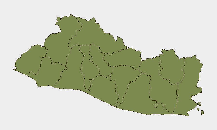
Cabañas Department stands as the country's highest-risk zone with a composite score of 31.3, substantially elevated above the remaining 13 departments (each scored 1.3). This disparity suggests concentrated organized-crime activity—likely gang presence, extortion networks, or trafficking logistics—in Cabañas rather than diffuse national instability. All other departments cluster at identical low scores, indicating either uniform baseline risk or data-aggregation effects that warrant field-level verification. Corporate security teams with personnel or assets in Cabañas should maintain heightened situational awareness and direct local intelligence collection; departments rated 1.3 may be treated as lower-priority for daily monitoring absent new incident signals.
How GeoBit Would Assist
Security teams should employ Intel Sweep and global event feeds for continuous 24/7 monitoring of El Salvador's security baseline, supplemented by X/Twitter and Telegram OSINT to detect emerging protests, unrest, or crime clusters in real time. AOI Monitoring & Early Warning on Cabañas Department and key transit corridors (ports, airports, major highways) will provide persistent alerting if threat levels shift. Routing & Network Analysis capabilities enable alternative-route planning for personnel and supply movements, mitigating exposure to high-risk zones during operational planning.
7-Day Outlook
El Salvador's near-term trajectory remains stable absent major exogenous shocks (e.g., regional cartel escalation, natural disasters). Cabañas Department warrants continued close watch given its outlier risk profile; any uptick in reported extortion, kidnapping, or homicides there should trigger immediate escalation. Natural hazards (seismic and flood risk) will persist; standard contingency planning for earthquake and weather events is advisable.
Highest-Risk Areas — Ranked
| # | State / Region | Risk |
|---|---|---|
| 1 | Cabañas Department | 31.3 |
| 2 | Ahuachapán Department | 1.3 |
| 3 | Sonsonate Department | 1.3 |
| 4 | Santa Ana Department | 1.3 |
| 5 | Chalatenango Department | 1.3 |
| 6 | La Libertad Department | 1.3 |
| 7 | San Salvador Department | 1.3 |
| 8 | Cuscatlán Department | 1.3 |
| 9 | La Paz Department | 1.3 |
| 10 | San Vicente Department | 1.3 |
| 11 | Usulután Department | 1.3 |
| 12 | San Miguel Department | 1.3 |
Sources
Previous Daily Briefs
A new El Salvador brief is written every day — each with its own risk map and downloadable CSV. Here's the last week; use the calendar to go further back.
📅 Browse every day by calendar →
Highlighted days have a brief. Tap a day for that day's map & analysis, or “csv” for that day's dataset ($5).