Situation Summary
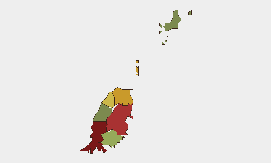
Grenada presents a low baseline security environment with no verified incidents reported in the last 24–48 hours and no active civil unrest, violent crime, or infrastructure disruption affecting international operations. The composite threat score of 12 and absence of tracked events reflects a stable operating picture. Risk concentration within Saint George, Saint Andrew, and Saint Patrick parishes suggests localized vulnerabilities in urban centers rather than systemic national instability.
Key Developments
No discrete security, crime, civil unrest, infrastructure, or travel-risk incidents have been verified through open-source reporting, social media, or international news coverage in the last 24–48 hours. The Grenada Development Bank announced an early public closure on 23 June 2026 (noon) to conduct a staff meeting—a routine administrative action unrelated to security concerns. Absence of multi-source reporting on protests, violent crime, terrorism activity, or port/airport disruptions in the current window indicates no acute operational threats.
Highest-Risk Areas
Saint George (risk score 92) and Saint Andrew (risk score 78) drive the national threat ranking, likely reflecting higher concentrations of urban crime, property theft, and gang activity typical of Caribbean port and capital regions. Saint Patrick (risk 71) shows elevated exposure, while southern parishes (Saint John, Saint David) and the outer islands of Carriacou and Petite Martinique (risk 12) present substantially lower operational risk. Teams with personnel or assets in the capital and northern parishes should apply heightened situational awareness during hours of darkness and in low-visibility commercial districts, while remote island operations face minimal localized security pressure.
How GeoBit Would Assist
AOI Monitoring & Early Warning would establish persistent watch on Saint George, Saint Andrew, and Saint Patrick, triggering alerts on emerging unrest, crime clusters, or infrastructure failures before widespread reporting. Intel Sweep combined with X/Twitter & Telegram OSINT and multi-language search would capture real-time local chatter and official government/police announcements, closing gaps between incident occurrence and mainstream news pickup. Routing & Network Analysis would support duty-of-care teams in identifying safe transit corridors and alternative logistics routes around high-risk urban nodes, particularly if localized disruptions develop.
7-Day Outlook
No indicators suggest material deterioration in the security environment over the next seven days. Seasonal weather patterns and routine economic activity are expected to proceed without disruption. Sustained monitoring of northern parishes and continued liaison with local authorities and travel-advisory services remain prudent for any organization maintaining ongoing operations in Grenada.
Highest-Risk Areas — Ranked
| # | State / Region | Risk |
|---|---|---|
| 1 | Saint George | 92 |
| 2 | Saint Andrew | 78 |
| 3 | Saint Patrick | 71 |
| 4 | Saint Mark | 64 |
| 5 | Saint David | 52 |
| 6 | Saint John | 38 |
| 7 | Carriacou and Petite Martinique | 12 |
Sources
Previous Daily Briefs
A new Grenada brief is written every day — each with its own risk map and downloadable CSV. Here's the last week; use the calendar to go further back.
📅 Browse every day by calendar →
Highlighted days have a brief. Tap a day for that day's map & analysis, or “csv” for that day's dataset ($5).