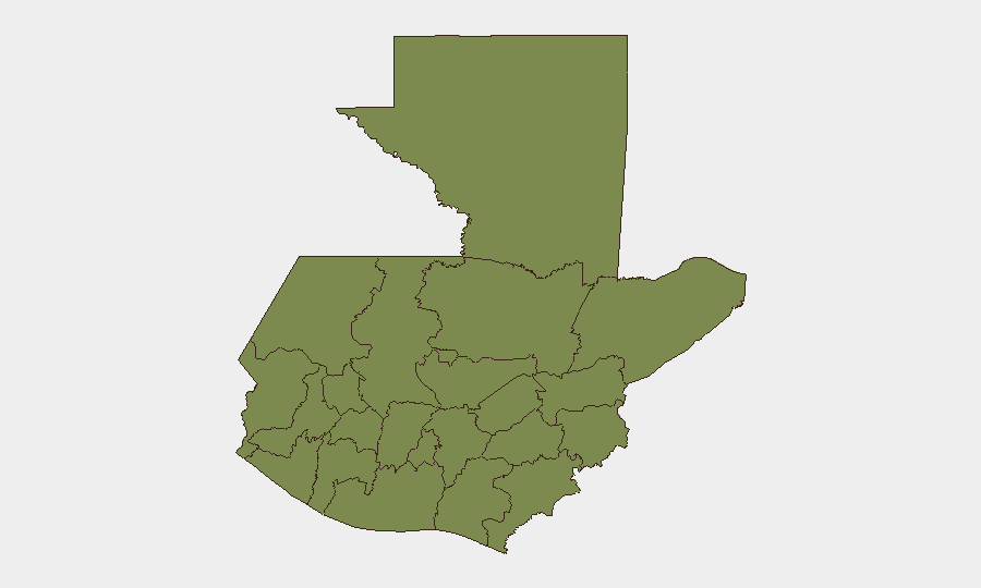
Situation Summary
Guatemala remains at moderate composite risk (rank #61 globally, score 17/100) with institutional and criminal pressures creating fragmentation rather than acute, widespread unrest. Sub-national disparities are stark: Alta Verapaz dominates threat metrics at 31.4, while most other departments cluster at 1.4, indicating concentrated rather than diffuse vulnerability. Recent signals include magistrate-executive friction, gang territorial claims in prisons, military deployments, and U.S. diplomatic statements, but open-source confirmation of time-stamped, location-specific incidents in the past 24–48 hours remains absent from multi-source reporting.
Key Developments
No verifiable, specifically dated security incidents from 16–17 June 2026 have been confirmed across independent open-source channels. Recent event signals (magistrate disapproval statements, presidential remarks, and military/criminal activity indicators) are present in structured feeds but lack independent corroboration, precise timestamps, or geographic specificity required for duty-of-care reporting. Prior reporting window (12–14 June) similarly yielded no confirmed discrete incidents meeting recency and multi-source standards. Ongoing institutional tensions—including judicial-executive friction and criminal territorial activity—persist as background conditions rather than escalating incidents. Corporate security teams should rely on GeoBit's persistent monitoring and alert infrastructure to capture emerging incidents in real time rather than retrospective briefing.
Highest-Risk Areas
Alta Verapaz stands apart at risk score 31.4—nearly 1.7× the national average and 22× higher than most other departments—driven by historical gang presence, narcotics trafficking networks, and weak state capacity in remote northern reaches. Guatemala Department (capital and surroundings, score 18.5) faces urban crime, gang activity, and institutional instability concentrated in and around Guatemala City. The remaining ten departments cluster at 1.4, suggesting either lower baseline threat, lighter criminality, better state presence, or sparse data collection; Petén, despite its size and remote character, shows similarly low scores, warranting validation of reporting coverage. This distribution implies risk concentration in the north-central highlands and the capital rather than systemic nationwide instability.
How GeoBit Would Assist
AOI Monitoring & Early Warning with persistent area-of-interest coverage of Alta Verapaz, Guatemala City, and transport corridors would capture emerging gang activity, military operations, or civil unrest at first appearance. Multi-language OSINT fusion (social media, local news feeds, radio SIGINT, and structured intelligence feeds) combined with entity extraction and temporal analysis would distinguish signal from noise and flag time-stamped, location-specific incidents meeting corporate due-diligence thresholds. Network & Actor Analysis would map gang structure, institutional rivalries, and cross-border criminal links to support threat assessment and personnel routing decisions.
7-Day Outlook
No acute escalation is forecast for the next seven days absent new triggering events. Institutional friction and low-level criminal territorial activity will likely persist; magistrate-executive disputes and prison gang dynamics may generate statements and localized incidents without systemic impact. Corporate operations should maintain baseline alertness, particularly in Alta Verapaz and Guatemala City, and rely on GeoBit alerting to detect any rapid change in pattern or confirmed reports of violence, roadblocks, or civil unrest.
Highest-Risk Areas — Ranked
| # | State / Region | Risk |
|---|---|---|
| 1 | Alta Verapaz | 31.4 |
| 2 | Guatemala Department | 18.5 |
| 3 | Petén | 1.4 |
| 4 | Huehuetenango | 1.4 |
| 5 | San Marcos | 1.4 |
| 6 | Quetzaltenango | 1.4 |
| 7 | Retalhuleu | 1.4 |
| 8 | Quiché | 1.4 |
| 9 | Totonicapán | 1.4 |
| 10 | Sololá | 1.4 |
| 11 | Chimaltenango | 1.4 |
| 12 | Suchitepéquez | 1.4 |
Sources
Previous Daily Briefs
A new Guatemala brief is written every day — each with its own risk map and downloadable CSV. Here's the last week; use the calendar to go further back.
📅 Browse every day by calendar →
Highlighted days have a brief. Tap a day for that day's map & analysis, or “csv” for that day's dataset ($5).