Situation Summary
Guinea ranks #118 globally (composite threat score 8) with 26 tracked events. The security environment remains fragmented across regions, with Kankan Region presenting significantly elevated risk (35.6) compared to all other administrative areas. Web research from the last 24–48 hours has not confirmed any fresh, timestamped security incidents, civil unrest, or infrastructure disruptions within Guinea proper; however, the historical event baseline and sub-national concentration warrant sustained monitoring, particularly in eastern and border-adjacent zones.
Key Developments
No verified incidents in Guinea from 2026-06-12 to 2026-06-13 were confirmed via open sources. The event signal list includes demonstrations (2026-06-11) and public statements (2026-06-13), but open-source corroboration and specific location details remain unavailable. Parallel maritime and military activity involving Guinea Bissau, Oman, and tanker assets (2026-06-12 to 2026-06-13) does not directly impact Guinea mainland operations but may affect regional maritime security posture and insurance/logistics costs for entities transiting West African waters.
Historical context (not current incidents): Election-related political tensions and opposition dispute concerns have been documented in Guinea's legislative cycle; however, no specific current escalation event has been sourced to the last 48 hours.
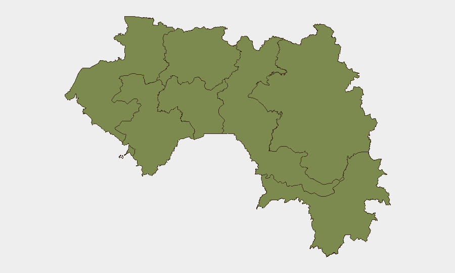
Highest-Risk Areas
Kankan Region dominates the sub-national risk picture, with a composite score of 35.6—nearly five times higher than the second-ranked Boké Region (7.4). This concentration suggests sustained instability in Guinea's southeastern frontier zone, historically associated with cross-border movement, mining-sector disputes, and limited state capacity. Boké and Conakry (7.4 and 7.1 respectively) represent secondary urban and industrial risk nodes. The remaining six regions cluster at 5.6, indicating either lower incident frequency or more dispersed, lower-intensity activity. Corporate assets and personnel in Kankan should be treated as the primary exposure zone; Conakry operations face standard urban risk (crime, logistics, political volatility) rather than acute conflict.
How GeoBit Would Assist
Security and duty-of-care teams should deploy Area-of-Interest (AOI) Monitoring & Early Warning on Kankan Region and Conakry to capture sub-regional event signals with alert thresholds set for demonstration, arrest, armed movement, and cross-border activity. OSINT Fusion (X/Twitter, Telegram, local news, election monitoring) would disambiguate political statements from operational incidents and catch local-language reporting missed by English-only feeds. Routing & Network Analysis and Maritime & Aviation tracking are critical for supply-chain resilience if regional tension affects transport corridors or port operations.
7-Day Outlook
No immediate crisis indicators are evident in the last 48 hours, but the Kankan Region's persistently elevated risk profile and ongoing electoral/political context warrant close monitoring. Expect continued low-intensity reporting (demonstrations, political statements) rather than sudden escalation. Border and maritime activity involving Guinea Bissau should be tracked as a secondary indicator of regional instability that could indirectly constrain Guinea's trade and security environment.
Highest-Risk Areas — Ranked
| # | State / Region | Risk |
|---|---|---|
| 1 | Kankan Region | 35.6 |
| 2 | Boké Region | 7.4 |
| 3 | Conakry | 7.1 |
| 4 | Labé Region | 5.6 |
| 5 | Kindia Region | 5.6 |
| 6 | Mamou Region | 5.6 |
| 7 | Faranah Region | 5.6 |
| 8 | Nzérékoré Region | 5.6 |
Sources
Previous Daily Briefs
A new Guinea brief is written every day — each with its own risk map and downloadable CSV. Here's the last week; use the calendar to go further back.
📅 Browse every day by calendar →
Highlighted days have a brief. Tap a day for that day's map & analysis, or “csv” for that day's dataset ($5).