Situation Summary
Ireland remains at low–moderate risk (global rank #94, composite threat score 11) with stable general security conditions across the Republic. However, County Dublin significantly elevates the national profile with a composite risk score of 31.8—nearly 1.5 times higher than the second-ranked County Tipperary—driven by recent judicial, media, and military-related event signals. Northern Ireland has experienced a contained but notable weapons and drugs seizure in Belfast (Rosapenna Parade, 17–18 July), though immediate civil disruption has ended. Infrastructure vulnerabilities—including near-record heatwave stress and indirect Middle East aviation risks—warrant monitoring but are not yet operationally critical.
Key Developments
- North Belfast, Rosapenna Parade (17–18 July 2026): PSNI conducted a security operation and property search following an early-hours evacuation on Cliftonville Road. Suspected firearms, ammunition, Class A drugs, and cash were recovered; a 28-year-old male was arrested on suspicion of possessing a firearm in suspicious circumstances and later released on bail. Residents were permitted to return and cordons lifted by 18 July.
- Dublin Airport regulatory change (mid-July 2026): The *Dublin Airport (Passenger Capacity) Act 2026* was enacted, removing the 32-million annual passenger cap and granting the transport minister powers to increase capacity. This introduces longer-term infrastructure and congestion planning considerations but no immediate security incident.
- Middle East aviation advisories affecting Ireland routes (updated mid-July 2026): The European Union Aviation Safety Agency (EASA) has advised air operators to avoid Gulf airspace until at least 29 July 2026 due to elevated terrorist and protest risks. Passengers connecting to Ireland via Bahrain, Israel, Kuwait, Qatar, UAE, Iran, Iraq, Lebanon, Palestine, Syria, or Yemen should expect possible rerouting, delays, or flight changes.
- Ireland heatwave stress (week ending 17 July 2026): Ireland experienced a near-record heatwave with the longest hot spell in 50 years nearly matched in County Cork. Prolonged high temperatures increase strain on water, power, and transport infrastructure and elevate health risks in vulnerable populations.
- Judicial and media-related event signals (18–19 July 2026): GeoBit event indexing notes a judge's public statement (18 July), tribunal rejection (18 July), media investigation (17 July), and unspecified threats (19 July) involving Irish and international actors. Attribution and operational details remain limited in open sources; monitoring is warranted given Dublin's elevated risk profile.
Highest-Risk Areas
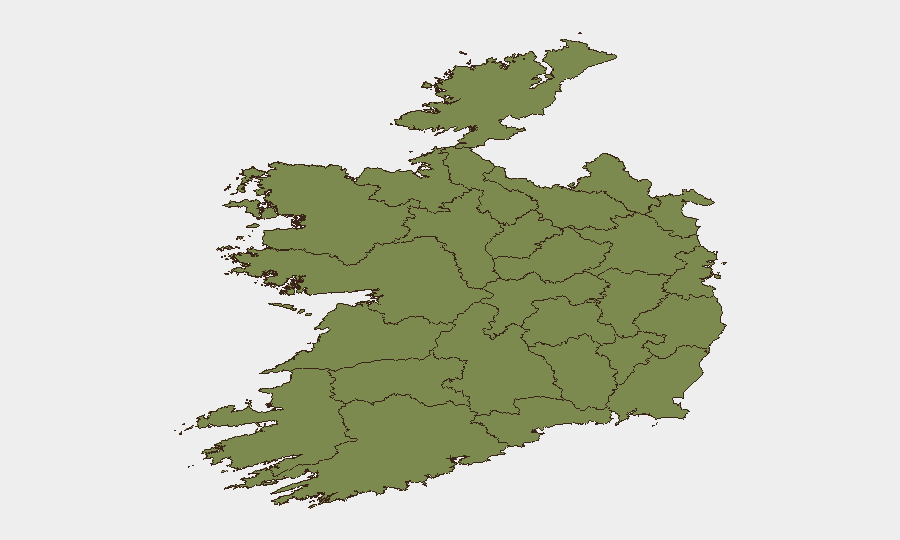
County Dublin drives national risk (31.8) through judicial, media, law-enforcement, and military-related events concentrated in and around the capital and airport zones. County Tipperary (22.1) shows secondary elevation; all other tracked counties remain below 8.0. Dublin's concentration reflects both population density and institutional activity (courts, government, international media presence); risk is acute but not currently indicative of civil unrest or large-scale instability. County Wicklow and Kerry show minimal elevation, and western counties (Mayo, Sligo, Galway, Clare, Limerick, Donegal, Leitrim, Roscommon) remain effectively stable.
How GeoBit Would Assist
Intel Sweep, OSINT Fusion & Corroboration, and multi-language search would clarify the judicial, media, and military event signals in Dublin and establish attribution and operational intent. AOI Monitoring & Early Warning targeted at Dublin Airport, Rosapenna Parade, and other infrastructure nodes would provide persistent alerting for travel disruption, security operations, or disorder escalation. Routing & Network Analysis would enable alternative journey planning for staff or assets affected by Middle East aviation restrictions or Dublin Airport congestion changes.
7-Day Outlook
Dublin's elevated event activity is expected to persist as judicial proceedings and media investigations continue; no major civil-unrest escalation is signalled. Infrastructure stress from heat and aviation rerouting will remain manageable but should be monitored for cumulative impact on business continuity and travel schedules. Northern Ireland security posture is expected to stabilize following the Rosapenna Parade operation, barring new intelligence developments.
Highest-Risk Areas — Ranked
| # | State / Region | Risk |
|---|---|---|
| 1 | County Dublin | 31.8 |
| 2 | County Tipperary | 22.1 |
| 3 | County Wicklow | 7.6 |
| 4 | County Kerry | 3.3 |
| 5 | County Mayo | 2.8 |
| 6 | County Sligo | 1.8 |
| 7 | County Galway | 1.8 |
| 8 | County Clare | 1.8 |
| 9 | County Limerick | 1.8 |
| 10 | County Donegal | 1.8 |
| 11 | County Leitrim | 1.8 |
| 12 | County Roscommon | 1.8 |
Sources
Previous Daily Briefs
A new Ireland brief is written every day — each with its own risk map and downloadable CSV. Here's the last week; use the calendar to go further back.
📅 Browse every day by calendar →
Highlighted days have a brief. Tap a day for that day's map & analysis, or “csv” for that day's dataset ($5).
Atlas — our AI intelligence desk — emails them this snapshot personally. Nothing else, no list.