Situation Summary
Maldives presents a composite threat score of 2, placing it outside the global top-tier risk countries. No tracked security events have been recorded in the current reporting window. The security environment remains stable, with risk concentrated in the capital region and immediate surrounding atolls rather than distributed across the archipelago.
Key Developments
No discrete security events meeting verification thresholds have been identified in Maldives for the 24–48 hour period ending 22 June 2026. Current web research, X/Twitter monitoring, and regional news aggregation have not surfaced confirmed incidents of civil unrest, infrastructure disruption, crime spikes, or official alerts. GeoBit's continuous event feed shows zero tracked incidents in this window.
*Note: Security teams requiring real-time event intelligence are advised to supplement this brief with direct monitoring of Maldivian government advisories, police press releases, and airport/maritime authority communications, which may reflect incidents not yet surfaced in international feeds.*
Highest-Risk Areas
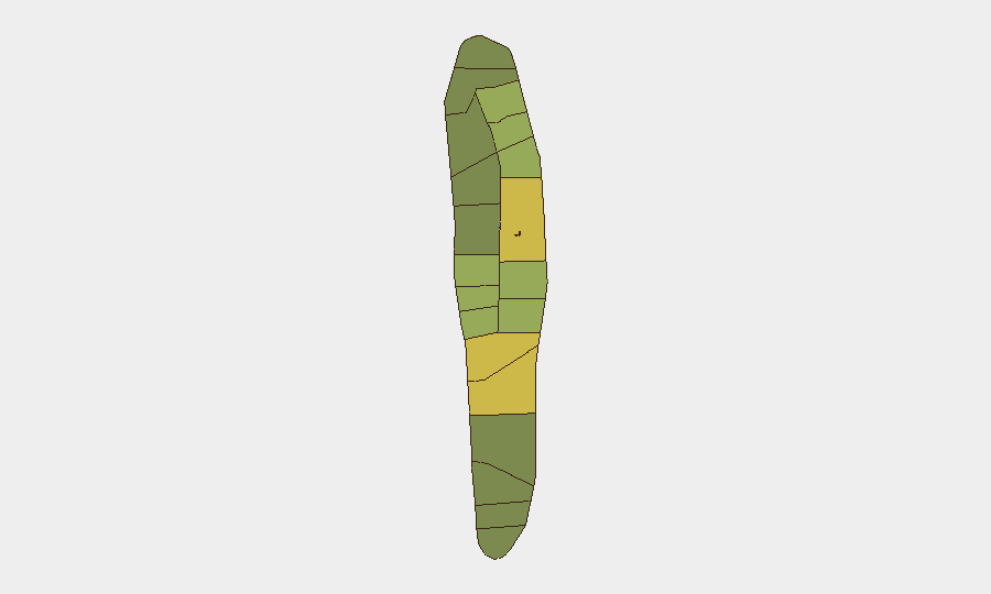
Malé (risk score 85) and Malé Atoll (68) account for the largest concentration of risk, reflecting the capital's role as the primary hub for finance, tourism, logistics, and government. Hadhdhunmathi (65) and Kolhumadulu (60) atolls show elevated secondary risk, likely driven by maritime activity, inter-island transit infrastructure, and economic density. Risk declines sharply in outer atolls (North/South Miladhunmadulu, Nilandhe, Ari below 50), which are geographically dispersed and economically specialized. Corporate assets, expatriate populations, and critical services concentrated in Malé create asymmetric exposure: a single incident in the capital poses disproportionate duty-of-care implications.
How GeoBit Would Assist
Security and risk teams protecting personnel or assets in Maldives would employ AOI Monitoring & Early Warning to establish persistent watch over Malé and high-traffic atolls, triggering alerts on protest activity, maritime incidents, or infrastructure outages. OSINT Fusion across X/Twitter, Telegram, local newsrooms, and government channels provides sub-24-hour event detection and corroboration, closing gaps in international news flow. GIS & Spatial Analysis combined with Routing & Network Analysis enables rapid assessment of alternative transit corridors should primary routes (airport approaches, ferry terminals, inter-atoll connections) be disrupted.
7-Day Outlook
No escalation trajectory is evident. Maldives remains in a stable baseline posture, with risk factors static and geographically concentrated. Duty-of-care teams should maintain standard monitoring protocols and confirm direct contact with in-country personnel and facility managers, particularly in Malé, to ensure independent visibility of local conditions independent of global news lag.
Highest-Risk Areas — Ranked
| # | State / Region | Risk |
|---|---|---|
| 1 | Malé | 85 |
| 2 | Malé Atoll | 68 |
| 3 | Hadhdhunmathi | 65 |
| 4 | Kolhumadulu | 60 |
| 5 | Felidhu Atoll | 58 |
| 6 | Mulaku Atoll | 55 |
| 7 | Faadhippolhu | 52 |
| 8 | South Miladhunmadulu | 48 |
| 9 | North Miladhunmadulu | 45 |
| 10 | South Nilandhe Atoll | 44 |
| 11 | North Nilandhe Atoll | 42 |
| 12 | South Ari Atoll | 40 |
Sources
Previous Daily Briefs
A new Maldives brief is written every day — each with its own risk map and downloadable CSV. Here's the last week; use the calendar to go further back.
📅 Browse every day by calendar →
Highlighted days have a brief. Tap a day for that day's map & analysis, or “csv” for that day's dataset ($5).