Situation Summary
The Netherlands maintains a relatively low composite threat score (5/global rank 141) with 61 tracked events. However, recent signal activity—including police investigations, small-arms incidents, military force deployments, and immigration-related tensions—indicates elevated operational tempo across multiple threat domains in the past 72 hours. Flevoland presents exceptional outlier risk (31.5), warranting focused attention; secondary risk clusters in Groningen and North Holland suggest localized instability rather than nationwide escalation at this time.
Key Developments
- 2026-06-20 · Small Arms Combat — Deputies engaged in armed incident; location and casualty status under clarification.
- 2026-06-20 · Conventional Military Force (European) — Multinational military activity detected; operational scope and duration not yet specified in available signals.
- 2026-06-19 · Conventional Military Force (Netherlands) — Domestic military deployment or mobilization; relationship to external security posture or internal operation unclear from event metadata alone.
- 2026-06-18–19 · Investigation Operations — Multiple police investigations initiated across Amsterdam and Holland; subjects span criminal suspects, employee conduct, and asylum/immigration matters.
- 2026-06-18 · Expulsion/Deportation Action — Residents expelled or deported in connection with unidentified male subject; potential immigration or criminal-justice driver.
- 2026-06-18 · Small Arms Incident (Hyundai) — Armed incident involving vehicle; incident type and severity require confirmation from primary sources.
*Note: Web research conducted 2026-06-21 did not surface independently corroborated Dutch news reporting on these specific incidents within the last 24–48 hours. Organizations should cross-reference GeoBit event signals against NOS, NU.nl, local police announcements, and municipal channels to validate operational status and assess business continuity impact.*
Highest-Risk Areas
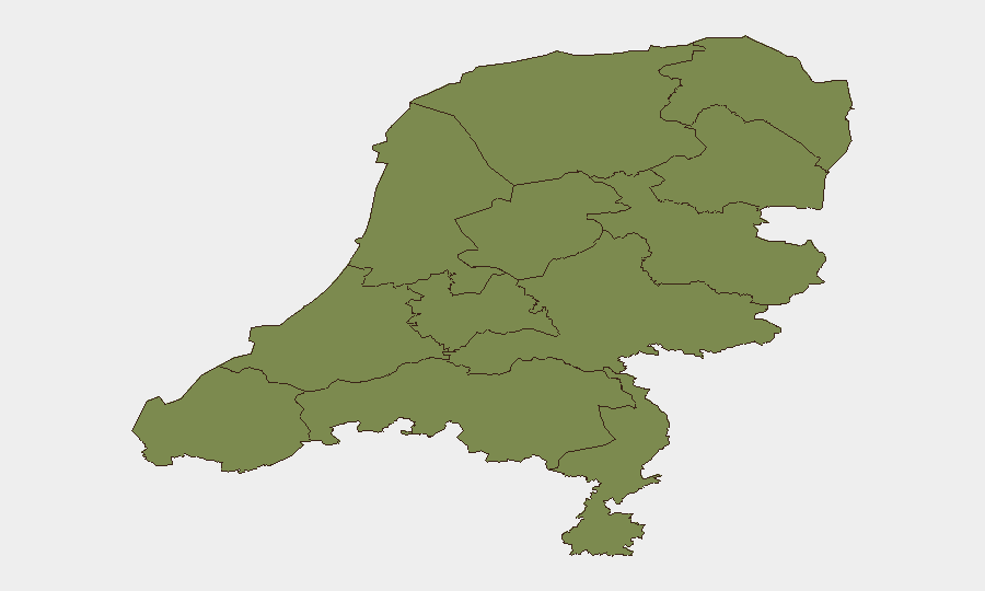
Flevoland's risk score (31.5) is 3.5× higher than the second-ranked region (Groningen, 9) and represents a significant statistical outlier; the underlying drivers—whether infrastructure vulnerability, organized crime activity, migration/asylum processing concentration, or other vectors—require urgent clarification via targeted AOI monitoring and local-source intelligence. Groningen and North Holland (combined score 16.2) form a secondary risk belt, likely reflecting port activity, transit corridors, and urban-center incident density. The remaining ten provinces cluster at 1.5–2.7, suggesting distributed, lower-intensity risk or data-aggregation artifacts. Organizations with assets or personnel in Flevoland should establish heightened situational awareness protocols; Groningen and North Holland warrant standard elevated vigilance.
How GeoBit Would Assist
AOI Monitoring & Early Warning with persistent watch on Flevoland, Groningen, and North Holland would flag developing incidents and trend analysis before they reach mainstream reporting. Intel Sweep across Dutch police radio, municipal announcements, X/Twitter, and local news in Dutch would provide real-time corroboration of event signals and clarify operational context (scope, duration, threat to civilians/assets). Risk & Threat Assessment linked to organization-specific asset locations would enable duty-of-care teams to model exposure and trigger contingency protocols if incidents approach personnel or critical infrastructure.
7-Day Outlook
No escalation signal is evident from current data, but the density of police investigations, military activity, and armed incidents in a 72-hour window suggests operational pressure across law enforcement, border management, and potentially defense postures. Flevoland's outlier risk and recent expulsion/asylum signals point to migration and/or social cohesion stressors; monitoring for secondary unrest or policy reactions over the next 7 days is warranted. Absent major incident spillover or geopolitical shock, the Netherlands is expected to remain in the current elevated-operational-tempo state rather than degrade further.
Highest-Risk Areas — Ranked
| # | State / Region | Risk |
|---|---|---|
| 1 | Flevoland | 31.5 |
| 2 | Groningen | 9 |
| 3 | North Holland | 7.2 |
| 4 | North Brabant | 2.7 |
| 5 | South Holland | 2.1 |
| 6 | Zeeland | 1.5 |
| 7 | Utrecht | 1.5 |
| 8 | Frisia | 1.5 |
| 9 | Drenthe | 1.5 |
| 10 | Gelderland | 1.5 |
| 11 | Overijssel | 1.5 |
| 12 | Limburg | 1.5 |
Sources
Previous Daily Briefs
A new Netherlands brief is written every day — each with its own risk map and downloadable CSV. Here's the last week; use the calendar to go further back.
📅 Browse every day by calendar →
Highlighted days have a brief. Tap a day for that day's map & analysis, or “csv” for that day's dataset ($5).