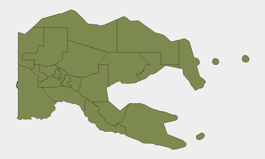
Situation Summary
Papua New Guinea remains a fragmented security environment with composite threat score of 18 and concentrated risk in Milne Bay Province (risk 31.3), while the National Capital District shows elevated but significantly lower risk at 11.3. Recent activity indicates localized criminal violence, maritime emergencies, and disease-surveillance alerts rather than systemic state failure or widespread instability. The security posture is stable but uneven across provinces, with operational police and military response capacity evident in recent incidents.
Key Developments
- Lae, Morobe Province – Campus security response, 25–26 July 2026: Papua New Guinea University of Technology (Unitech) issued a statement confirming no intruder breach of campus following weekend disturbance near student accommodation; university deployed additional security officers and overnight patrols in response.
- Lae, Morobe Province – Police operation in Poaba-Egatang settlement, 26 July 2026: Lae police conducted a destructive operation targeting suspected OBT gang members linked to the Unitech dormitory incident; suspects escaped and remain at large, indicating ongoing risk of retaliation or secondary violence in adjacent settlements.
- East New Britain Province – Maritime casualty death toll revised upward, late July 2026: Confirmed death toll from recent maritime incident near Tigak Group of Islands rose to 12 after four additional bodies recovered Friday morning; search operations ongoing and public cooperation requested.
- Port Moresby – Arrest/detain incident involving community, 28 July 2026: Official GeoB event signal recorded; limited public reporting available at time of writing.
- Papua New Guinea-wide – cVDPV2 circulation alert: Circulating vaccine-derived poliovirus type 2 detected; public health response in progress.
- Seismic activity (regional context, not PNG-specific risk driver): Four earthquakes magnitude 4.6–5.4 recorded east of Kokopo and Kimbe in East New Britain/West New Britain maritime zones within recent period; no tsunami warnings or casualty reports published.
- Defence cooperation milestone, 22 July 2026 (context): PNG Defence Minister and New Zealand Defence Minister signed Statement of Intent on Defence Co-operation 2026–2029, signalling medium-term commitment to maritime security and capacity building.
Highest-Risk Areas
Milne Bay Province dominates the sub-national risk profile at 31.3, driven by historical organized crime, maritime trafficking, and resource-competition violence; the National Capital District (11.3) reflects Port Moresby's urban crime, gang activity, and institutional instability. All other tracked provinces cluster at risk 1.3, indicating either lower incident density or data-gathering gaps. The sharp differential between Milne Bay and NCD versus the remaining provinces suggests either concentrated threat activity or uneven intelligence coverage; corporate presence and supply chains in these two zones warrant priority monitoring.
How GeoBit Would Assist
A security team protecting PNG personnel and assets should employ AOI Monitoring & Early Warning on high-risk districts (Milne Bay, NCD, Lae settlements) to catch emerging criminal or maritime incidents; Intel Sweep and multi-language OSINT fusion to correlate police, media, and unofficial sources for faster tactical awareness than public announcements; and Routing & Network Analysis to identify safe passage corridors and avoid settlements with active OBT presence or police operations. Real-time maritime and aviation tracking capabilities are essential given recent casualty events and cross-border movement risks near the Indonesian frontier.
7-Day Outlook
No escalation to state-level instability is indicated; however, the Lae criminal-gang retaliation cycle and ongoing maritime emergencies suggest continued localized incidents over the next week. Cross-border tension in Yahukimo (Indonesian Papua) may generate minor spillover pressure at PNG's western frontier but is unlikely to drive direct internal PNG destabilization. Routine vigilance on campus and settlement security, public-health surveillance, and maritime incident response should remain standard.
Highest-Risk Areas — Ranked
| # | State / Region | Risk |
|---|---|---|
| 1 | Milne Bay | 31.3 |
| 2 | National Capital District | 11.3 |
| 3 | Eastern Highlands | 1.3 |
| 4 | Gulf | 1.3 |
| 5 | Madang | 1.3 |
| 6 | Manus | 1.3 |
| 7 | West New Britain | 1.3 |
| 8 | New Ireland | 1.3 |
| 9 | East New Britain | 1.3 |
| 10 | Morobe | 1.3 |
| 11 | Central | 1.3 |
| 12 | Oro | 1.3 |
Sources
Previous Daily Briefs
A new Papua New Guinea brief is written every day — each with its own risk map and downloadable CSV. Here's the last week; use the calendar to go further back.
📅 Browse every day by calendar →
Highlighted days have a brief. Tap a day for that day's map & analysis, or “csv” for that day's dataset ($5).
Atlas — our AI intelligence desk — emails them this snapshot personally. Nothing else, no list.