Situation Summary
The Philippines faces a compounded security and natural-disaster crisis following a 7.8-magnitude earthquake that struck Mindanao on 8 June, triggering tsunami warnings, widespread infrastructure damage, and ongoing aftershocks. Concurrent political tensions—evidenced by recent diplomatic friction with Japan and Malaysia, internal government investigations, and planned large-scale demonstrations in Metro Manila—are adding pressure to already-stretched emergency response and security services. The country's composite threat score of 35.3 reflects persistent sub-national conflict in Mindanao and elevated political volatility; the earthquake has materially increased immediate risk to both life safety and business continuity in southern and central regions.
Key Developments
- 8 June, Mindanao Island (southern Philippines): A 7.8-magnitude earthquake caused building collapses, infrastructure damage, and power interruptions across western and central Mindanao. PHIVOLCS issued tsunami warnings and NDRRMC activated emergency protocols; authorities advised evacuation of coastal low-lying zones and avoidance of damaged structures pending search-and-rescue completion.
- 8–9 June, coastal Mindanao: Tsunami threat prompted mass evacuations to higher ground in affected communities; authorities advised residents and visitors to remain away from shorelines pending all-clear from PHIVOLCS.
- 8–9 June, Mindanao region: Continuing aftershocks and damage to roads, bridges, and local services reported; UK FCDO reiterated standing advisory against all travel to western/central Mindanao and Sulu archipelago due to pre-existing terrorist activity and military–insurgent clashes, now compounded by earthquake-induced service disruption.
- 8–9 June, Metro Manila and nationwide: UK FCDO confirmed large-scale political demonstrations expected over coming weeks; warnings issued for travel disruption and possible security incidents; advice to avoid gatherings and allow extra travel time.
- 7–8 June, diplomatic tension escalation: Philippine government issued public statements against Japan; Malaysia arrested Philippine nationals and issued threats; Philippine authorities initiated investigations into government bodies—signals suggesting elevated state-level friction and potential spillover to public order.
- Camiguin, Dinagat, Siargao Islands (Mindanao region): These islands remain under lower-risk advisories relative to broader Mindanao warnings, but aftershock exposure and service disruption persist; travellers advised to verify disaster insurance coverage.
Highest-Risk Areas
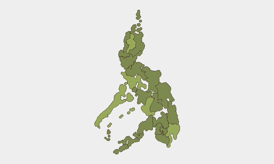
Cordillera Administrative Region (54.7) and Negros Island Region (48.5) lead the sub-national rankings, closely followed by Metro Manila (47.1) and Davao Region (46.6). The Mindanao earthquake has materially elevated risk in Davao Region and adjacent areas (Soccsksargen, 27.1) due to immediate life-safety, infrastructure, and emergency-response capacity constraints. Metro Manila's elevation reflects both political demonstration activity and its role as the national coordination hub for disaster response; simultaneous large-scale protests will strain police and health resources already mobilized for earthquake support. Cordillera and Negros Island regions carry enduring risk from conflict actors, organized crime, and mining-related tensions unrelated to the current earthquake.
How GeoBit Would Assist
Security teams should deploy AOI Monitoring & Early Warning over Mindanao's affected provinces and Metro Manila demonstration zones to track aftershock activity, protest scaling, and service-restoration timelines in real time. Conflict & Military mapping and Network & Actor Analysis will help assess whether insurgent groups in western Mindanao exploit earthquake-driven security-service distraction. Routing & Network Analysis can provide real-time alternative transport and supply-chain routes around damaged infrastructure, and Sentiment & Temporal Analysis (X, Telegram, local media) will flag escalating political rhetoric or public order breakdown ahead of mass demonstrations.
7-Day Outlook
Aftershocks will likely persist for 7–14 days, with risk of additional structural damage and service disruption in Mindanao provinces through mid-June. Metro Manila demonstrations are expected to intensify in coming weeks; security and duty-of-care teams should anticipate transport delays, temporary security-force redeployment, and elevated ambient tension through at least 15 June. Regional diplomatic friction may complicate international rescue and relief coordination.
Highest-Risk Areas — Ranked
| # | State / Region | Risk |
|---|---|---|
| 1 | Cordillera Administrative Region | 54.7 |
| 2 | Negros Island Region | 48.5 |
| 3 | Metro Manila | 47.1 |
| 4 | Davao Region | 46.6 |
| 5 | Mimaropa | 46.1 |
| 6 | Central Luzon | 32.3 |
| 7 | Zamboanga Peninsula | 31.9 |
| 8 | Soccsksargen | 27.1 |
| 9 | Bicol Region | 26.6 |
| 10 | Western Visayas | 26.1 |
| 11 | Bangsamoro | 25.2 |
| 12 | Eastern Visayas | 25.2 |
Previous Daily Briefs
A new Philippines brief is written every day — each with its own risk map and downloadable CSV. Here's the last week; use the calendar to go further back.
📅 Browse every day by calendar →
Highlighted days have a brief. Tap a day for that day's map & analysis, or “csv” for that day's dataset ($5).