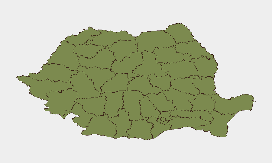
Situation Summary
Romania's security environment remains moderately elevated (rank #103 globally) following a series of drone incursions from Ukrainian territory over the past week. Air-defense operations have intensified along the eastern border, with three confirmed shoot-downs of unmanned aerial vehicles between July 24–26, and ongoing radar detections of aerial targets near the Danube Delta and Tulcea County. Diplomatic tensions with Russia have escalated following the airspace violations and expulsion of a Russian diplomat on July 27. The threat landscape is concentrated in border regions, particularly Hunedoara and Bucharest, though spillover risk to civilian infrastructure remains present.
Key Developments
- Tulcea County (Danube Delta) – August 1, 2026, overnight: Air-raid alerts activated in northern Tulcea following detection of explosions and loud detonations across the Ukrainian border in Izmail district; Romanian authorities confirmed no airspace violation and lifted alerts after targets remained outside national territory.[2]
- Eastern border (river frontier with Ukraine) – July 31, 2026: Romanian Defence Ministry reported scramble of two F‑16 fighter jets after radar detected a group of aerial targets near the river border; targets disappeared from radar without entering Romanian airspace, with subsequent explosions confirmed on Ukrainian soil.[2]
- Constanța Black Sea Port – July 29, 2026: A bomb-threat phone call prompted evacuation of port staff and security sweeps; authorities reported no explosive device discovered and operations resumed after all-clear checks.[15]
- Tulcea County (near Danube Delta) – July 29, 2026: Radar systems detected a group of aerial targets near the river border at approximately 10:30, triggering F‑16 scramble from Borcea Air Base; no confirmed airspace incursion was reported.[15]
- Padina, Buzău County (central-eastern Romania) – July 24, 2026: Romanian F‑16 shot down a Russian Shahed-type unmanned aerial vehicle after it crossed into Romanian airspace—the first confirmed hostile UAV destruction over Romanian territory.[6][7][12]
- Northern Tulcea County border area – July 25, 2026: Second drone destroyed by F‑16 after crossing from Ukraine; RO‑Alert warnings directed residents in northern Tulcea to shelter indoors with no reported casualties or damage.[7][8][9]
- Black Sea, 12 km northeast of Sulina – July 26, 2026: Third drone shot down over Romanian territorial waters by F‑16 at 10:13; no casualties or infrastructure damage reported.[6][7][8][12]
- Bucharest (Ministry of Foreign Affairs) – July 27, 2026: Following drone incidents, Russian ambassador was summoned, a Russian embassy diplomat was expelled for repeated airspace violations, and Romania's ambassador was recalled from Moscow in diplomatic protest.[8][9][10]
Highest-Risk Areas
Hunedoara County dominates the sub-national risk ranking (31.4), driven by proximity to the western border and industrial infrastructure vulnerability. Bucharest (11.4) faces elevated risk due to critical government and diplomatic presence, heightened alert posture, and potential for cascading civil-security incidents. The southeastern border counties—Prahova, Gorj, Dolj, and notably Tulcea—form a secondary risk band (3.9–1.4) where air-defense operations, drone incidents, and cross-border radar contacts are concentrating operational activity and public alert cycles.
How GeoBit Would Assist
Teams operating in Romania should deploy AOI Monitoring & Early Warning systems on Hunedoara, Tulcea, and Constanța to track real-time border activity and air-defense operations. Conflict & Military capabilities—including force-structure tracking and weapons-system location—enable monitoring of F‑16 basing and air-defense posture. Intel Sweep and X/Twitter OSINT provide 24-hour pattern detection of Defence Ministry alerts, diplomatic statements, and civilian-sourced border observations before formal announcements.
7-Day Outlook
Drone incursions and radar detections are expected to continue intermittently along the eastern border as Ukrainian operations sustain pressure near the Danube crossing points. Air-alert cycles will likely persist in Tulcea and Constanța, with potential for secondary civilian-security responses (evacuations, port closures, shelter-in-place advisories). Diplomatic friction with Russia will remain elevated but is unlikely to trigger direct military escalation in Romanian territory.
Highest-Risk Areas — Ranked
| # | State / Region | Risk |
|---|---|---|
| 1 | Hunedoara | 31.4 |
| 2 | Bucharest | 11.4 |
| 3 | Prahova | 3.9 |
| 4 | Gorj | 3.9 |
| 5 | Dolj | 3.9 |
| 6 | Vâlcea | 1.4 |
| 7 | Brașov | 1.4 |
| 8 | Bihor | 1.4 |
| 9 | Timiș | 1.4 |
| 10 | Caraș-Severin | 1.4 |
| 11 | Satu Mare | 1.4 |
| 12 | Sălaj | 1.4 |
Sources
Previous Daily Briefs
A new Romania brief is written every day — each with its own risk map and downloadable CSV. Here's the last week; use the calendar to go further back.
📅 Browse every day by calendar →
Highlighted days have a brief. Tap a day for that day's map & analysis, or “csv” for that day's dataset ($5).
Atlas — our AI intelligence desk — emails them this snapshot personally. Nothing else, no list.