Situation Summary
Saint Lucia remains at global rank #153 with a composite threat score of 6, reflecting endemic urban homicide pressure concentrated in the capital and northern parishes. Over the weekend of 15–16 August 2026, three fatal shootings occurred within Castries—two in the Belair area and one in Ravine Chabot—bringing the national homicide count to 46 for the year. The incidents underscore a persistent pattern of lethal violence in high-density urban zones; no suspects or motives have been publicly disclosed, and investigations are ongoing.
Key Developments
- Belair/Vanard, Castries — Fatal shooting, 22:28 hrs, Saturday 15 August 2026. A 25-year-old male (Jamal Thomas) was found with multiple gunshot wounds to the upper torso and pronounced dead at the scene by officers from Marigot Police Station. This incident brought the 2026 homicide tally to 46.
- Belair, Castries — Fatal shooting, 00:39 hrs, Sunday 16 August 2026. A 25-year-old male was discovered on a concrete roadway with apparent gunshot wounds and pronounced dead. The proximity in location and timing to the previous night's incident remains under investigation; no confirmed connection has been disclosed.
- Ravine Chabot, Castries — Fatal shooting, 23:10 hrs, Sunday 16 August 2026. A 56-year-old male (John Ferdinand, "John Slade") was found in a heavily vegetated area with gunshot wounds. Police have not indicated a link to the Belair killings.
- Castries (general) — Major Crimes Unit investigation escalation, 17 August 2026. The Royal Saint Lucia Police Force opened formal investigations into the weekend double and triple homicides, appealing for public assistance via the Crime Hotline and designated tip numbers. Local media coverage indicates family members calling for justice.
- Ongoing homicide trajectory. Three confirmed lethal shootings within 36 hours in a single parish reinforce the elevated risk profile for Castries; no de-escalation indicators are apparent as of 18 August 2026.
Highest-Risk Areas
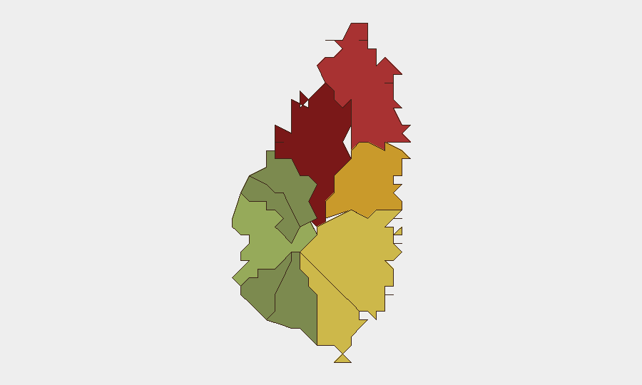
Castries dominates the sub-national risk ranking at 95, driven by recurring lethal violence in densely populated communities including Belair, Ravine Chabot, and Vanard. Gros Islet (78) and Dennery (72) follow, reflecting secondary clusters of homicide and gang-related activity typical of northern Saint Lucia. The concentration of three fatal shootings in Castries parishes within a single weekend demonstrates that risk scores track real incident frequency; organizations with personnel or operations in the capital and northern zones face heightened exposure. Southern and western parishes (Canaries, Anse La Raye, Choiseul) remain significantly lower-risk.
How GeoBit Would Assist
Teams with staff or assets in Saint Lucia should employ AOI Monitoring & Early Warning on Castries, Gros Islet, and Dennery to detect emerging incident clusters and trigger duty-of-care escalations. Intel Sweep and OSINT fusion across local news, police disclosures, and social channels would provide real-time tracking of homicide investigations, suspect identification, and any gang-related territorial disputes affecting specific neighborhoods. Risk & Threat Assessment can stratify individual office locations, residences, and transit routes by micro-level exposure and recommend operational adjustments.
7-Day Outlook
No intelligence indicates imminent organized violence, large-scale unrest, or infrastructure disruption; however, the frequency of weekend homicides in Castries suggests continued opportunistic and gang-related lethal conflict through the coming week. Organizations should maintain heightened situational awareness in the capital and consider temporary restrictions on non-essential movement in Belair, Ravine Chabot, and adjacent high-risk zones pending police briefings. A full homicide trend analysis will clarify whether August 2026 represents anomalous clustering or a sustained acceleration.
Highest-Risk Areas — Ranked
| # | State / Region | Risk |
|---|---|---|
| 1 | Castries | 95 |
| 2 | Gros Islet | 78 |
| 3 | Dennery | 72 |
| 4 | Vieux Fort | 68 |
| 5 | Micoud | 65 |
| 6 | Soufrière | 42 |
| 7 | Laborie | 38 |
| 8 | Choiseul | 35 |
| 9 | Anse La Raye | 28 |
| 10 | Canaries | 12 |
Sources
Previous Daily Briefs
A new Saint Lucia brief is written every day — each with its own risk map and downloadable CSV. Here's the last week; use the calendar to go further back.
- August 16, 2026
- August 14, 2026
- August 12, 2026
- August 10, 2026
- August 8, 2026
- August 6, 2026
- August 5, 2026
📅 Browse every day by calendar →
Highlighted days have a brief. Tap a day for that day's map & analysis, or “csv” for that day's dataset ($5).
Atlas — our AI intelligence desk — emails them this snapshot personally. Nothing else, no list.