Situation Summary
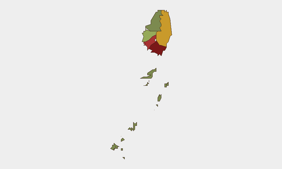
Saint Vincent remains a low-threat environment globally (rank #130, composite score 12) with no discrete security incidents tracked in the current reporting window. However, sub-national risk concentration in Saint George (92), Saint Andrew (78), and Charlotte (71) suggests localized vulnerabilities merit monitoring. Recent operational disruptions—traffic accidents and utility infrastructure failures—underscore exposure to environmental and systemic hazards rather than deliberate security threats.
Key Developments
- La Croix, Saint George — 2026-09-09: Police investigated a bus accident in which an omnibus went over an embankment, injuring the driver, conductor, and multiple passengers; the driver and three passengers were hospitalized. Investigation status remains open.
- Mainland Saint Vincent — 2026-09-07 to 2026-09-08: VINLEC reported a power outage across several areas caused by wildlife contact with energized electrical equipment. A second outage event was reported the following day under similar circumstances, indicating repeated infrastructure vulnerability to environmental interference.
- Nationwide — 2026-09-13 to 2026-09-14: The Meteorological Service issued advisories for flash flooding, Saharan dust, reduced visibility, and an approaching tropical wave. Alerts targeted motorists, residents near rivers and streams, and mariners; heavy showers and marine hazards pose travel and infrastructure-disruption risk.
Highest-Risk Areas
Saint George (risk 92) significantly outranks other parishes and warrants priority focus; it encompasses the capital and primary commercial center, amplifying exposure. Saint Andrew (78) and Charlotte (71) form a secondary risk tier, suggesting either geographic clustering of underlying vulnerabilities or concentration of critical infrastructure and population. The Grenadines (risk 12) remain substantially lower-risk. The disparity between top-tier and lower-ranked regions indicates that security and duty-of-care resources should be concentrated in Saint George and the north-central parishes, though the drivers of these scores (crime, instability, infrastructure fragility, or disaster exposure) require targeted investigation to refine protective posture.
How GeoBit Would Assist
Intel Sweep and OSINT fusion would establish systematic, real-time visibility into incidents, social-media sentiment, and emerging tensions in high-risk parishes—particularly Saint George—enabling security teams to detect early signals before they escalate. AOI Monitoring & Early Warning on critical infrastructure nodes (power distribution, transport hubs, ports) in Saint George and Saint Andrew would provide persistent alerting on disruptions comparable to the recent utility failures, allowing advance notice to personnel and asset-protection planning. Environmental & Health monitoring combined with Routing & Network Analysis would enable duty-of-care teams to forecast weather impacts, plan alternative transport routes during tropical threats, and issue timely guidance to staff and dependents.
7-Day Outlook
The tropical weather system poses near-term infrastructure and travel disruption risk through mid-week; organizations should anticipate potential power outages, road closures, and maritime hazards affecting Saint Vincent. Absent significant criminal or political escalation signals in open reporting, the security environment is expected to remain stable; however, the concentration of risk in Saint George and Saint Andrew suggests that localized monitoring and contingency planning remain prudent baseline measures. Follow-up assessment of the La Croix bus accident outcome and any pattern in wildlife-related power failures is warranted to determine whether systemic infrastructure hardening is needed.
Highest-Risk Areas — Ranked
| # | State / Region | Risk |
|---|---|---|
| 1 | Saint George | 92 |
| 2 | Saint Andrew | 78 |
| 3 | Charlotte | 71 |
| 4 | Saint Patrick | 58 |
| 5 | Saint David | 34 |
| 6 | Grenadines | 12 |
Sources
Previous Weekly Briefs
A new Saint Vincent brief is written every Monday, covering the week — each with its own risk map and downloadable CSV. Use the calendar to go further back.
- September 7, 2026
- September 1, 2026
- August 30, 2026
- August 28, 2026
- August 26, 2026
- August 24, 2026
- August 22, 2026
📅 Browse past briefs by calendar →
Highlighted days have a brief. Tap a day for that day's map & analysis, or “csv” for that day's dataset ($5).
Atlas — our AI intelligence desk — emails them this snapshot personally. Nothing else, no list.