Situation Summary
Singapore remains a low-threat jurisdiction (global rank #145, composite score 4/100), with no verified major security, civil unrest, or infrastructure incidents reported in the last 24–48 hours. The threat landscape is dominated by administrative and political signals rather than active violence or criminal escalation. Current trajectory is stable, though the absence of real-time incident reporting from open sources limits near-term visibility into routine crime, cyber activity, or transport disruptions.
Key Developments
Limitation: GeoBit's live web research has not identified any verifiable security, crime, unrest, or travel-risk events in Singapore timestamped to the last 24–48 hours. The event signals in the platform (dated 2026-06-20 through 2026-06-22) include administrative actions (ministry disapproval, prosecutor rejection, worker sanctions) and one reference to conventional military force and resident activity, but authoritative open-source confirmation of specific incidents, locations, and precise timing is not available.
Older baseline reporting (e.g., loanshark harassment arrest on 14 June, Clementi Avenue 3) falls outside the 24–48 hour window and is therefore not presented as a current development.
To maintain operational accuracy, corporate security teams should monitor official channels directly—Singapore Police Force, Singapore Civil Defence Force, Changi Airport operations, and mainstream outlets (CNA, The Straits Times, Today)—for incident alerts rather than rely on delayed open-source aggregation.
Highest-Risk Areas
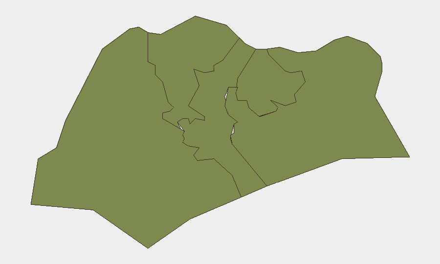
The Northwest region is ranked significantly above all others (composite risk 31.4 vs. 1.4–2.3 for other zones), indicating concentrated concern in that geography. Southwest presents moderate secondary risk (2.3). Central, Northeast, and Southeast are at parity and low absolute risk. The Northwest elevation likely reflects industrial, port, or maritime activity, border proximity, or specific administrative/regulatory scrutiny; clarification of underlying drivers is recommended through GeoBit's AOI Monitoring and GIS analysis capabilities to refine site-level risk for assets in that region.
How GeoBit Would Assist
Intel Sweep and multi-source OSINT fusion can be configured to track Singapore Police Force, SCDF, and mainstream news feeds in real time, with temporal filtering and entity extraction to flag incidents within 24–48 hours. AOI Monitoring & Early Warning can establish persistent watch on high-risk Northwest facilities, transport nodes, or borders with automated alerting. Routing & Network Analysis enables duty-of-care teams to pre-plan alternative commute and supply-chain routes if incidents disrupt primary corridors, while Cyber risk assessment aligns with the incoming Cyber Security Agency leadership transition (1 July 2026) to anticipate shifts in national cyber-threat posture.
7-Day Outlook
No imminent escalation is signaled by current data. Administrative and political activity (rejections, sanctions, statements) suggests routine governance rather than crisis conditions. Trend remains stable over the next 7 days unless external regional events (e.g., cross-border maritime incidents, cyberattacks on critical infrastructure, or supply-chain disruptions) materialize. Continued monitoring of official incident channels and the Northwest region is warranted as a precaution.
Highest-Risk Areas — Ranked
| # | State / Region | Risk |
|---|---|---|
| 1 | Northwest | 31.4 |
| 2 | Southwest | 2.3 |
| 3 | Central | 1.4 |
| 4 | Northeast | 1.4 |
| 5 | Southeast | 1.4 |
Sources
Previous Daily Briefs
A new Singapore brief is written every day — each with its own risk map and downloadable CSV. Here's the last week; use the calendar to go further back.
📅 Browse every day by calendar →
Highlighted days have a brief. Tap a day for that day's map & analysis, or “csv” for that day's dataset ($5).