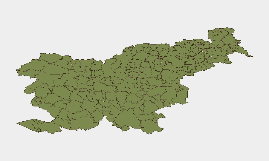
Situation Summary
Slovenia remains at very low baseline security risk (global rank #176, composite threat score 4), with no tracked intentional security incidents, civil unrest, or political instability reported in the current 24–48-hour window. The dominant risk driver in the last 48 hours has been severe weather: a major storm system on 21 August 2026 produced tornado-like conditions, lightning fatalities, widespread flooding, and infrastructure damage across central and western regions. The security environment remains stable, but acute weather hazards and secondary infrastructure failures present near-term operational and duty-of-care risks for personnel and assets in affected municipalities.
Key Developments
- Fatal bridge fall, Predoslje (Kranj municipality), night of 22 August 2026: A 26-year-old man died and a 20-year-old woman was seriously injured after falling from a bridge over the Kokra river. Emergency services recovered both individuals from beneath the bridge; cause under investigation but classified as accident rather than crime.
- Tornado and severe damage, Komen municipality (Primorska region), 21 August 2026, ~15:15: A tornado formed during a broader storm system, causing significant structural damage to roofs and buildings, extensive tree fall, and power-line destruction across the municipality.
- Lightning fatality, Mala Pirešica/Žalec municipality (Savinjska region), night of 20–21 August 2026: A 46-year-old man died after being struck by lightning while sheltering under a tree; a second male, also 46, was injured and hospitalized in Celje.
- Storm-related infrastructure damage and flooding, central and western Slovenia, 21–22 August 2026: Civil-protection services recorded 51 incidents across Ljubljana (28), Celje (13), Kranj (7), Trbovlje (2), and Koper (1), including flooded basements, damaged roofs, fallen trees, and debris obstruction of roads and underpasses.
- Large-scale power outages, Elektro Celje and Elektro Ljubljana service areas, night of 21 August 2026: Approximately 5,800 customers lost power in the Celje region and nearly 9,300 in the Ljubljana region; 285 transformer stations were temporarily out of service, affecting communications, water systems, and transport infrastructure.
- Storm-triggered fires and firefighting surge, multiple locations, evening of 21 August 2026: Lightning ignited fires in agricultural buildings, stables, and residential structures; firefighters responded to 71 incidents, with operations hampered by flooded cellars and debris.
- Political controversy over presidential intelligence access, national level, 21–22 August 2026: Opposition figures have publicly called for restrictions on President Nataša Pirc Musar's access to classified intelligence briefings and NATO materials following unverified allegations of Russian contacts; the president has denied collaboration. No protests or civil unrest reported.
Highest-Risk Areas
All 12 sub-national zones are currently ranked at risk level 0. The infrastructure and environmental hazards from the 21 August storm are concentrated in central and western Slovenia, particularly in and around Ljubljana, Celje, Kranj, and Komen municipalities. While these areas do not show elevated intentional security risk, the storm damage has created temporary vulnerabilities in utilities, transportation corridors, and emergency-response capacity; recovery and debris clearance will be ongoing through the near term.
How GeoBit Would Assist
Teams with personnel or assets in Slovenia should use GeoBit's AOI Monitoring & Early Warning (area-of-interest watch) to track weather and infrastructure incidents in real time, paired with Routing & Network Analysis to identify alternative routes around flooded underpasses and debris-affected transport corridors. Live web research and multi-language OSINT capabilities enable rapid corroboration of emerging incidents (e.g., power restoration status, road closures) to inform duty-of-care decisions for employee movements and supply chains.
7-Day Outlook
The severe-weather system is expected to clear over the next 24–48 hours, with normal conditions returning by late 24 August. Power restoration and debris clearance will proceed through the week; localized flooding and road closures may persist in low-lying areas. No escalation of political tension or security incidents is anticipated; the baseline low-risk profile should hold.
Highest-Risk Areas — Ranked
| # | State / Region | Risk |
|---|---|---|
| 1 | Bovec | 0 |
| 2 | Kobarid | 0 |
| 3 | Kanal | 0 |
| 4 | Kranjska Gora | 0 |
| 5 | Gorje | 0 |
| 6 | Tolmin | 0 |
| 7 | Bohinj | 0 |
| 8 | Cerkno | 0 |
| 9 | Brda | 0 |
| 10 | Šempeter-Vrtojba | 0 |
| 11 | Renče-Vogrsko | 0 |
| 12 | Miren-Kostanjevica | 0 |
Sources
Previous Daily Briefs
A new Slovenia brief is written every day — each with its own risk map and downloadable CSV. Here's the last week; use the calendar to go further back.
- August 20, 2026
- August 18, 2026
- August 16, 2026
- August 14, 2026
- August 12, 2026
- August 10, 2026
- August 8, 2026
📅 Browse every day by calendar →
Highlighted days have a brief. Tap a day for that day's map & analysis, or “csv” for that day's dataset ($5).
Atlas — our AI intelligence desk — emails them this snapshot personally. Nothing else, no list.