Situation Summary
Uganda remains a composite-threat environment (#61 globally) with significant sub-national variation, driven primarily by ongoing security operations and regional instability. The Northern Region carries the highest risk profile (composite score 32), substantially outpacing the Western and Central regions. Current developments include large-scale law-enforcement operations against transnational cybercrime in the capital and surrounding districts, alongside persistent Ebola-related travel restrictions affecting Entebbe International Airport. The security climate reflects both state capacity-building efforts and active organized-crime disruption.
Key Developments
- Kampala & Wakiso District, 11–12 July 2026: Ugandan security forces conducted large-scale raids targeting alleged transnational cybercrime operations, reportedly detaining 700–1,000 foreign nationals (predominantly Chinese) and seizing computing and communications equipment. Risk of localized disruptions to telecom, utilities, and movement in affected urban areas; foreign nationals in these districts may face heightened screening.
- Entebbe International Airport, ongoing through 12 July 2026: KLM and other carriers maintain flight cancellations and heightened crew/passenger screening protocols due to Ebola-related entry measures. Indirect transit delays and screening requirements may affect onward travel via secondary hubs.
- National-level messaging, 11 July 2026: President Museveni's public statement reiterating Uganda's strategic focus on self-reliance and internal security capacity-building. Reflects continued political prioritization of security posture in response to regional pressures.
- Police operations and citizen sentiment: Social media signals (dated 10 July) indicate public disapproval directed at police and security force conduct, suggesting ongoing tension between security operations and civil-society perception.
- Regional interstate messaging, 11 July 2026: Uganda's public rejection statement regarding Rwanda-related matters indicates sustained bilateral friction. No escalation reported, but relevant to Northern Region instability factors.
Highest-Risk Areas
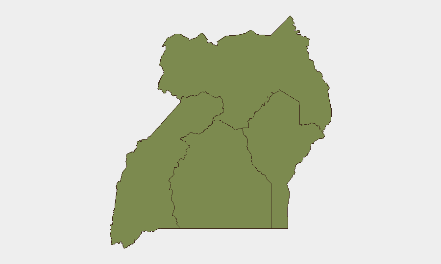
The Northern Region (composite score 32) is the dominant driver of Uganda's overall threat profile—more than one and a half times higher than Western or Central regions. This reflects a combination of Lord's Resistance Army (LRA) residual activity, cross-border trafficking, and historical conflict infrastructure. The Western and Central regions (both score 17) present moderate, similar-level risks tied to organized crime, resource competition, and intercommunal tensions. The Eastern Region (score 2) remains substantially lower-risk. Organizations with personnel or assets in the North should apply elevated duty-of-care protocols; those in Kampala should monitor for service disruptions and checkpoint activity arising from ongoing cybercrime investigations.
How GeoBit Would Assist
Organizations managing risk in Uganda should deploy AOI Monitoring & Early Warning on high-risk districts (Northern Region, Kampala/Wakiso) to detect emerging security operations, protests, or infrastructure disruption in near-real time. Conflict & Military and Network & Actor Analysis capabilities enable tracking of security-force deployment and organized-crime networks, informing decisions on staff movement and asset exposure. Search & Research on crime, terrorism, and border activity provides baseline intelligence on Northern Region threats; Routing & Network Analysis supports alternative journey planning when primary infrastructure is compromised.
7-Day Outlook
Cybercrime-related enforcement operations in Kampala and Wakiso are likely to continue through mid-to-late July, with potential for secondary detentions and checkpoint activity. Ebola-related travel restrictions at Entebbe remain in place pending regional coordination; commercial air services may remain episodic. Northern Region risks remain stable but persistent; no major escalation is signaled, but cross-border and trafficking activity should be assumed constant.
Highest-Risk Areas — Ranked
| # | State / Region | Risk |
|---|---|---|
| 1 | Northern Region | 32 |
| 2 | Western Region | 17 |
| 3 | Central Region | 17 |
| 4 | Eastern Region | 2 |
Sources
Previous Daily Briefs
A new Uganda brief is written every day — each with its own risk map and downloadable CSV. Here's the last week; use the calendar to go further back.
📅 Browse every day by calendar →
Highlighted days have a brief. Tap a day for that day's map & analysis, or “csv” for that day's dataset ($5).
Atlas — our AI intelligence desk — emails them this snapshot personally. Nothing else, no list.