Situation Summary
Botswana remains a low-threat environment at the global level (rank #183, composite score 3/5), with no confirmed security or unrest incidents documented in the last 24–48 hours. The country faces localized wildfire activity and a routine police–government statement, but neither constitutes an active security emergency. Overall trajectory remains stable, though sub-national risk concentration in the capital and mining-belt towns warrants targeted monitoring.
Key Developments
- 2026-07-09 · Gaborone (capital). Police issued a public statement regarding government relations; no evidence of operational conflict or service disruption confirmed at this time.
- Recent · Botswana (unspecified location). Two wildfire events recorded (IDs 1029243, 1029230); scope, containment status, and impact on populated areas or critical infrastructure require clarification.
- No further confirmed incidents in last 24–48 hours. Live web research yielded no substantiated crime, unrest, infrastructure failure, or security event meeting the current reporting threshold.
Highest-Risk Areas
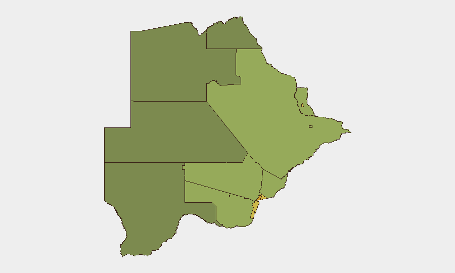
Gaborone (risk 72) and the South-East District (risk 68) drive the national risk profile, reflecting urban crime, logistics concentration, and proximity to the South African border. Lobatse (65) and Francistown (62) follow, both linked to mining activity, cross-border trade, and associated labor and criminal networks. The mining towns of Jwaneng (61) and Selebi Phikwe (58) carry elevated localized risk despite smaller populations. Risk diminishes significantly in northern and western districts, suggesting security concerns are concentrated in the economically active southern and eastern corridors.
How GeoBit Would Assist
Corporate security teams should deploy AOI Monitoring & Early Warning on Gaborone, the South-East District, and mining-belt towns to detect emerging crime, labor unrest, or infrastructure disruption in real time. OSINT fusion (X/Twitter, local news feeds, and radio SIGINT) across these high-risk zones would establish a baseline for detecting shifts in police activity, political statements, or cross-border incidents. GIS & Spatial Analysis combined with alternative route planning would support duty-of-care teams in identifying safe transit corridors and contingency logistics in the event of localized disruption.
7-Day Outlook
No imminent escalation is anticipated based on current signal density and global threat trends. Wildfire activity should be monitored for impact on mining operations and road networks in central and eastern regions. Routine political and institutional announcements are expected; any shift toward labor unrest, border tension, or crime-linked disruption should be treated as a change-of-baseline trigger for enhanced monitoring.
Next Update: 2026-07-10 (or upon significant verified development).
Highest-Risk Areas — Ranked
| # | State / Region | Risk |
|---|---|---|
| 1 | Gaborone | 72 |
| 2 | South-East District | 68 |
| 3 | Lobatse | 65 |
| 4 | Francistown | 62 |
| 5 | Jwaneng | 61 |
| 6 | Selebi Phikwe | 58 |
| 7 | Southern District | 55 |
| 8 | Kgatleng District | 50 |
| 9 | Kweneng District | 48 |
| 10 | North-East District | 45 |
| 11 | Central District | 42 |
| 12 | North-West District | 38 |
Sources
Previous Daily Briefs
A new Botswana brief is written every day — each with its own risk map and downloadable CSV. Here's the last week; use the calendar to go further back.
📅 Browse every day by calendar →
Highlighted days have a brief. Tap a day for that day's map & analysis, or “csv” for that day's dataset ($5).
Atlas — our AI intelligence desk — emails them this snapshot personally. Nothing else, no list.