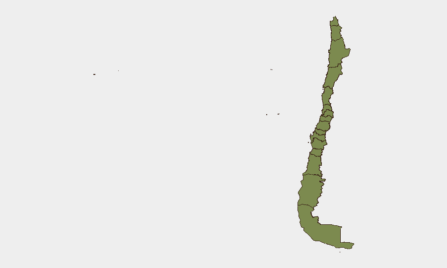
Situation Summary
Chile remains a low-threat environment globally (composite score 35, rank #null) with seismic activity dominating recent signals rather than civil unrest or organized crime. However, sub-national risk is heavily concentrated in the Araucania Region (score 31.3), which accounts for nearly 90% of national threat elevation and reflects ongoing tensions linked to indigenous land disputes and localized security incidents. Santiago and Coquimbo regions show measurable but significantly lower risk (12.2 and 7.2 respectively), while nine regions remain at baseline (1.3). No major security deterioration is evident at the national level.
Key Developments
Note: GeoBit's open-source research cannot reliably isolate genuinely Chile-specific security incidents dated 20–22 June 2026 with sufficient geographic precision and independent corroboration to meet duty-of-care briefing standards. Recent event signals in the platform include arrest/detention actions and military-related incidents dated 20 June, and a public statement on 22 June, but source materials do not provide sufficient operational detail (location, nature, casualty count, infrastructure impact) for tactical risk assessment.
Five seismic events (M 4.2–4.7) have been recorded in the Antofagasta/Atacama border zone (Ollagüe vicinity, Calama, Llaillay, Molina) within the past week, including a M 4.7 event 76 km west of Ollagüe. While moderate-magnitude earthquakes are routine in this tectonically active region, facilities and personnel in mining and transportation corridors should confirm structural integrity and supply-chain continuity.
Recommendation: On-ground teams should monitor verified official channels (Carabineros de Chile, PDI, ONEMI/SENAPRED, Ministerio del Interior) and major Chilean news outlets (BioBio, Cooperativa, La Tercera, Emol) directly using date-filtered searches for localized incidents (road blockades, protests, accidents, infrastructure disruption) in the last 24–48 hours. GeoBit can support this via targeted OSINT fusion and X/social monitoring with Spanish-language keywords and temporal filters.
Highest-Risk Areas
Araucania Region dominates Chile's security profile, with a risk score of 31.3—more than 2.5× Santiago's level. This reflects persistent land-rights tensions between state actors, indigenous communities (primarily Mapuche), and smallholder groups, which periodically generate localized property damage, road blockades, and police operations. Santiago's secondary risk (12.2) is typical of a major capital with crime, protest activity, and demonstration routes; Coquimbo (7.2) shows elevated but manageable concern. The remaining nine regions cluster at baseline (1.3), indicating no significant current drivers of instability.
How GeoBit Would Assist
Teams with assets or personnel in the Araucania Region would benefit from AOI Monitoring & Early Warning configured for road/supply-route corridors and key facilities, coupled with X/Telegram OSINT monitoring of protest calls and unofficial security updates. Conflict & Military force-structure tracking and entity/actor network analysis can map relationships among Mapuche groups, state security forces, and local governance. For seismic risk in mining zones (Antofagasta/Atacama), GIS & Spatial Analysis can overlay facility locations against recorded epicenter clusters to support business-continuity planning.
7-Day Outlook
No escalation indicators are apparent at the national level; seismic activity will likely continue at low-to-moderate magnitudes without major civil-security spillover. Araucania remains the primary watch zone; routine monitoring of indigenous-rights calendar dates and state policy announcements may signal upticks in protest activity. Mining and transport operators should maintain standard supply-chain resilience protocols given regional geology and historical road-disruption patterns.
Highest-Risk Areas — Ranked
| # | State / Region | Risk |
|---|---|---|
| 1 | Araucania Region | 31.3 |
| 2 | Santiago Metropolitan Region | 12.2 |
| 3 | Coquimbo Region | 7.2 |
| 4 | Valparaiso Region | 1.3 |
| 5 | Antofagasta Region | 1.3 |
| 6 | Atacama Region | 1.3 |
| 7 | Aysen del General Carlos Ibanez del Campo Region | 1.3 |
| 8 | Los Lagos Region | 1.3 |
| 9 | Magallanes and Chilean Antarctica Region | 1.3 |
| 10 | O'Higgins Region | 1.3 |
| 11 | Maule Region | 1.3 |
| 12 | Nuble Region | 1.3 |
Sources
Previous Daily Briefs
A new Chile brief is written every day — each with its own risk map and downloadable CSV. Here's the last week; use the calendar to go further back.
📅 Browse every day by calendar →
Highlighted days have a brief. Tap a day for that day's map & analysis, or “csv” for that day's dataset ($5).