Situation Summary
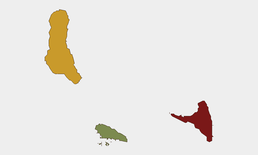
Comoros presents a stable but fragmented security environment, with no confirmed security incidents, civil unrest, or infrastructure disruptions reported in the last 24–48 hours. The archipelago's low media coverage and limited open-source reporting mean the absence of incident signals should not be interpreted as complete safety assurance. Structural vulnerabilities—particularly in Anjouan (composite risk 88)—persist as chronic drivers of underlying instability, though no acute triggering events are currently visible. The near-term outlook remains quiescent absent new political or economic shocks.
Key Developments
No discrete security, conflict, civil-unrest, crime, infrastructure, or political-stability incidents meeting 24–48 hour recency and cross-source verification criteria were surfaced in live web research, X/Twitter monitoring, or regional security wires for Comoros on or after 22 June 2026.
This represents a continuation of the low-incident reporting norm for the archipelago and does not indicate absence of localized criminal activity, intercommunal tension, or governance friction—only the non-appearance of incidents that reached international or regional open-source channels with verifiable timestamps.
Highest-Risk Areas
Anjouan (risk score 88) remains the primary driver of national-level vulnerability, reflecting its history of separatist movements, weak central government authority, and recurring inter-island political friction since the early 2000s. Grande Comore (risk 72), the capital island, concentrates administrative functions and remains subject to political volatility and port/urban security pressures, including petty and organized crime in Moroni. Moheli (risk 35) presents substantially lower risk. Together, the concentration of governance fragility and economic marginalization in Anjouan and Grande Comore creates persistent conditions for localized unrest, criminal activity, and political instability, even during periods of surface calm.
How GeoBit Would Assist
Security teams with personnel or assets in Comoros should employ Intel Sweep and multi-language OSINT fusion to monitor government and regional media for signs of emerging political tension or economic shocks, combined with X/Twitter and Telegram OSINT focused on Anjouan and Moroni to detect early civil-unrest signals before international reporting lags. AOI Monitoring & Early Warning with persistent alerts on key nodes (ports, airports, government compounds, major intersections in Moroni and Mutsamudu) would provide rapid notification if localized incidents escalate. Routing & Network Analysis can identify safe movement corridors and alternative transportation options if ground conditions degrade, complemented by direct maritime and aviation tracking to confirm operator status during periods of elevated uncertainty.
7-Day Outlook
No acute security triggers are apparent in the immediate outlook. The archipelago's underlying political and economic fragilities—particularly Anjouan's governance challenges and inter-island tensions—remain present but dormant. Monitoring should remain continuous, with particular attention to social media and local reporting for signs of renewed separatist rhetoric, labor unrest, or political faction mobilization, which could precede visible incidents by days or weeks in a low-coverage environment.
Highest-Risk Areas — Ranked
| # | State / Region | Risk |
|---|---|---|
| 1 | Anjouan | 88 |
| 2 | Grande Comore | 72 |
| 3 | Moheli | 35 |
Previous Daily Briefs
A new Comoros brief is written every day — each with its own risk map and downloadable CSV. Here's the last week; use the calendar to go further back.
📅 Browse every day by calendar →
Highlighted days have a brief. Tap a day for that day's map & analysis, or “csv” for that day's dataset ($5).