Situation Summary
El Salvador maintains a composite threat score of 21 (rank #null globally) as of 23 June 2026, reflecting a stabilized but fragmented security environment. Natural hazards—specifically seismic activity—now compete with persistent organized-crime and gang-related risks as operational concerns. The country's overall risk profile remains moderate, though sub-national variation is extreme, with Cabañas Department significantly elevated above all other jurisdictions.
Key Developments
- Seismic Event, 22 June 2026: Magnitude 4.7 earthquake occurred approximately 103 km south-southwest of Puerto El Triunfo, Cuscatlán Department, at ~10 km depth. Impact on critical infrastructure, transport routes, and utilities in coastal and southern zones requires assessment; no casualties or disruptions confirmed in available reports as of 23 June 0600 local.
- Maritime Narcotics Interdiction (circa 21 June): Salvadoran Navy seized over six tonnes of cocaine from two interdicted vessels; six crew members detained. Exact date and location of interdiction not confirmed in 24–48 hour window; operation reflects ongoing Pacific maritime trafficking activity but does not indicate new territorial incursions or port-area security breaches.
- Three Threat Signals, 23 June 2026: GeoBit's event feed has registered three "Threaten" category alerts for El Salvador on 23 June; underlying incident details, locations, and confirmation status are not yet resolved in open research. Recommend direct platform review and source corroboration.
- No Confirmed Civil Unrest or Major Crime Incidents (22–23 June): Open-source reporting does not surface specific, timestamped reports of protests, riots, homicides, mass arrests, or gang violence in major cities during the past 48 hours. Background conditions remain volatile in gang-contested zones, but no discrete incidents meet incident-level confirmation standards for this window.
- Infrastructure Status: No widespread power outages, major road closures, or airport/port disruptions reported independent of the earthquake event noted above.
Highest-Risk Areas
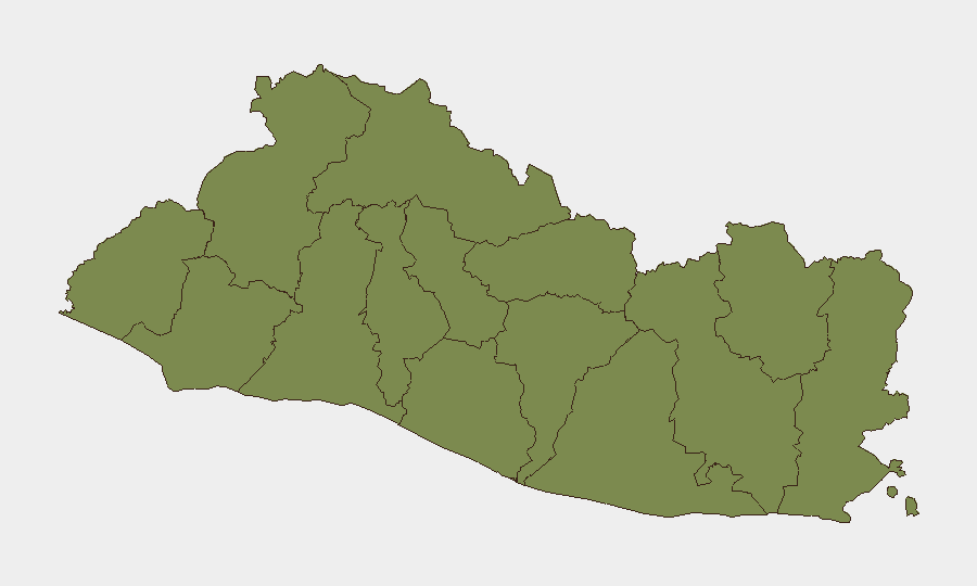
Cabañas Department (risk 31.2) stands isolated as El Salvador's highest-risk jurisdiction—more than 25 times the baseline of every other department (all rated 1.2). This extreme variance suggests concentrated gang presence, territorial control disputes, or criminal resource extraction in Cabañas; security teams with personnel or assets in that zone face materially different threat surfaces than those in San Salvador, La Libertad, or southern departments. All other departments cluster at near-baseline risk, indicating either effective containment in Cabañas or a data-collection artifact requiring clarification. Teams should verify whether Cabañas risk reflects recent escalation or persistent structural conditions.
How GeoBit Would Assist
Intel Sweep and X/Twitter & Telegram OSINT capabilities enable continuous monitoring of incident feeds, gang communications, and real-time event signals in El Salvador, flagging threats hours to days before mainstream reporting. AOI Monitoring & Early Warning with persistent geographic watches on Cabañas Department, major transport corridors, and port facilities (Puerto El Triunfo, Acajutla) provide advance notice of roadblocks, cargo theft, or supply-chain disruption. Routing & Network Analysis identifies safer alternative routes and departure windows for corporate travel and logistics given seismic risk and organized-crime hotspots.
7-Day Outlook
Seismic aftershock probability remains elevated through late June; infrastructure inspections and logistical delays are likely in southern and coastal zones. Gang and trafficking activity will continue at baseline rates in Cabañas and northern departments absent specific triggers. Duty-of-care teams should confirm staff safety in earthquake-affected areas, verify insurance and evacuation plans, and monitor the three unresolved "Threaten" alerts for operational impact.
Highest-Risk Areas — Ranked
| # | State / Region | Risk |
|---|---|---|
| 1 | Cabañas Department | 31.2 |
| 2 | Ahuachapán Department | 1.2 |
| 3 | Sonsonate Department | 1.2 |
| 4 | Santa Ana Department | 1.2 |
| 5 | Chalatenango Department | 1.2 |
| 6 | La Libertad Department | 1.2 |
| 7 | San Salvador Department | 1.2 |
| 8 | Cuscatlán Department | 1.2 |
| 9 | La Paz Department | 1.2 |
| 10 | San Vicente Department | 1.2 |
| 11 | Usulután Department | 1.2 |
| 12 | San Miguel Department | 1.2 |
Sources
Previous Daily Briefs
A new El Salvador brief is written every day — each with its own risk map and downloadable CSV. Here's the last week; use the calendar to go further back.
📅 Browse every day by calendar →
Highlighted days have a brief. Tap a day for that day's map & analysis, or “csv” for that day's dataset ($5).