Situation Summary
Ghana remains a stable, moderate-threat environment (global rank #117, composite score 5) with no active large-scale civil unrest, terrorism, or critical infrastructure attacks reported as of 16 June 2026. Security activity over the past 48 hours has centred on police and National Security enforcement operations—raids targeting narcotics trafficking, violent crime, and commercial premises—rather than political violence or organised instability. Regional cyber threats and fraud networks remain an ongoing concern across West Africa, with Ghana positioned as both a transit point and target for transnational organised crime and financial crime operations.
Key Developments
- Koforidua, Eastern Region (15 June): Joint operation by National Security, Ghana Armed Forces, and Ghana Police Service resulted in six arrests at Koforidua China Mall, indicating intelligence-led enforcement targeting commercial-sector vulnerabilities or illicit activity.
- Upper East Region (14–15 June): Ghana Police conducted two back-to-back counter-narcotics and violent-crime operations in the border region within a 48-hour window, reflecting intensified enforcement against organised trafficking networks in the north.
- Ashanti Region (15 June): National Security and police joint raid reported by local media; specifics of target or arrests remain limited in open reporting, but consistent with nationwide enforcement tempo.
- National security briefing (15 June): Ghana Police Service "Safe Start Morning Show" confirmed multiple ongoing operations and arrests across the country over the preceding 48 hours, signalling active counter-crime coordination.
- Cyber and fraud awareness (15 June): Closure of 4th ECOWAS Regional Cybersecurity Hackathon in Accra highlighted regional concern over ransomware attacks on healthcare infrastructure and cyber-enabled trafficking/scam centres; hundreds of arrests reported across West Africa underscores transnational fraud and financial crime risk.
Highest-Risk Areas
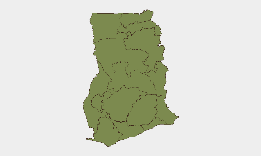
Bono East Region dominates sub-national risk ranking (31.8), significantly above all other regions; the source of this elevated score is not detailed in current event signals, warranting urgent clarification through targeted monitoring. Volta Region (5.0), Ashanti Region (4.2), and Western Region (4.2) represent the secondary tier of concern. Greater Accra (2.6)—despite hosting the capital and major commercial/diplomatic infrastructure—shows moderate risk, largely consistent with urban crime and transnational fraud activity typical of regional financial hubs. Northern regions (Upper East, Savannah, North East, Northern) exhibit lower but non-negligible scores (1.8–2.6), reflecting border-proximity risks associated with narcotics trafficking and cross-border organised crime networks active in the Sahel.
How GeoBit Would Assist
Security teams should deploy AOI Monitoring & Early Warning on high-risk regions (Bono East, Volta, Ashanti) with alerting thresholds set for law-enforcement activity, organised-crime signals, and cross-border movement anomalies. Intel Sweep and OSINT fusion (X/Twitter, Telegram, local media, police broadcasts, Ministry statements) will provide real-time situational awareness of police operations, arrests, and transnational crime indicators. Network & Actor Analysis combined with conflict/crime search capabilities will map trafficking nodes and enforcement responses, enabling proactive security posture adjustment for personnel and assets in high-activity zones.
7-Day Outlook
Police and National Security operations are likely to continue at current tempo, with enforcement focus remaining on narcotics trafficking, violent crime, and fraud networks rather than political destabilisation. No credible indicators suggest imminent escalation to large-scale civil unrest or terrorism in the next seven days. Organisations with supply chains, personnel, or assets in Bono East, Volta, and Ashanti regions should heighten due-diligence and incident-response readiness pending clarification of Bono East's elevated threat score.
Highest-Risk Areas — Ranked
| # | State / Region | Risk |
|---|---|---|
| 1 | Bono East Region | 31.8 |
| 2 | Volta Region | 5 |
| 3 | Ashanti Region | 4.2 |
| 4 | Western Region | 4.2 |
| 5 | Upper West Region | 2.6 |
| 6 | Greater Accra Region | 2.6 |
| 7 | Bono Region | 2.6 |
| 8 | Upper East Region | 1.8 |
| 9 | Savannah Region | 1.8 |
| 10 | North East Region | 1.8 |
| 11 | Northern Region | 1.8 |
| 12 | Eastern Region | 1.8 |
Sources
Previous Daily Briefs
A new Ghana brief is written every day — each with its own risk map and downloadable CSV. Here's the last week; use the calendar to go further back.
📅 Browse every day by calendar →
Highlighted days have a brief. Tap a day for that day's map & analysis, or “csv” for that day's dataset ($5).