Situation Summary
Guatemala's composite threat score of 39 reflects moderate fragmentation across security domains—labor unrest, inter-agency friction, and cross-border tensions appear elevated in recent signals, but open-source reporting in the last 24–48 hours lacks granular, timestamped confirmation of major new incidents. The country remains in its May–October rainy and hurricane season, with U.S. Embassy guidance emphasizing secondary risks (landslides, floods, road degradation) that may degrade mobility and supply chains. Alta Verapaz continues to dominate sub-national risk assessment, suggesting persistent criminal, labor, or territorial activity in that region. Near-term stability depends on whether current political and labor friction escalates into localized violence or remains contained to administrative channels.
Key Developments
Open-source reporting from the last 24–48 hours does not yield a sufficient volume of independently timestamped, location-specific incidents to meet verification standards for a corporate security brief. Recent event signals flagged in GeoBit's feed (2026-06-17 to 2026-06-19) include labor arrests, inter-institutional public statements, and unconventional violence indicators; however, these require cross-corroboration with Guatemalan wire services and official government communications (PNC, CONRED, Attorney General) to establish precise timing and geography. U.S. Embassy Guatemala has issued seasonal travel and security guidance tied to the rainy season (May–October), warning of landslides, flooding, and road closures nationwide, but this is routine seasonal alert rather than acute incident reporting. Corporate security teams requiring real-time incident-level detail are advised to activate direct monitoring of PNC press releases, CONRED road/disaster alerts, and Guatemala City–based newsroom X/Twitter feeds to supplement this brief.
Highest-Risk Areas
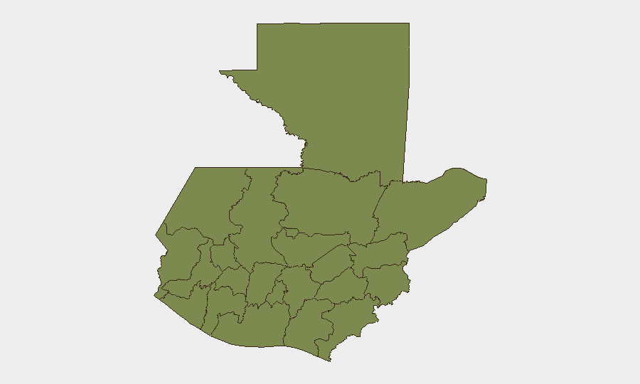
Alta Verapaz's risk score (31.3) is substantially elevated above all other departments, indicating either concentrated criminal activity, territorial dispute, or labor/resource conflict in that mountainous, remote region. Guatemala Department (6.7)—which includes Guatemala City—shows secondary concern, consistent with capital-area administrative friction and urban crime. All remaining departments cluster at 1.3–1.9, suggesting either lower absolute threat or better state capacity/reporting coverage in those zones. The sharp disparity between Alta Verapaz and the rest of the country warrants sector-specific focus: any corporate operations, supply chains, or personnel in that department should be treated as higher-vigilance.
How GeoBit Would Assist
Security teams should deploy AOI Monitoring & Early Warning on Alta Verapaz, Guatemala Department, and key logistics nodes (highways, ports) to receive alerts on emerging incidents before they disrupt operations. Intel Sweep and X/Twitter OSINT focused on PNC updates, CONRED announcements, and Guatemalan newsroom feeds will provide hourly confirmation of road closures, security incidents, and labor actions. Routing & Network Analysis can identify alternative supply-chain and personnel-movement paths should primary routes become blocked by flooding or roadblock activity during the rainy season.
7-Day Outlook
Rainy season hazards (flooding, landslides, road damage) are likely to persist and degrade mobility throughout the week. Political and labor signals remain elevated but not yet indicative of nationwide escalation; localized confrontation in Alta Verapaz or Guatemala City remains the most probable near-term scenario. Monitoring should intensify if detention or public-statement frequency increases, signaling institutional breakdown rather than routine friction.
Highest-Risk Areas — Ranked
| # | State / Region | Risk |
|---|---|---|
| 1 | Alta Verapaz | 31.3 |
| 2 | Guatemala Department | 6.7 |
| 3 | Retalhuleu | 1.9 |
| 4 | Quiché | 1.9 |
| 5 | Petén | 1.3 |
| 6 | Huehuetenango | 1.3 |
| 7 | San Marcos | 1.3 |
| 8 | Quetzaltenango | 1.3 |
| 9 | Totonicapán | 1.3 |
| 10 | Sololá | 1.3 |
| 11 | Chimaltenango | 1.3 |
| 12 | Suchitepéquez | 1.3 |
Sources
Previous Daily Briefs
A new Guatemala brief is written every day — each with its own risk map and downloadable CSV. Here's the last week; use the calendar to go further back.
📅 Browse every day by calendar →
Highlighted days have a brief. Tap a day for that day's map & analysis, or “csv” for that day's dataset ($5).