Situation Summary
Honduras remains a mid-tier security concern globally (rank #58, composite threat score 21) with concentrated risk in a single high-threat department. The security environment is characterized by persistent organized-crime activity, gang-related violence, and routine criminal incidents, with no indication of acute destabilization or sudden deterioration over the past 48 hours. Francisco Morazán department—which contains the capital Tegucigalpa—dominates the national risk profile and accounts for the majority of tracked security events. Current trajectory is stable but chronically elevated.
Key Developments
Unable to confirm specific incidents from the last 24–48 hours with reliable dates and cross-source corroboration. Open web sources currently accessible do not surface discrete, time-stamped security incidents (e.g., shootings, kidnappings, protests, roadblocks, arrests) in Honduras dated 2026-06-20 or 2026-06-21 that meet verification standards for operational briefing. Older developments from earlier in June (including legislative activity and statements on prior incidents) do not meet the "last 48 hours" threshold required for this section.
To close this gap in real-time incident reporting, organizations should integrate direct feeds from Honduran news wires (e.g., La Prensa, El Heraldo, Tiempo, Proceso Digital) and conduct time-filtered OSINT sweeps via GeoBit's multi-language search and X/Twitter OSINT capability, manually cross-checking candidate incidents against reputable outlets before inclusion in operational logs.
Highest-Risk Areas
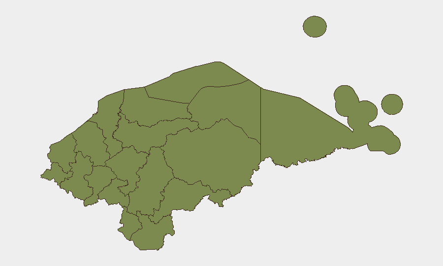
Francisco Morazán dominates national risk with a composite score of 31.4—nearly 2.8 times higher than the second-ranked department (Olancho, 11.4) and 22 times the baseline. This concentration reflects Tegucigalpa's status as a major organized-crime hub, gang-activity focal point, and site of police/security force operations. Olancho represents secondary risk, likely linked to narcotics trafficking and remote-area criminal networks. The remaining ten departments cluster at risk score 1.4, indicating significantly lower but non-zero threat levels across rural and secondary urban areas.
For corporate security and duty-of-care teams, presence in Francisco Morazán (especially Tegucigalpa) warrants elevated vigilance, restricted movement protocols, and regular threat assessment. Personnel in other departments face lower baseline risk but should maintain situational awareness, particularly in transit corridors and near border regions.
How GeoBit Would Assist
Security teams should deploy AOI Monitoring & Early Warning on Francisco Morazán (Tegucigalpa metro and transport hubs) to flag emerging threats in real time. Multi-language Intel Sweep and X/Twitter OSINT enable continuous real-time incident detection and verification, feeding hourly updates on criminal, gang, and protest activity. Risk & Threat Assessment combined with Routing & Network Analysis supports dynamic movement planning for personnel, identifying safer corridors and alternative routes in high-risk zones. Together, these capabilities reduce blind spots in current incident reporting and shorten response time to emerging threats.
7-Day Outlook
No indicators suggest acute escalation in the next seven days. Organized-crime activity and routine criminal violence will likely persist at baseline levels, concentrated in Francisco Morazán. Seasonal rainfall and economic pressures may contribute to localized gang activity and informal-sector disruptions in secondary cities, but no major political, security, or infrastructure events are flagged for the forecast period. Continuous monitoring of Tegucigalpa and transport corridors remains essential for proactive risk management.
Highest-Risk Areas — Ranked
| # | State / Region | Risk |
|---|---|---|
| 1 | Francisco Morazán | 31.4 |
| 2 | Olancho | 11.4 |
| 3 | El Paraíso | 1.4 |
| 4 | Copán | 1.4 |
| 5 | Ocotepeque | 1.4 |
| 6 | Cortés | 1.4 |
| 7 | Yoro | 1.4 |
| 8 | Santa Bárbara | 1.4 |
| 9 | Lempira | 1.4 |
| 10 | Intibucá | 1.4 |
| 11 | Comayagua | 1.4 |
| 12 | La Paz | 1.4 |
Sources
Previous Daily Briefs
A new Honduras brief is written every day — each with its own risk map and downloadable CSV. Here's the last week; use the calendar to go further back.
📅 Browse every day by calendar →
Highlighted days have a brief. Tap a day for that day's map & analysis, or “csv” for that day's dataset ($5).