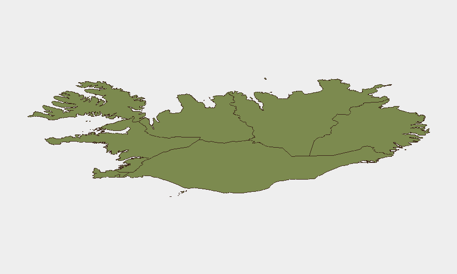
Situation Summary
Iceland remains a low-threat environment with a composite threat score of 3 and no tracked active security incidents as of 22 June 2026. Web research and open-source monitoring across the last 24–48 hours confirm the absence of protests, infrastructure disruptions, terrorism alerts, or crime spikes—consistent with Iceland's baseline status as one of the world's safest jurisdictions. No acute developments warrant elevated travel or operational risk posture for corporate personnel or assets.
Key Developments
- No credible security incidents reported, nationwide, 20–22 June 2026. Open-source and social-media monitoring detected no protests, demonstrations, civil unrest, terrorism alerts, mass-casualty crime, or infrastructure failures across Iceland in the last 48 hours.
- Capital Region remains highest sub-national risk zone (score 24). Reykjavík and surrounding areas carry elevated risk relative to other Icelandic regions, though absolute risk remains low; monitoring of political activity, public gatherings, and airport operations in the capital remains standard practice.
- Southern Peninsula and Southern Region show secondary risk concentration (scores 12 and 11 respectively). Tourist corridors including the Golden Circle and South Coast show no current disruption; no alerts from local authorities or travel platforms in the last 24 hours.
- Outlying regions (Westfjords, Northwestern, Northeastern) continue low-risk profile (scores 6–8). These areas maintain minimal security event frequency and remain suitable for routine operations.
- No geopolitical spillover detected in Iceland from Middle East events. Recent event signals flagged in global monitoring (Israel–Lebanon, Israel–US incidents on 21–22 June) show no corresponding security impact, protests, or policy changes affecting Iceland's internal stability or travel conditions.
- Critical infrastructure operational. Airports, ports, roads, and utilities report no current disruptions or outages; supply-chain and logistics continuity confirmed as normal.
Highest-Risk Areas
The Capital Region (Reykjavík and surroundings) dominates Iceland's sub-national risk profile with a score of 24, driven by population density, political/diplomatic activity, and media concentration. The Southern Peninsula (12) and Southern Region (11) rank second and third, primarily reflecting higher tourism footfall and transient-population exposure rather than acute security threats. All other regions score below 10 and remain low-risk. Risk concentration in these three zones reflects routine exposure factors (crowds, transportation hubs, visitor volume) rather than current incidents or instability; corporate teams should apply standard duty-of-care protocols (staff communication, incident reporting, route awareness) rather than enhanced restrictions.
How GeoBit Would Assist
Continuous AOI Monitoring & Early Warning on Reykjavík, airports, and tourist corridors would provide real-time alert capability if protests, disruptions, or political activity escalate. OSINT fusion (X/Twitter, news feeds, social sentiment, multi-language search) combined with Intel Sweep capabilities would detect emerging civil unrest, travel advisories, or infrastructure faults within 2–4 hours of onset. Routing & Network Analysis would enable corporate security to identify alternative routes and logistics pathways if primary arteries (Golden Circle, South Coast roads, Keflavík airport access) faced temporary congestion or closure.
7-Day Outlook
No indicators suggest material change in Iceland's security posture over the next 7 days. Sustained monitoring for spillover effects from Middle East tensions, seasonal tourism patterns, and routine infrastructure maintenance will continue to anchor baseline risk. Personnel and asset-protection teams should maintain standard low-risk protocols without elevation.
Highest-Risk Areas — Ranked
| # | State / Region | Risk |
|---|---|---|
| 1 | Capital Region | 24 |
| 2 | Southern Peninsula | 12 |
| 3 | Southern Region | 11 |
| 4 | Eastern Region | 10 |
| 5 | Western Region | 9 |
| 6 | Westfjords Region | 8 |
| 7 | Northwestern Region | 7 |
| 8 | Northeastern Region | 6 |
Sources
Previous Daily Briefs
A new Iceland brief is written every day — each with its own risk map and downloadable CSV. Here's the last week; use the calendar to go further back.
📅 Browse every day by calendar →
Highlighted days have a brief. Tap a day for that day's map & analysis, or “csv” for that day's dataset ($5).