Situation Summary
Ireland remains a low-global-threat environment (rank #113) but faces renewed activity from dissident republican elements, particularly along the border region with Northern Ireland. Law enforcement has scored a significant tactical success with the interception of a sophisticated IED near Carrickmacross on 23 July, preventing what officials assess as a potentially "devastating" attack. However, the incident underscores persistent organizational capacity among fringe armed groups and suggests elevated threat signalling that warrants heightened awareness among corporate and personnel security teams, especially those operating in border counties and Dublin.
Key Developments
- Carrickmacross, Co Monaghan – 23–24 July 2026: Gardaí intercepted a vehicle on the N2 south of Carrickmacross carrying an extremely sophisticated IED believed destined for a dissident republican attack in Northern Ireland. A female driver (20s) was charged in connection with possession and transport; a male suspect (40s) remains in custody under Offences Against the State legislation. Officials characterized the device as among the most advanced recovered in recent years, indicating the seizure likely prevented a major attack.
- Border Region, Co Monaghan – 23–24 July 2026: The N2 corridor near the Monaghan–Northern Ireland border has become the focus of heightened security operations, with Gardaí and Defence Forces coordinating to counter dissident republican activity in the area.
- Killarney, Co Kerry – 24 July 2026: Post-mortem examination confirmed a US national found in Killarney died from suffocation. Gardaí report the primary suspect has fled Ireland; cross-border law enforcement coordination is underway, indicating active criminal investigation with implications for travel security in the Kerry region.
- Multiple Counties – 24 July 2026: Gardaí conducted coordinated raids across several counties targeting retailers distributing illegal cannabis vapes and jellies, reflecting ongoing illicit drug distribution affecting commercial premises.
- An Sraith Salach, Connemara, Co Galway – 24 July 2026: Businesses at this location were destroyed by fire with significant damage to commercial properties and associated business continuity disruption; cause remains under examination.
Highest-Risk Areas
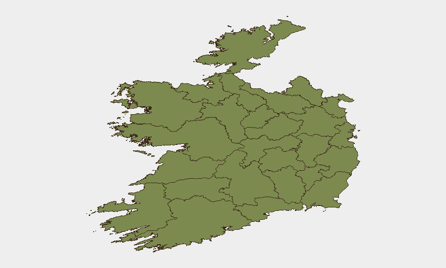
County Dublin dominates the risk profile (31.4) as Ireland's capital and largest business hub, concentrating government, financial, corporate, and diplomatic activity. County Waterford (18.1) shows elevated risk, though the primary security concern remains the border corridor—specifically County Monaghan and County Louth (each 2.2)—where the recent IED interception and historical dissident republican activity create a distinct threat vector for personnel and asset movement. The Carrickmacross incident demonstrates that border counties remain the active operational focus for threat actors despite their low aggregate risk scores; organizations with operations or supply chains spanning the N2 and adjacent border routes should treat these areas with operational caution disproportionate to their numerical rankings.
How GeoBit Would Assist
Security teams should employ AOI Monitoring & Early Warning capabilities to track the N2 corridor and border region for emerging activity signals; Network & Actor Analysis to map dissident republican organizational capacity and personnel flows; and Routing & Network Analysis to develop alternative logistical routes that avoid highest-risk border transit corridors. Real-time X/Twitter and Telegram OSINT combined with multi-language search would provide early detection of threat actor communications or mobilization indicators ahead of operational activity.
7-Day Outlook
The Carrickmacross seizure will likely prompt temporary surge in border policing and heightened checkpoint activity on the N2 and adjacent routes. Dissident republican organizations may attempt tactical recalibration or messaging to reassert relevance following the public interception; security teams should monitor for retaliatory rhetoric or claims-of-credit in underground forums. Overall near-term risk remains contained but warrants sustained vigilance in border and Dublin-based operations.
Highest-Risk Areas — Ranked
| # | State / Region | Risk |
|---|---|---|
| 1 | County Dublin | 31.4 |
| 2 | County Waterford | 18.1 |
| 3 | County Galway | 5.2 |
| 4 | County Clare | 2.2 |
| 5 | County Tipperary | 2.2 |
| 6 | County Louth | 2.2 |
| 7 | County Mayo | 1.4 |
| 8 | County Sligo | 1.4 |
| 9 | County Limerick | 1.4 |
| 10 | County Donegal | 1.4 |
| 11 | County Leitrim | 1.4 |
| 12 | County Roscommon | 1.4 |
Sources
Previous Daily Briefs
A new Ireland brief is written every day — each with its own risk map and downloadable CSV. Here's the last week; use the calendar to go further back.
📅 Browse every day by calendar →
Highlighted days have a brief. Tap a day for that day's map & analysis, or “csv” for that day's dataset ($5).
Atlas — our AI intelligence desk — emails them this snapshot personally. Nothing else, no list.