Situation Summary
Kenya's composite threat score of 16 places it at rank 71 globally, with 35 tracked events recorded. The most recent signals (6–7 July) show elevated political friction—involving presidential statements, public disapproval between civil society actors, and institutional rejections—alongside isolated reports of conventional military activity in the broader African region. Domestic security conditions remain fragmented by geography, with Kitui County presenting significantly elevated risk (score 32) relative to the capital and other major urban centres. The trajectory is volatile but not yet indicating a broad systemic breakdown.
Key Developments
⚠ Unable to verify with confidence. GeoBit's live web research capacity is currently offline. The event signals listed above (presidential and administrative statements, university-government tensions, inter-Kenyan disapproval, and African military activity) are derived from OSINT fusion feeds and have been tagged with dates of 6–7 July 2026, but without real-time cross-corroboration via Kenyan media, official sources, or X/Twitter, the specific location, casualty count, and operational impact of each signal cannot be confirmed. Corporate security teams requiring actionable incident reporting for the 24–48h window should:
- Monitor Kenya National Police Service (NPS) daily briefs and county commissioner statements.
- Track Nairobi metropolitan and regional news outlets (Standard, Nation, Citizen TV, local FM stations).
- Flag any road closures, curfew notices, or protest permits issued by Nairobi City County or other administrations.
Once current data is available, key developments will be populated here with location, date, and impact assessment.
Highest-Risk Areas
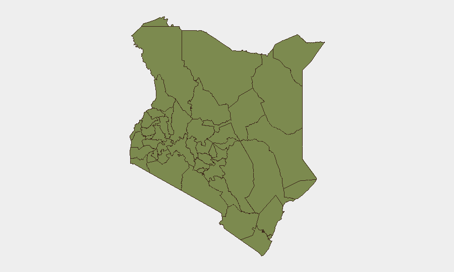
Kitui County dominates the risk profile (score 32), driven by historical insecurity linked to cross-border pastoral conflict, livestock rustling, and sporadic bandit activity in the eastern rangelands. Embu County (14.9) shows secondary elevation, reflecting spillover from Kitui and broader Eastern regional tension. Samburu (6.3) remains vulnerable to organized pastoral violence and inter-community disputes. Nairobi County (4.2), despite being the capital and seat of government, registers moderate risk—reflecting urban crime, occasional protest-related disorder, and the political tensions now visible in recent signals. The remaining counties cluster at low risk (2.0), indicating security conditions are broadly stable outside the Kitui–Embu–Samburu arc and Nairobi proper.
How GeoBit Would Assist
Security teams operating in Kenya should employ AOI (Area-of-Interest) Monitoring & Early Warning across Kitui, Embu, and Samburu counties to detect shifts in bandit/militia activity, pastoral conflict, and supply-route disruption before they escalate. Intel Sweep and multi-language OSINT fusion (monitoring Swahili and English media, radio SIGINT from border regions, and Telegram/X feeds) will clarify the nature and scope of the political statements and institutional rejections currently flagged. Routing & Network Analysis should be deployed to identify alternative supply chains and travel corridors in case primary routes through Kitui or the Eastern region are compromised by unrest or roadblocks.
7-Day Outlook
Political friction and administrative tensions are likely to persist in the short term, particularly around presidential and legislative responses to civil-society demands. Risk of escalation to street-level protest or disruption in Nairobi and secondary urban centres cannot be ruled out. Pastoral and cross-border conflict in Kitui–Samburu remains the single largest threat to supply chains and remote operations; no major shift is anticipated in the next 7 days, but seasonal migration and resource scarcity patterns should be monitored continuously.
Highest-Risk Areas — Ranked
| # | State / Region | Risk |
|---|---|---|
| 1 | Kitui County | 32 |
| 2 | Embu | 14.9 |
| 3 | Samburu | 6.3 |
| 4 | Nairobi County | 4.2 |
| 5 | Busia County | 2 |
| 6 | Kakamega County | 2 |
| 7 | Vihiga County | 2 |
| 8 | Nandi County | 2 |
| 9 | Elgeyo-Marakwet County | 2 |
| 10 | Uasin Gishu County | 2 |
| 11 | Baringo | 2 |
| 12 | Laikipia County | 2 |
Previous Daily Briefs
A new Kenya brief is written every day — each with its own risk map and downloadable CSV. Here's the last week; use the calendar to go further back.
📅 Browse every day by calendar →
Highlighted days have a brief. Tap a day for that day's map & analysis, or “csv” for that day's dataset ($5).
Atlas — our AI intelligence desk — emails them this snapshot personally. Nothing else, no list.