Situation Summary
Kuwait faces an elevated and unpredictable security environment stemming from ongoing Iran–US regional escalation. Over the past 48 hours, Kuwaiti air defences have intercepted approximately 24 Iranian drones and multiple ballistic missiles targeting or transiting Kuwaiti airspace, with no reported damage to critical infrastructure or U.S. installations. International travel advisories have been upgraded to "reconsider your need to travel," and authorities have tightened customs controls at all entry points; the threat trajectory remains volatile pending further developments in the broader regional conflict.
Key Developments
- Kuwait airspace, 3–4 July 2026: Kuwaiti Army air defences detected and intercepted approximately 24 Iranian drones fired toward Kuwait over a 48-hour window, indicating multiple coordinated incursion attempts across the national airspace. No casualties or infrastructure damage reported.
- Kuwait airspace, overnight 2–3 July 2026 (confirmed in last 24–48h reporting): Kuwaiti military and regional media sources confirmed successful interception of hostile missiles and drones launched by Iran in response to recent U.S. airstrikes; U.S. military installations in Kuwait sustained no damage.
- Kuwait International Airport, Terminal 4, Farwaniya Governorate, early July 2026: Customs officers seized three bags of counterfeit goods and undeclared foreign currency from an arriving passenger originating from China, initiating legal proceedings and signaling heightened border-control enforcement across all entry points.
- Kuwait airspace and military sites, 28 June 2026 (confirmed in current briefings): Two ballistic missiles were intercepted over Kuwaiti airspace during wider Iranian strikes on U.S. Gulf military infrastructure; confirmation in current security advisories underscores sustained regional threat and elevated alert posture.
- Kuwait defence procurement, announced within last 24–48h: Kuwait has agreed to acquire the NASAMS air-defence system (approximately $400 million contract) via U.S. Foreign Military Sales to enhance protection against aerial threats, reflecting sustained institutional concern about missile and drone attacks.
- International travel advisory update, 3–4 July 2026: Australia's Smartraveller and similar government advisories updated their Kuwait guidance to "reconsider your need to travel" due to the unpredictable regional security situation and risk of sudden deterioration or travel disruption.
Highest-Risk Areas
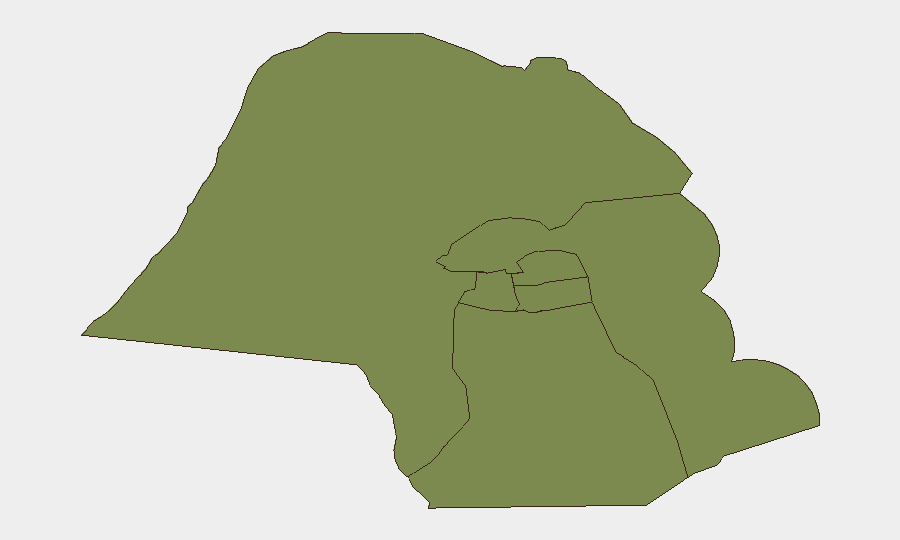
Jahra Governorate is significantly elevated above other sub-national jurisdictions with a composite risk score of 31.4, roughly 22 times higher than the five other tracked governorates. This elevation likely reflects Jahra's proximity to Iraq and its historical exposure to cross-border activity; the current spike in aerial threats and military air-defence operations may further concentrate incident risk in northern and western border zones. The remaining five governorates—including the Capital and Ahmadi—cluster at 1.4, indicating that risk is presently concentrated in specific geographic areas rather than dispersed nationally.
How GeoBit Would Assist
Security teams in Kuwait should employ AOI Monitoring & Early Warning to maintain persistent watch on airspace, military sites, and critical infrastructure in Jahra and border areas, with real-time alerting for further drone or missile activity. Conflict & Military capabilities—including battle mapping and weapons-capability tracking—will aid tracking of air-defence operations and Iranian capability trends. Intel Sweep, OSINT fusion, and multi-language social-media monitoring (X/Twitter, Telegram) will corroborate military announcements, detect emerging threats, and identify travel disruptions or customs enforcement changes in real-time.
7-Day Outlook
Regional escalation remains the dominant driver of near-term risk. Absent a ceasefire or de-escalation signal from Iran or the U.S., further aerial incursions into Kuwaiti airspace are plausible, potentially triggering air-raid sirens, temporary flight suspensions, or spontaneous commercial disruptions. Personnel and asset movement should remain contingent on daily threat monitoring and coordination with host-nation authorities.
Highest-Risk Areas — Ranked
| # | State / Region | Risk |
|---|---|---|
| 1 | Jahra Governorate | 31.4 |
| 2 | Ahmadi Governorate | 1.4 |
| 3 | Farwaniya Governorate | 1.4 |
| 4 | Hawalli Governorate | 1.4 |
| 5 | Mubarak al-Kabir Governorate | 1.4 |
| 6 | Capital Governorate | 1.4 |
Sources
Previous Daily Briefs
A new Kuwait brief is written every day — each with its own risk map and downloadable CSV. Here's the last week; use the calendar to go further back.
📅 Browse every day by calendar →
Highlighted days have a brief. Tap a day for that day's map & analysis, or “csv” for that day's dataset ($5).
Atlas — our AI intelligence desk — emails them this snapshot personally. Nothing else, no list.