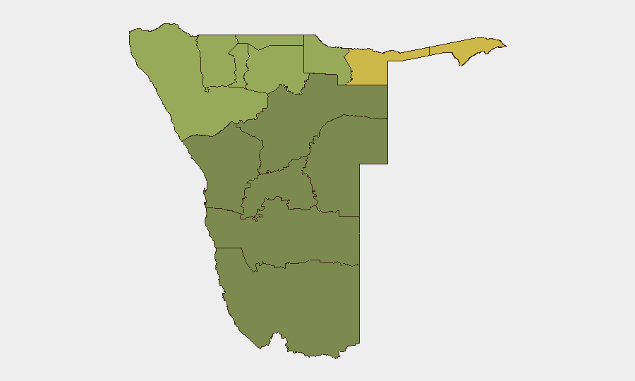
Situation Summary
Namibia remains a low-threat environment globally (rank #131, composite score 8) with no confirmed acute security incidents in the last 24–48 hours. The security landscape is dominated by sub-national regional disparities: northern border regions (Zambezi, Kavango East/West, Kunene) face elevated risks from cross-border movement, wildlife crime, and resource trafficking, while central and southern regions remain substantially safer. Overall stability trajectories remain stable, with no indicators of imminent political instability or organized civil unrest.
Key Developments
No confirmed Namibia-specific security, conflict, civil-unrest, crime, political-instability, or infrastructure incidents have been reliably identified in the last 24–48 hours from independent sources. Recent accessible public statements and diplomatic announcements (including a forthcoming state visit) concern economic and diplomatic engagement rather than acute threats. A wildfire event is recorded in the platform's recent event signals but cannot be corroborated with current location, severity, or operational impact details at this time.
Highest-Risk Areas
Northern border regions drive the composite threat ranking: Zambezi (risk 68), Kavango East (62), and Kavango West (58) face elevated exposure to cross-border trafficking (wildlife, minerals, narcotics), irregular population movement, and low state administrative capacity. Kunene Region (risk 52) reflects similar border-proximity vulnerabilities, particularly along the Angola/Kunene frontier. By contrast, central urban zones (Oshana, Otjozondjupa) and the southern economy-anchored Erongo Region (32) show materially lower risk profiles, reflecting stronger infrastructure, law enforcement density, and formal commercial activity. Risk in northern regions is chronic rather than acute, driven by structural factors (remote terrain, porous borders, limited policing) rather than current conflict or instability.
How GeoBit Would Assist
Security and risk teams with operations in Namibia should deploy AOI Monitoring & Early Warning on high-risk northern regions to detect emerging trafficking, cross-border incidents, or community unrest before they escalate. OSINT fusion (X/Twitter, Telegram, local news aggregation, multi-language search) combined with Intel Sweep event tracking provides continuous low-cost situational awareness across the country and regional press—especially valuable given the limited English-language reporting from border districts. Routing & Network Analysis helps duty-of-care teams plan safer movement corridors and identify alternative supply or personnel routes that avoid chronic-risk zones, particularly in Zambezi and Kavango regions.
7-Day Outlook
No acute security triggers or triggering events are forecast for the next seven days. The environment is expected to remain stable, with routine administrative and diplomatic activity dominating the public record. Continued attention to northern border regions is warranted as a persistent, background monitoring priority rather than an acute response posture.
Highest-Risk Areas — Ranked
| # | State / Region | Risk |
|---|---|---|
| 1 | Zambezi | 68 |
| 2 | Kavango East | 62 |
| 3 | Kavango West | 58 |
| 4 | Kunene Region | 52 |
| 5 | Oshikoto | 48 |
| 6 | Ohangwena | 45 |
| 7 | Omusati | 42 |
| 8 | Oshana | 40 |
| 9 | Otjozondjupa | 35 |
| 10 | Erongo Region | 32 |
| 11 | Hardap | 28 |
| 12 | Omaheke | 25 |
Previous Daily Briefs
A new Namibia brief is written every day — each with its own risk map and downloadable CSV. Here's the last week; use the calendar to go further back.
📅 Browse every day by calendar →
Highlighted days have a brief. Tap a day for that day's map & analysis, or “csv” for that day's dataset ($5).
Atlas — our AI intelligence desk — emails them this snapshot personally. Nothing else, no list.