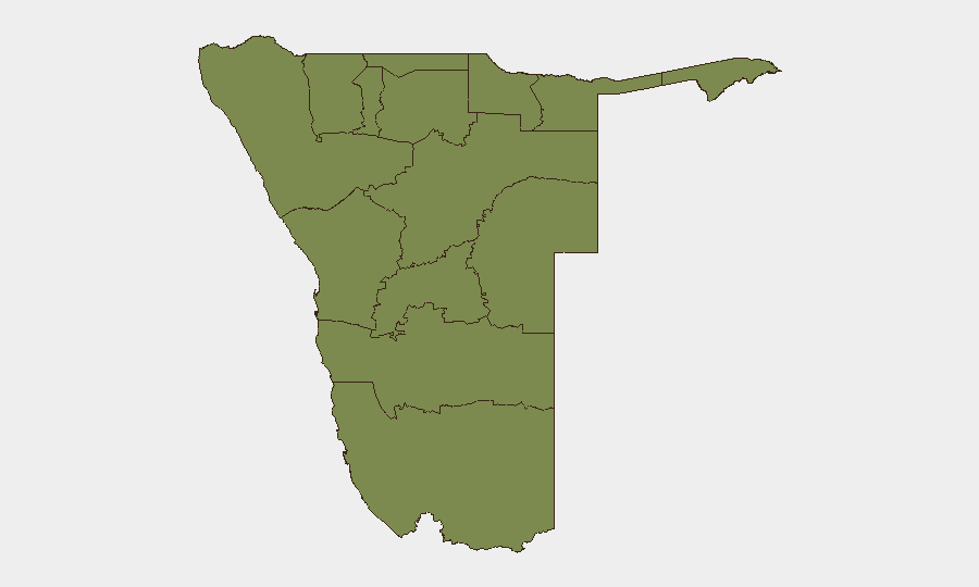
Situation Summary
Namibia remains a low-threat environment globally (rank #126; composite score 14), with no tracked security events in the current scoring period. However, sub-national risk is concentrated in the north and northeast, particularly Zambezi Region (score 68), where cross-border factors and remote governance create persistent vulnerabilities. The past week has seen isolated incidents of violent crime, document fraud, and disease-control disruption, none of which alter the overall security trajectory, though they underscore localized protection needs in specific zones.
Key Developments
- Onheleiwa, Omusati Region (2–8 October): A 60-year-old woman was fatally attacked in her home; police arrested and charged a 15-year-old pupil with murder and robbery on 8 October, indicating a serious violent-crime incident in the north-central region.
- //Kharas Region (5–7 October): Authorities confirmed 127 foot-and-mouth disease (FMD) cases across 15 farms and intensified movement controls, roadblocks, and testing. Disease-driven trade and livestock-movement restrictions are expected to persist and may affect supply-chain continuity for agribusiness and livestock exporters.
- Undisclosed location (7 October): Authorities detained two Iranian women who allegedly presented fake Hungarian passports while posing as Israeli nationals, indicating potential document-fraud networks and irregular transit activity.
- Windhoek (8 October): Cybersecurity specialists reported increased targeting scams leveraging publicly available social-media data and AI-generated messaging. Corporate and individual accounts remain at elevated risk from credential and financial fraud.
Highest-Risk Areas
Zambezi Region (score 68) and both Kavango regions (East 62, West 58) dominate the risk profile and collectively account for northern and northeastern vulnerability. These zones are characterized by remote terrain, limited state capacity, cross-border movement, and historical instability. Kunene Region (52) and Oshikoto (48) present secondary concern, while the southern and central regions (Hardap, Omaheke, Otjozondjupa) and coastal Erongo remain lower-risk. Corporate and NGO operations in the north should prioritize movement protocols and communications redundancy.
How GeoBit Would Assist
Intel Sweep and X/Twitter & Telegram OSINT would enable continuous monitoring of crime, health, and security reporting in high-risk regions, surfacing localized incidents before broad dissemination. AOI Monitoring & Early Warning on Zambezi, Kavango, and Kunene regions would provide persistent alerting for violence, disease outbreaks, or border-movement irregularities affecting duty-of-care obligations. Risk & Threat Assessment and GIS & Spatial Analysis would support targeted route planning and site-security posture in the north, while Cyber intelligence tracking would monitor evolving social-engineering and document-fraud campaigns targeting staff and assets.
7-Day Outlook
FMD-related movement controls in //Kharas are likely to remain in place through mid-to-late October, creating ongoing logistics friction for livestock and food-export operations. Sporadic violent crime and fraud incidents are expected to continue at baseline rates; no major deterioration in national security posture is anticipated. Teams with personnel or assets in Zambezi and Kavango regions should maintain elevated situational awareness and verify travel and communication protocols.
Highest-Risk Areas — Ranked
| # | State / Region | Risk |
|---|---|---|
| 1 | Zambezi | 68 |
| 2 | Kavango East | 62 |
| 3 | Kavango West | 58 |
| 4 | Kunene Region | 52 |
| 5 | Oshikoto | 48 |
| 6 | Ohangwena | 45 |
| 7 | Omusati | 42 |
| 8 | Oshana | 40 |
| 9 | Otjozondjupa | 35 |
| 10 | Erongo Region | 32 |
| 11 | Hardap | 28 |
| 12 | Omaheke | 25 |
Sources
Previous Weekly Briefs
A new Namibia brief is written every Monday, covering the week — each with its own risk map and downloadable CSV. Use the calendar to go further back.
- October 5, 2026
- September 28, 2026
- September 21, 2026
- September 14, 2026
- September 7, 2026
- September 1, 2026
- August 30, 2026
📅 Browse past briefs by calendar →
Highlighted days have a brief. Tap a day for that day's map & analysis, or “csv” for that day's dataset ($5).
Atlas — our AI intelligence desk — emails them this snapshot personally. Nothing else, no list.