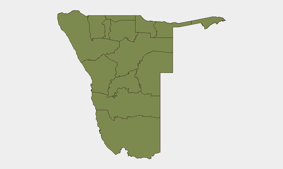
Situation Summary
Namibia remains a low-threat environment globally, ranked #146 overall with a composite threat score of 5 across 272 tracked events. No confirmed security incidents, civil unrest, crime spikes, or infrastructure disruptions have been reported in the last 24–48 hours. The security landscape is stable, though Otjozondjupa Region shows elevated risk requiring continued monitoring.
Key Developments
- No confirmed incidents in last 24–48 hours. Live web research and independent corroboration checks returned no verified security, conflict, crime, political instability, or travel-risk events with specific locations and dates occurring since 2026-07-12.
- Otjozondjupa Region flagged for elevated risk (2026-07-10/11). A platform signal referencing "demand" and "territorial occupation" claims was logged; however, this remains unverified and lacks independent date-specific corroboration. Requires continued AOI monitoring but should not be treated as a confirmed incident at this time.
- Scheduled diplomatic engagement. Xi Jinping–Namibian presidential ceremony scheduled (date TBD); no security incidents associated. Standard diplomatic-protection considerations apply.
- Regional business forum (future). Johannesburg–Namibia trade forum scheduled as forward event; not a current risk development.
- No Windhoek-specific incidents. Generic crime-risk guidance for the capital remains consistent with long-term threat profile; no new incidents reported in the assessment window.
Highest-Risk Areas
Otjozondjupa Region is the sole significant outlier, with a composite risk score of 31.5—substantially higher than all other provinces, which cluster at 1.5. This concentration suggests either a localized territorial or resource dispute, livestock/border dynamics, or a developing political claim; the unverified "demand" signal from 10–11 July warrants dedicated area-of-interest monitoring. All other regions (Kunene, Omusati, Ohangwena, Oshana, Oshikoto, Kavango West/East, Omaheke, Erongo, Khomas, Zambezi) are at baseline risk and do not show acute drivers at present. Northern and northeastern border regions historically experience lower-level pastoralist tension and informal cross-border activity; ongoing but not escalating.
How GeoBit Would Assist
Teams with operations or personnel in Namibia should employ AOI Monitoring & Early Warning with persistent watch on Otjozondjupa to detect follow-on claims, occupation attempts, or mobilization signals. Intel Sweep and OSINT fusion (including X/Twitter, Telegram, and multi-language search) would clarify the "demand" signal and cross-check independent sources before escalating to incident status. Routing & Network Analysis can support contingency planning for personnel in or transiting northern regions, and Risk & Threat Assessment can align security posture to the sub-national gradient—heightened vigilance in Otjozondjupa, baseline in all other provinces.
7-Day Outlook
Namibia's threat environment is expected to remain stable over the next seven days absent new information. Otjozondjupa warrants close monitoring; any verified incident activity, public mobilization, or additional territorial claims would trigger rapid reassessment. Diplomatic calendar events are unlikely to generate security spillover.
Highest-Risk Areas — Ranked
| # | State / Region | Risk |
|---|---|---|
| 1 | Otjozondjupa | 31.5 |
| 2 | Kunene Region | 1.5 |
| 3 | Omusati | 1.5 |
| 4 | Ohangwena | 1.5 |
| 5 | Oshana | 1.5 |
| 6 | Oshikoto | 1.5 |
| 7 | Kavango West | 1.5 |
| 8 | Omaheke | 1.5 |
| 9 | Kavango East | 1.5 |
| 10 | Erongo Region | 1.5 |
| 11 | Khomas | 1.5 |
| 12 | Zambezi | 1.5 |
Sources
Previous Daily Briefs
A new Namibia brief is written every day — each with its own risk map and downloadable CSV. Here's the last week; use the calendar to go further back.
📅 Browse every day by calendar →
Highlighted days have a brief. Tap a day for that day's map & analysis, or “csv” for that day's dataset ($5).
Atlas — our AI intelligence desk — emails them this snapshot personally. Nothing else, no list.