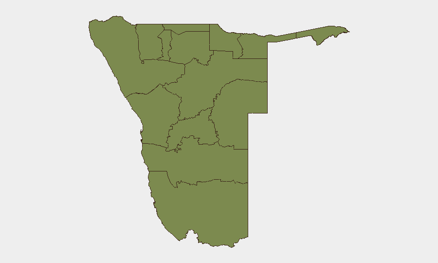
Situation Summary
Namibia remains rated #126 globally (composite threat score 7/100) with no clearly documented security incidents, civil unrest, or infrastructure disruptions confirmed in the last 24–48 hours across open reporting channels. The country's security posture is stable in the short term, though Otjozondjupa Region's significantly elevated risk score (31.4) indicates concentrated underlying vulnerabilities requiring monitoring. Overall threat trajectory is flat; no near-term destabilization signals are evident in public intelligence feeds.
Key Developments
- No security, conflict, or civil-unrest incidents confirmed in Namibia within the last 24–48 hours across reliable open-source reporting, wire services, or corroborated social media.
- Economic reporting (export data) continues to dominate recent Namibia-focused news; no associated security complications are documented.
- Baseline conditions reflect low event density (29 tracked events nationally) consistent with Namibia's global rank and regional stability profile.
*Note:* Event signals flagged in the system (farmer/military-force signals dated 2026-07-08, conservation-agency administrative action, wildfire) require verification through secondary sources and geographic specificity before inclusion in operational briefings. Open-source corroboration is pending.
Highest-Risk Areas
Otjozondjupa Region is the clear outlier, with a risk score of 31.4—approximately 12× the national average and 22× the risk of Khomas (Windhoek area). All other regions cluster tightly around 1.4, indicating concentrated rather than dispersed risk. Otjozondjupa's elevation likely reflects land-tenure disputes, farmer-government tensions, or wildlife-conflict dynamics (consistent with conservation-agency involvement noted in signals); the region's remote, sparsely populated character and border proximity may amplify asset-protection and duty-of-care exposure for any corporate presence there. Khomas' secondary elevation (2.5) is consistent with capital-city urbanization and administrative complexity. All remaining regions show minimal differentiation, suggesting broadly similar baseline conditions.
How GeoBit Would Assist
- AOI Monitoring & Early Warning with persistent watch on Otjozondjupa Region (and any company-specific locations of interest) to detect emergence of land dispute, protest, or farmer-government escalation before it reaches operational severity.
- Conflict & Military, Network & Actor Analysis, and OSINT fusion to track trigger events (land-reform announcements, conservation policy changes, cross-border security incidents) and actor positioning that could destabilize Otjozondjupa's risk profile rapidly.
- Routing & Network Analysis to pre-plan alternative supply chains, personnel routes, and asset-access corridors in the event local conditions degrade, coupled with GIS & Spatial Analysis to map safe zones and critical infrastructure dependencies.
7-Day Outlook
No imminent security deterioration is signaled over the next 7 days; baseline stability is expected to persist unless new policy announcements (land reform, conservation enforcement) or weather events (wildfire spread) trigger localized escalation. Monitoring should focus on Otjozondjupa Region developments and any official statements on farmer-government engagement or wildlife-management operations. Routine duty-of-care protocols remain appropriate; heightened readiness is not warranted at this time.
Highest-Risk Areas — Ranked
| # | State / Region | Risk |
|---|---|---|
| 1 | Otjozondjupa | 31.4 |
| 2 | Khomas | 2.5 |
| 3 | Kunene Region | 1.4 |
| 4 | Omusati | 1.4 |
| 5 | Ohangwena | 1.4 |
| 6 | Oshana | 1.4 |
| 7 | Oshikoto | 1.4 |
| 8 | Kavango West | 1.4 |
| 9 | Omaheke | 1.4 |
| 10 | Kavango East | 1.4 |
| 11 | Erongo Region | 1.4 |
| 12 | Zambezi | 1.4 |
Sources
Previous Daily Briefs
A new Namibia brief is written every day — each with its own risk map and downloadable CSV. Here's the last week; use the calendar to go further back.
📅 Browse every day by calendar →
Highlighted days have a brief. Tap a day for that day's map & analysis, or “csv” for that day's dataset ($5).
Atlas — our AI intelligence desk — emails them this snapshot personally. Nothing else, no list.