Situation Summary
Namibia remains a low-threat environment globally (rank #158, composite score 5) with a stable security baseline. However, Otjozondjupa Region presents a significantly elevated risk profile (31.5) compared to all other regions, driven by recent signals including demands, territorial occupation claims, and public statements. General security posture remains manageable for corporate operations, but regional concentration of activity warrants targeted awareness.
Key Developments
Reliable, independently time-stamped incidents in the past 24–48 hours remain limited in open reporting. GeoBit's event signals for 2026-07-10 and 2026-07-11 include:
- Otjozondjupa Region – Demand and Occupy Territory signal (2026-07-10/11): Platform detected demand-related activity and a territorial occupation assertion attributed to China versus Namibia. Limited open-source corroboration and precise event detail; requires follow-up via OSINT fusion and entity extraction to clarify intent, scale, and duration.
- Windhoek – Threats directed at residents and business (2026-07-10): Signals indicate threat activity in the capital targeting civilian and commercial interests. Open web research has not surfaced detailed, time-stamped incident reports; cybersecurity vulnerabilities in government websites (timing unconfirmed) may be tangentially related or separate. Confidence in specific threat type and target remains low pending additional intelligence.
- National-level Producer Statement (2026-07-11): A public statement from a producer entity was recorded; context and operational significance remain unclear from available open data.
Note: Given the absence of multiple independent, date-specific corroborations in public sources, these signals should be treated as indicators requiring active verification rather than confirmed incidents. Corporate teams should monitor official Namibian government and law enforcement communications, diplomatic channels, and in-country contacts for clarification.
Highest-Risk Areas
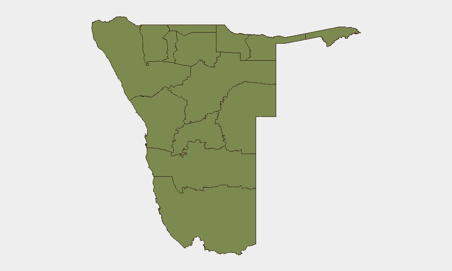
Otjozondjupa Region is the primary driver of Namibia's elevated subnational risk, with a composite score of 31.5—approximately five times higher than Khomas (Windhoek area, 5.8) and twenty times higher than all other regions (all at 1.5). The spike correlates with the recent demand, territorial occupation, and producer statement signals. All other regions remain at uniformly low baseline risk, suggesting that Otjozondjupa's activity is either geographically isolated or represents a discrete incident cluster. Khomas retains secondary concern due to its status as the national capital and economic hub, where threats to business and residents were recorded.
How GeoBit Would Assist
Security and duty-of-care teams would employ AOI Monitoring & Early Warning to establish persistent watch over Otjozondjupa and Khomas, with automated alerts on changes in activity level, actor statements, and incident frequency. OSINT Fusion & Corroboration, multi-language search, entity extraction, and Network & Actor Analysis would clarify the origin, scale, and intent behind the territorial occupation signal and threats in Windhoek, reducing ambiguity in current reporting. Intel Sweep and global event feeds combined with Sentiment & Temporal Analysis would track whether activity is trending toward escalation or resolution over the coming week.
7-Day Outlook
Without additional incidents or escalation, Namibia is likely to remain a low-threat environment. However, if the Otjozondjupa signals represent an emerging dispute or organized activity, early indicators of expansion to other regions or Khomas should be monitored closely. Corporate teams should maintain heightened situational awareness in Otjozondjupa and prepare alternative routing and contingency communications; routine operations in other regions warrant no immediate change.
Highest-Risk Areas — Ranked
| # | State / Region | Risk |
|---|---|---|
| 1 | Otjozondjupa | 31.5 |
| 2 | Khomas | 5.8 |
| 3 | Kunene Region | 1.5 |
| 4 | Omusati | 1.5 |
| 5 | Ohangwena | 1.5 |
| 6 | Oshana | 1.5 |
| 7 | Oshikoto | 1.5 |
| 8 | Kavango West | 1.5 |
| 9 | Omaheke | 1.5 |
| 10 | Kavango East | 1.5 |
| 11 | Erongo Region | 1.5 |
| 12 | Zambezi | 1.5 |
Sources
Previous Daily Briefs
A new Namibia brief is written every day — each with its own risk map and downloadable CSV. Here's the last week; use the calendar to go further back.
📅 Browse every day by calendar →
Highlighted days have a brief. Tap a day for that day's map & analysis, or “csv” for that day's dataset ($5).
Atlas — our AI intelligence desk — emails them this snapshot personally. Nothing else, no list.