Situation Summary
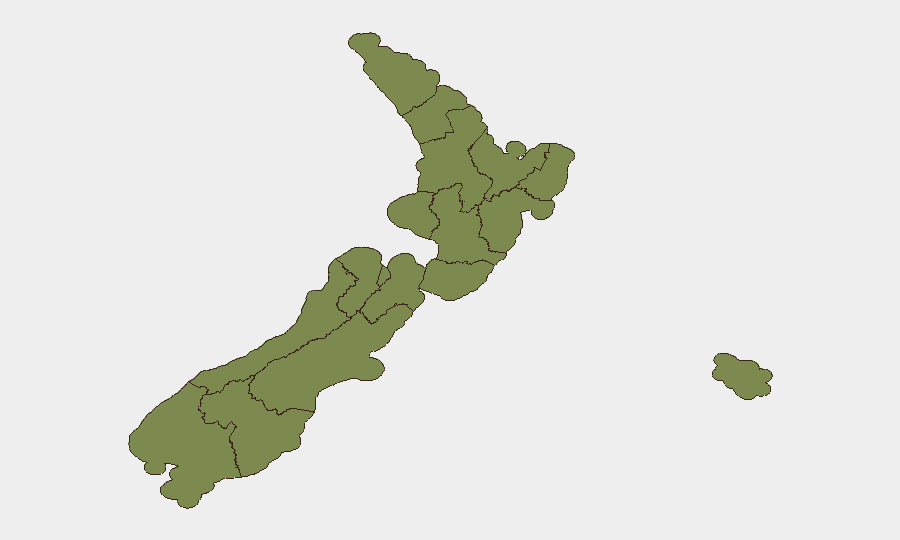
New Zealand faces a near-term security environment characterised by elevated property crime, armed violence, and transport disruption concentrated in the upper North Island and Wellington. A cluster of serious road incidents on 29 July—including a fatal crash, multiple injury collisions, and severe weather warnings—has compounded travel and infrastructure risk across the South Island and lower North Island. While the composite threat score remains moderate (9 globally), sub-national concentrations in Waikato (31.3), Wellington (25.7), and Hawke's Bay (23.4) reflect acute localized demand, suggesting tactical rather than systemic national instability.
Key Developments
- Raglan, Waikato – 29 Jul 2026: Police charged a man following a shooting incident; approximately 50 rounds of ammunition were seized. No wider threat has been reported, but the event underscores armed-violence risk in the highest-scoring region.
- Christchurch CBD – 29 Jul 2026: A 90-minute early-morning crime spree caused extensive damage to multiple businesses, indicating elevated property-crime and vandalism risk in Canterbury's urban centre.
- Port Albert, north of Auckland – 29 Jul 2026: A fatal single-vehicle crash occurred on Port Albert Rd near Kaipara Harbour around 5:25 pm; road closure and traffic management followed.
- Selwyn District, Canterbury – 29 Jul 2026: A serious multi-vehicle crash resulted in more than a dozen injured, two critically, prompting significant emergency response and highlighting hazardous road conditions.
- Johns Rd, Christchurch (Northwood) – 29 Jul 2026: Emergency services attended a serious two-vehicle collision with multiple injuries and significant road disruption.
- Christchurch Airport – 29 Jul 2026: An Air New Zealand flight triggered emergency protocols when smoke was reported in the cabin; no fire was confirmed after inspection.
- South Island and lower North Island – 29 Jul 2026: MetService issued severe-weather warnings for dangerous river conditions, significant flooding, slips, and potentially impassable roads, raising travel and infrastructure-disruption risk.
- Tairāwhiti region – 29 Jul 2026: Police conducted enforcement operations resulting in multiple detections for drink and drug driving, reflecting ongoing road-safety concerns.
Highest-Risk Areas
Waikato ranks significantly above all other regions (31.3), driven by the 29 July armed-violence incident and underlying civil-order disapproval signals dating to 27 July. Wellington (25.7) and Hawke's Bay (23.4) follow, likely reflecting recent demand-related parliamentary activity and broader governance tensions. Auckland, despite being the largest metropolitan area, ranks sixth (12.3), suggesting concentrated rather than dispersed risk. The clustering of crash incidents in Canterbury and transport-network vulnerability across the South Island elevate those corridors operationally, even if their regional composite scores remain lower.
How GeoBit Would Assist
Corporate security teams should deploy AOI Monitoring & Early Warning on Waikato, Wellington, and Canterbury to track emerging armed-violence, property-crime, and transport-disruption patterns in real time. OSINT Fusion & Corroboration (X/Twitter, Telegram, local news feeds) will rapidly detect escalation in civil unrest or criminal activity post-incident. Routing & Network Analysis capabilities enable duty-of-care teams to model safe travel corridors around current crash zones and severe-weather impacts, protecting personnel mobility.
7-Day Outlook
Severe weather is forecast to persist through early August, sustaining elevated transport risk and infrastructure vulnerability in the South Island and Waikato. Armed-violence and property-crime investigations are ongoing, with police activity likely to remain elevated in Waikato and Christchurch through the week. No indicators suggest rapid de-escalation; monitoring should remain continuous on parliamentary activity and civil-order signals, particularly in Wellington and Waikato.
Highest-Risk Areas — Ranked
| # | State / Region | Risk |
|---|---|---|
| 1 | Waikato | 31.3 |
| 2 | Wellington | 25.7 |
| 3 | Hawke's Bay | 23.4 |
| 4 | Southland | 20.2 |
| 5 | Otago | 13.9 |
| 6 | Auckland | 12.3 |
| 7 | Canterbury | 7.6 |
| 8 | Manawatū-Whanganui | 4.4 |
| 9 | West Coast | 2.8 |
| 10 | Chatham Islands | 1.3 |
| 11 | Northland | 1.3 |
| 12 | Taranaki | 1.3 |
Sources
Previous Daily Briefs
A new New Zealand brief is written every day — each with its own risk map and downloadable CSV. Here's the last week; use the calendar to go further back.
📅 Browse every day by calendar →
Highlighted days have a brief. Tap a day for that day's map & analysis, or “csv” for that day's dataset ($5).
Atlas — our AI intelligence desk — emails them this snapshot personally. Nothing else, no list.