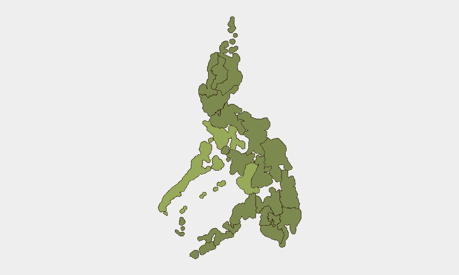
Situation Summary
Philippines remains at moderate composite threat (rank #55 globally, score 34) with 176 tracked events, but sub-national risk is highly concentrated in western island regions and Metro Manila. The past 72 hours have seen a convergence of cybersecurity incidents, political-security precautions around national commemorations, and ongoing natural-disaster aftermath from the 7.8 magnitude Mindanao earthquake (June 8). Current trajectory indicates heightened vigilance by authorities but no systemic destabilization; however, the persistence of military-insurgent clashes in Mindanao and persistent cyber activity warrant continued monitoring.
Key Developments
- Metro Manila, Senate Complex — 2026-06-11: Philippine Senate website reported "under maintenance" following allegations that a page had been defaced by a group claiming the handle "Nullsec Philippines." The claim circulated on social media; independent confirmation of compromise status remains pending. This marks a publicly attributed targeting of a critical government institution.
- Metro Manila — 2026-06-11: Philippine authorities implemented heightened security protocols around Friday Independence Day celebrations (June 12) in response to reports of a destabilization plot, indicating a specific near-term threat concern at the national political level.
- Mindanao (broad region) — 2026-06-08 onwards: The 7.8 magnitude earthquake and ongoing aftershock sequence continue to pose secondary security and infrastructure risks; UK FCDO issued updated travel warnings citing tsunami risk and structural damage. This is an active humanitarian and logistics emergency affecting regional stability.
- Western & Central Mindanao, Sulu Archipelago — ongoing: UK FCDO reiterates standing advisory against travel to these areas due to active terrorist organizations and military-insurgent clashes; no new tactical engagement reported in last 24 hours, but advisories remain in force.
- National — 2026-06-09 to 2026-06-11: Event signals indicate multiple public statements by Philippine authorities, media scrutiny, military operations, and international comment (Taiwan, California, South Korea) on unspecified matters; precise incident details are not yet clarified in available reporting.
Highest-Risk Areas
Negros Island Region (risk 54) and Mimaropa (51.6) lead the sub-national index, followed by Metro Manila (37.5)—a triadic concentration of risk in island and metropolitan zones. Negros and Mimaropa are likely driven by ongoing criminal networks, resource conflicts, and historical communist insurgency activity; Metro Manila's elevation reflects political volatility, cybersecurity exposure, and density of national institutions. Cordillera Administrative Region (33.8) and Central Luzon (28.9) carry moderately elevated risk, typically associated with landlessness disputes and militant activity. Mindanao regions—Davao (28.3), Soccsksargen (25.8), Bangsamoro (24), Caraga (24), Northern Mindanao (24)—remain endemic flashpoints for terrorist organizations (ASG, BIFF variants) and military operations, now compounded by post-earthquake instability.
How GeoBit Would Assist
Corporate teams should deploy AOI Monitoring & Early Warning on Metro Manila (political/cyber risk), Negros/Mimaropa (criminal networks), and Mindanao conflict zones (military-insurgent activity and post-quake conditions). Intel Sweep and X/Telegram OSINT would provide real-time detection of cyber-targeting campaigns and public statements signaling unrest. Conflict & Military battle-mapping and Routing & Network Analysis would enable alternative-route planning and asset-movement planning around high-risk regions and aftershock zones.
7-Day Outlook
Independence Day commemorations (June 12) will likely see sustained heightened-security posture; cyber-targeting of government infrastructure may continue or escalate if the Senate incident galvanizes a wider campaign. Mindanao aftershocks and infrastructure disruption will persist, affecting logistics and travel; no imminent political crisis is signaled, but intelligence gaps in current reporting suggest closer monitoring is warranted.
Highest-Risk Areas — Ranked
| # | State / Region | Risk |
|---|---|---|
| 1 | Negros Island Region | 54 |
| 2 | Mimaropa | 51.6 |
| 3 | Metro Manila | 37.5 |
| 4 | Cordillera Administrative Region | 33.8 |
| 5 | Central Luzon | 28.9 |
| 6 | Davao Region | 28.3 |
| 7 | Soccsksargen | 25.8 |
| 8 | Eastern Visayas | 24.6 |
| 9 | Western Visayas | 24.6 |
| 10 | Bangsamoro | 24 |
| 11 | Caraga | 24 |
| 12 | Northern Mindanao | 24 |
Sources
Previous Daily Briefs
A new Philippines brief is written every day — each with its own risk map and downloadable CSV. Here's the last week; use the calendar to go further back.
📅 Browse every day by calendar →
Highlighted days have a brief. Tap a day for that day's map & analysis, or “csv” for that day's dataset ($5).