Situation Summary
Saint Lucia remains a moderate-threat environment globally (#154, composite score 6) but faces persistent elevated firearm violence, particularly in urban centers. Mid-year statistics (released 19 August 2026) report 45 homicides, with firearms implicated in approximately 75% of cases. Recent incidents in Castries—including two homicides on the night of 17 August—underscore concentrated risk in the capital and adjoining parishes; no major infrastructure disruption, civil unrest, or terrorist activity is currently reported.
Key Developments
- Castries, Belair – homicide (17 Aug 2026, coverage current 19–20 Aug). Jamal Thomas, 25, shot dead shortly after midnight; Royal Saint Lucia Police Force responded ~12:39 a.m. Victim pronounced dead at scene. Investigation ongoing; no public suspect confirmation. [Incident slightly outside strict 48-hour window but currently active police operation.]
- Castries, Ravine Chabot – homicide (17 Aug 2026, coverage current 19–20 Aug). John Slade (56) found shot dead ~11:10 p.m. same night in heavily vegetated area. Major Crimes Unit investigating; public appeal for information ongoing. [Same "violent weekend" incident cluster, currently open case.]
- National crime statistics release (19 Aug 2026). Royal Saint Lucia Police Force released mid-year homicide count: 45 homicides in 2026 to date, with firearms involved in ~75% of cases. Assessment highlights gun violence as persistent national security challenge and underscores elevated underlying threat across multiple parishes.
- Vanard community, near Marigot – shooting death (15 Aug 2026, investigation continuing through 19 Aug). Male found with multiple penetrating injuries, pronounced dead; recorded as 46th 2026 homicide. No new incident on 19–20 Aug, but active investigation reflects ongoing violence in Marigot corridor.
- Media narrative of "violent weekend" (coverage 18–20 Aug). Local broadcast outlets frame 15–17 August incidents collectively as "another violent weekend," citing two homicides and community brawl-related injury. Narrative circulating actively among local population, reinforcing perception of elevated risk around social gatherings and weekend periods.
- Institutional accountability activism (18–19 Aug). Family of Joy St. Omer (killed 20 May 2026 in Marigot) renewed public calls for independent inquiry and accountability, citing system failures. Coverage highlights public distrust in law-enforcement and justice institutions; no new violence but reflects civil-society tension relevant to stability assessment.
Highest-Risk Areas
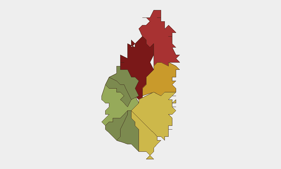
Castries (risk 95) dominates the sub-national threat landscape, accounting for two recent homicides and anchoring national firearm-violence statistics. Gros Islet (78) and Dennery (72) follow, indicating risk concentration in the northern and east-central regions. Vieux Fort (68) and Micoud (65) extend moderate-to-high risk southward. Risk drivers are primarily gang-affiliated or interpersonal firearm violence; southern parishes (Soufrière, 42; Laborie, 38; Canaries, 12) show substantially lower scores, suggesting geographic containment of active threat.
How GeoBit Would Assist
Corporate security teams operating in Castries or Gros Islet should deploy AOI Monitoring & Early Warning (persistent watch on high-risk districts with alerting) and OSINT Fusion (real-time aggregation of police statements, media, social platforms, and YouTube content) to detect emerging violence clusters. Routing & Network Analysis would enable duty-of-care teams to identify lower-risk transit corridors and safe operating windows, especially for staff movement after dark. Sentiment & Temporal Analysis on local social platforms can flag community events (carnivals, gatherings) where secondary violence risks elevate.
7-Day Outlook
No major incident escalation or institutional disruption is forecast for the next week. Firearm violence will likely persist at current or slightly elevated levels given mid-year homicide pace and absence of announced intervention by national authorities. Risk remains geographically concentrated in Castries and northern parishes; duty-of-care protocols focused on after-hours movement and crowd avoidance remain justified.
Highest-Risk Areas — Ranked
| # | State / Region | Risk |
|---|---|---|
| 1 | Castries | 95 |
| 2 | Gros Islet | 78 |
| 3 | Dennery | 72 |
| 4 | Vieux Fort | 68 |
| 5 | Micoud | 65 |
| 6 | Soufrière | 42 |
| 7 | Laborie | 38 |
| 8 | Choiseul | 35 |
| 9 | Anse La Raye | 28 |
| 10 | Canaries | 12 |
Sources
Previous Daily Briefs
A new Saint Lucia brief is written every day — each with its own risk map and downloadable CSV. Here's the last week; use the calendar to go further back.
- August 18, 2026
- August 16, 2026
- August 14, 2026
- August 12, 2026
- August 10, 2026
- August 8, 2026
- August 6, 2026
📅 Browse every day by calendar →
Highlighted days have a brief. Tap a day for that day's map & analysis, or “csv” for that day's dataset ($5).
Atlas — our AI intelligence desk — emails them this snapshot personally. Nothing else, no list.