Situation Summary
Sierra Leone remains a low-threat environment globally (rank #141) with minimal tracked security events over the past week. However, sub-national risk concentration in the Eastern Province (score 68) and Western Area (score 35) warrants targeted monitoring, particularly around recent community tensions and emerging cyber infrastructure vulnerabilities. The country's overall stability trajectory remains steady, though isolated incidents—notably DNS compromise and civil-order enforcement—signal areas requiring continued attention.
Key Developments
- Orugu Bridge, Sierra Leone — 7 October: Authorities demolished an illegal structure following a technical safety inspection that identified risks to residents, motorists, road users, and the waterway. The action underscores infrastructure-governance activity in high-risk zones.
- Sierra Leone .sl domain registry — 7 October: Third-party DNS operator was compromised; attackers altered domain records and obtained unauthorized HTTPS certificates, exposing all .sl-domain entities to impersonation and credential-harvesting risk. Incident affects government, financial, and commercial digital operations nationwide.
- Sierra Leone borders and Freetown International Airport — 8 October: Health authorities increased Ebola surveillance and airport screening following Kenya's report of an imported case. No suspected or confirmed cases were reported in Sierra Leone at the time of the announcement.
- Supreme Court, Freetown — 8 October: Police arrested opposition APC lawyer Joseph Fitzgerald Kamara inside the courtroom on the Chief Justice's orders following an alleged contempt incident. The arrest highlighted judicial-security and political-tension dynamics in Freetown.
- Public universities nationwide — 9 October: The Ministry of Technical and Higher Education declared the lecturers' strike unlawful and ordered staff to return to work; campuses prepared to reopen on 12 October. The directive reflected resolution of ongoing labor-related campus disruption.
- Freetown — 10 October: President Julius Maada Bio departed for Geneva for scheduled peace-and-security keynote addresses. Movement was diplomatic rather than security-incident related.
Highest-Risk Areas
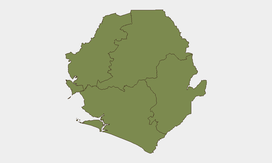
Eastern Province (composite risk 68) and Western Area (risk 35) account for nearly all tracked sub-national vulnerability in Sierra Leone. Eastern Province's elevated score reflects reported recent violence against civilians and ongoing community tensions, evidenced by Regional Police Commander engagement with paramount chiefs and stakeholders on 1 October. Western Area's secondary risk level reflects Freetown's concentration of political, judicial, and cyber-critical infrastructure, where civil order and institutional security incidents are more likely to be documented. The remaining provinces (North West, Northern, Southern) register minimal tracked risk and show no current indicators of instability.
How GeoBit Would Assist
Corporate teams with operations or personnel in Eastern Province or Freetown should deploy AOI Monitoring & Early Warning on high-risk districts and critical infrastructure sites to detect emerging civil unrest or violence signals in real time. Cyber threat intelligence and OSINT fusion would provide ongoing corroboration of DNS/domain-registry recovery and residual exposure of .sl-domain users, informing internal IT and third-party vendor notification protocols. Network & Actor Analysis and Sentiment Analysis on Telegram and X/Twitter would surface political tensions and labor unrest before escalation to operational impact.
7-Day Outlook
No immediate security escalation is forecast for the coming week. Ongoing university reopening and continued health surveillance for Ebola remain administrative priorities. Monitoring for secondary political friction (following the Supreme Court arrest) and DNS-recovery completion will be warranted through mid-week.
Highest-Risk Areas — Ranked
| # | State / Region | Risk |
|---|---|---|
| 1 | Eastern Province | 68 |
| 2 | Western Area | 35 |
| 3 | North West Province, Sierra Leone | 0 |
| 4 | Northern Province, Sierra Leone | 0 |
| 5 | Southern Province, Sierra Leone | 0 |
Sources
Previous Weekly Briefs
A new Sierra Leone brief is written every Monday, covering the week — each with its own risk map and downloadable CSV. Use the calendar to go further back.
- October 6, 2026
- September 29, 2026
- September 22, 2026
- September 15, 2026
- September 8, 2026
- September 1, 2026
- August 30, 2026
📅 Browse past briefs by calendar →
Highlighted days have a brief. Tap a day for that day's map & analysis, or “csv” for that day's dataset ($5).
Atlas — our AI intelligence desk — emails them this snapshot personally. Nothing else, no list.