Situation Summary
Taiwan faces elevated cross-Strait military activity and readiness posturing as of 22 June 2026, with the PLA conducting large-scale air and naval operations around the island concurrent with Taiwan's own five-day combat readiness exercises. The operational tempo and scale of concurrent drills—involving 23+ PLA aircraft, multiple naval formations, and live-fire training across Taiwan's outlying islands—reflect sustained pressure on Taiwan's defensive posture and signal intensified military competition in the region. Corporate operations and supply chains remain functional but exposed to potential disruption if current exercise cycles escalate or trigger unintended escalation spirals.
Key Developments
- Kinmen Island, 21–22 June: Taiwan's military initiated five-day "immediate combat readiness" drills with live-fire artillery and rapid-deployment exercises focused on simulated PLA attack and gray-zone escalation scenarios; drills emphasize real-time response to sudden blockade and amphibious assault.
- Taiwan ADIZ & Western Pacific, 21 June: Taiwan's Ministry of National Defense reported 23 PLA military aircraft and 7 PLA naval vessels plus 5 additional Chinese government vessels operating around Taiwan; 19 aircraft penetrated Taiwan's southwestern ADIZ and continued into the western Pacific as part of a declared "far-sea long-range" training operation.
- Northern Taiwan (Taipei), evening 21–22 June: Residents and local media documented increased military aircraft overflights and helicopter movements over Taipei City, attributed to concurrent Taiwan Air Force readiness exercises and rapid-deployment operations near urban population centers.
- Western Taiwan ports & coastal areas, 21–22 June: ROC Navy vessels and patrol craft increased sorties from western-coast bases facing the Taiwan Strait, coordinating with joint interagency drills and heightened maritime surveillance of PLA formations.
- Taiwan Strait & southwestern ADIZ, 21–22 June: Taiwan's air and maritime forces executed heightened surveillance and combat-air-patrol scrambling in response to PLA long-range training activities, maintaining continuous monitoring of PLA movements into western Pacific approaches.
- Defense procurement & tech sector (national), 21–22 June: Regional defense demand for drones and advanced systems is rising in response to perceived Taiwan conflict risk; Ukrainian drone manufacturers actively marketing to Asian defense buyers citing Taiwan scenario concerns.
- Cyber & telecom infrastructure (national), 22 June: International policy discourse on 6G security explicitly references Taiwan as a target of espionage and disruption risk, highlighting exposure of critical networks amid cross-Strait tensions.
Highest-Risk Areas
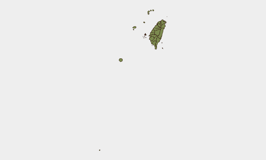
Nantau County carries a composite risk score of 31.2—more than eight times higher than Taipei (3.8)—likely reflecting geographic proximity to the Taiwan Strait, concentration of critical infrastructure, and military installations; however, the clustering of high-activity military events (ADIZ incursions, island drills, strait operations) creates acute near-term risk to Taipei, Kinmen, and outlying island operations. Kinmen's risk score (1.2) understates operational exposure during the current five-day drill cycle and elevated PLA air/sea presence. Corporate or logistics assets in western coastal zones and outlying islands face the highest disruption exposure in a rapid-escalation scenario.
How GeoBit Would Assist
Security teams should employ Maritime & Aviation tracking and OSINT fusion capabilities to monitor real-time PLA and ROC Navy vessel/aircraft movements in the Strait and ADIZ, correlate with official MND disclosures, and detect anomalies signaling escalation. AOI Monitoring & Early Warning configured for Kinmen, Taipei, western ports, and critical infrastructure zones would provide persistent alerting on military activity density, vessel staging, or airspace penetrations exceeding declared drill parameters. Conflict & Military force-structure tracking combined with sentiment & temporal analysis of defense-sector discourse enables early detection of policy shifts or procurement surge signaling heightened readiness or de-escalation intent.
7-Day Outlook
The five-day combat readiness exercise is scheduled to conclude by 25 June; however, PLA air and sea activity is expected to remain elevated through the end of June as routine "training" and gray-zone posturing. Corporate operations and supply-chain continuity should assume baseline disruption risk (port delays, airspace restrictions, telecom volatility) will persist through early July absent a formal de-escalation statement. Monitor for any unplanned extensions of drills or unscheduled PLA operations as potential indicators of strategic shift.
Highest-Risk Areas — Ranked
| # | State / Region | Risk |
|---|---|---|
| 1 | Nantou County | 31.2 |
| 2 | Taipei | 3.8 |
| 3 | Pingtung County | 3 |
| 4 | Kaohsiung | 1.2 |
| 5 | Taitung County | 1.2 |
| 6 | Lienchiang County | 1.2 |
| 7 | Kinmen | 1.2 |
| 8 | Penghu | 1.2 |
| 9 | Changhua County | 1.2 |
| 10 | Miaoli County | 1.2 |
| 11 | Taichung | 1.2 |
| 12 | Yunlin County | 1.2 |
Sources
Previous Daily Briefs
A new Taiwan brief is written every day — each with its own risk map and downloadable CSV. Here's the last week; use the calendar to go further back.
📅 Browse every day by calendar →
Highlighted days have a brief. Tap a day for that day's map & analysis, or “csv” for that day's dataset ($5).